
What Is a GPS-DENIED Drone?
A GPS-denied drone uses advanced onboard visual sensors to allow the aircraft to navigate in spaces that lack GPS.
Most modern drones rely on the Global Positioning System (GPS) to navigate and hover in place. While GPS drones are safe, accurate, and reliable, they do not perform well for indoor drone applications.
As drone adoption grows for professional uses, the demand for drones that can fly without GPS will continue to grow. Almost any industry that uses drones for inspections can benefit from GPS-denied drones, since they can operate inside confined spaces for inspection data collection.
Some of the top industries that can benefit from drones that don’t use GPS to fly include mining, oil and gas, power generation, sewer/wastewater infrastructure, and pharmaceuticals.
In this guide on GPS-denied drones, we'll take a deep dive into the following topics:
What Is a GPS-Denied Drone?
A GPS-denied drone is designed to rely on sensors for navigation and orientation instead of GPS. Most off-the-shelf consumer drones use GPS drones to orient themselves in three dimensional space and remain stable while in flight.
However, GPS-denied environments lack connection to GPS, or the signals are not strong enough, resulting in poor or erratic flying behavior.
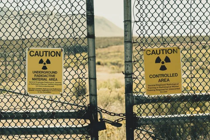
In addition, in some environments, such as operations at sensitive or critical infrastructure, GPS may not be desirable for security reasons, since it is perceived as requiring an internet connection.
Regarding security concerns, GPS does not require an external connection, and therefore does not pose an actual risk. But the perception can still be negative, and therefore many who work at places like nuclear power plants prefer to use a drone that simply does not require GPS at all.
According to NASA in the U.S., a future requirement for all drone technology may be the ability to fly without GPS:
“. . . one of the FAA’s requirements will be the ability to navigate in the event of a GPS outage . . . because GPS signals can often be degraded at low altitudes in urban areas—exactly where the highest precision is needed.”
- NASA
How Can Drones Fly without GPS?
GPS-denied drones rely on a mix of high-tech sensors to operate.
Onboard optical sensors act as the drone's eyes and stabilize it throughout the flight.
Each of these onboard sensors provides the drone with reference points and data points regarding its altitude, attitude, and location. With all this information, the drone can hover and fly as if it had a GPS signal.
Onboard LiDAR sensors may also be used to provide the drone with its real-time location in space using SLAM (simultaneous localization and mapping), allowing it to remain stable and to create 3D maps of its environment in real time, while in flight.
A SLAM drone like Flyability’s new Elios 3 (shown below) uses a combination of visual sensors and LiDAR sensors to create a 2D or 3D map throughout the flight.
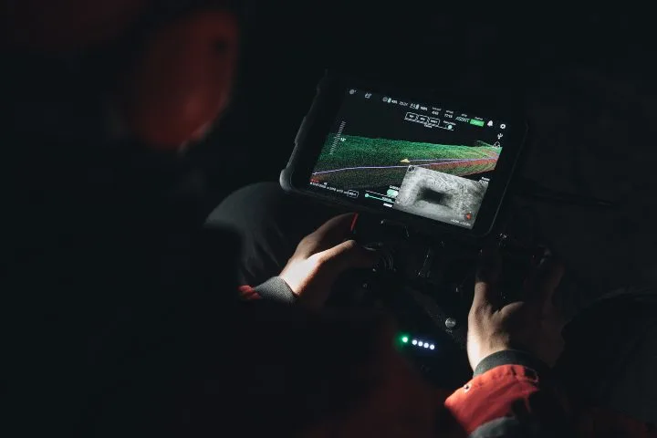
3D models are more complex but offer 360° of coverage, which is a huge benefit for inspectors when flying in confined spaces.
LiDAR stands for Light Detection and Ranging, a relatively new technology. It works by sending pulses of laser light out towards a subject to build a 3D image.
When the light bounces back, the sensors can determine the structure makeup by calculating the time it takes for the light to return or by its wavelength.
Think of the technology as being similar to a fish finder. A transducer sends sound waves into the water. When the sound waves bounce off fish and the lake structure, it creates an image and shows the approximate depths of the fish and the lake bed.
A unique aspect of LIDAR sensing technology is that it is capable of seeing through foliage and debris. Having this ability makes a SLAM drone a strong candidate for search and rescue and a host of other applications.
When Is a GPS-Denied Drone Necessary?
Flying a drone without GPS is not a new concept.
In fact, many early consumer drone models lacked GPS modules—and these drones were difficult to operate and prone to crashing, both due to the lack of GPS and due to a general need for further developing the technology.
Also, many autonomous drones can switch into non-GPS modes.
A common problem associated with GPS-denid drones is that most pilots are not trained to handle the drone without assistance from the GPS and sensors.
But with a GPS-denied drone, the sensing capabilities and advanced sensors thrive in challenging conditions where the signal ends.
Here are eight scenarios that call for using a GPS-denied drone:
1. Indoor Inspections
Many of the applications discussed thus far are technically indoors, but GPS-denied navigation is also essential in large assets used at industrial facilities.
These assets are often made of metal and are so large that a GPS signal can’t reliably be used inside them.
Examples of the types of assets in which inspectors are using GPS-denied drones include:
-
Boilers
-
Pressure vessels
-
Storage tanks, silos, and bins
-
FCC units
-
Nuclear reactors
2. Work on Critical Infrastructure
Using drones to collect important data on military bases, dams, and power plants has become common practice. The ability to gather sensitive data in a short time frame is a huge benefit.
But these activities have also resulted in a lot of controversy in recent years.
In 2017, a document from U.S. customs authorities surfaced security concerns associated with drone manufacturers based in China, making for a potential claim that information from a drone could be shared with third parties, risking exposing data about critical infrastructure through the drone’s internet connection.
While the security risks associated with GPS appear to be unfounded, as we noted above, many governmental agencies in the U.S. and elsewhere prefer to use a GPS-denied drone for any work around nuclear power plants or other critical infrastructure.
3. Wind Turbine Inspections
As renewable energy efforts continue to ramp up globally, internal inspections of wind turbines are rapidly increasing.
Inspecting wind turbines is challenging due to their size, metal housings, and mechanical components, which can cause interference with GPS signals.
With tight navigational corridors housing expensive equipment, there is no room for error in these inspections. Therefore, a GPS-denied drone is ideal for inspections and preventive maintenance on wind turbines.
4. Bridge Inspections
Similar to flying a drone in a wind turbine, the metal structure of a bridge can interfere with a drone’s GPS signal. Concrete bridges can also be a threat because they contain rebar.
When operating near a bridge, it's critical that the drone remains stable and on course to avoid damage to the bridge and to the drone.
With robust autonomous drone programming capabilities, a GPS-denied drone can alleviate concerns about signal loss and resulting damage.
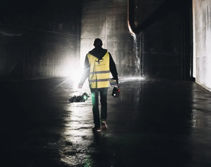
5. Maritime Inspections
Inspecting cargo holds and ballast fuel tanks is a dangerous and time-consuming task.
But with the integration of drones for maritime inspections, these operations have become faster, cheaper, and far less risky than before.
A recurring theme with GPS-denied drones is they are most often required in underground or metal structures. Fuel tanks and cargo holds are located deep within a ship, and the vast amount of metal makes it impossible to employ a regular drone for these types of inspections.
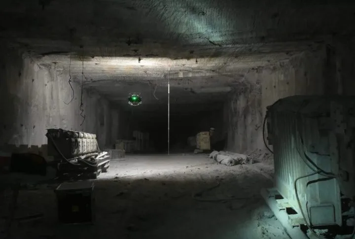
6. Mining Operations
Mining presents numerous challenges and hazardous working conditions unsuitable for humans. To ease the burden, mining professionals have been adopting drones as an essential tool for their work, both for outdoor and indoor mining applications.
Exterior mining drone work, such as volumetric measurements, mine site monitoring, and planning can also use traditional GPS drones.
But inside the mine, the depth of tunnels, crumbling rocks, and dust makes it impossible to obtain and maintain a GPS signal. And that’s why the GPS-denied navigation challenges of an underground mining environment are ideal for drones without GPS.
By letting the drone fly into dangerous areas for data collection, mining professionals can improve safety, save time, and reduce operational expenses.
7. Search and Rescue
When flying through a densely wooded area, it can be easy to lose control of a drone with an unstable GPS connection. The canopy of trees and the surrounding terrain can interfere with, and even block, the drone’s transmission signals.
GPS denial during search and rescue operations can quickly become a life and death situation. A GPS-denied drone eliminates any worries of connection failure, allowing for all the focus to be placed on the task of finding and rescuing those in need of help.
8. Surveying Damage Sites
When disaster strikes, the aftermath of large debris piles such as building materials can interfere with GPS signals. Searching through the rubble with a drone can be difficult if it's not built to handle GPS-denied navigation environments.
A GPS-denied drone essentially creates its own GPS signal by using sensors to keep the drone on course as it traverses rubble and rugged terrain to search for victims.
Industries that Use GPS-Denied Drones
As GPS denial sensing continues to advance, drones without GPS will open the door for new applications.
Here are some of the main industries using GPS-denied drones technology:
-
Oil & Gas
-
Power Generation
-
Chemical Storage
-
Mining
-
Water and Sewer Management
-
Public Safety
-
Infrastructure (bridges, tunnels, etc.)
-
Steel Manufacturing
-
Maritime (ships and supporting infrastructure)
Benefits of Using a GPS-Denied Drone
Here are the top benefits of using a drone that can fly without GPS:
-
They can operate in any environment because they do not rely on a GPS connection.
-
Inspections are more detailed and accurate, with 2D and 3D models created from LIDAR sensors.
-
Drones without GPS are great for search and rescue missions where challenging terrain and severe weather can cause signal issues.
-
Visual data is collected remotely, removing humans from danger.
-
Advanced drone sensors capture high-resolution images and videos compared to traditional ground-based sensing technology.
-
Inspections can be conducted more frequently due to the time and money savings realized by use of the drone technology.
-
Drone inspections require less personnel and resources, which significantly reduces expenses.
-
Humans are not exposed to heights, heavy equipment, and dangerous environments.
-
They minimize downtime of mines, sewers, power plants, ships, wind turbines, and other critical infrastructure.
Use Cases For GPS-Denied Drones
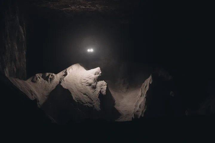
Stockpile Measurements Improve Safety & Accuracy at Salt Mine
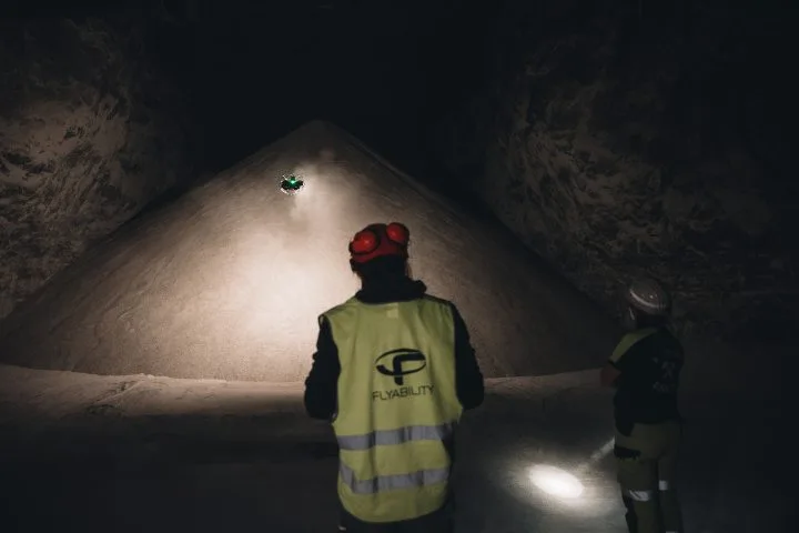
Industry: Mining
Mission: To calculate the amount of salt present at a salt mine in Germany using LiDAR data collected by Flyability’s Elios 3 indoor drone.
Results: Using the Elios 3, personnel at the mine were able to collect all the data they needed to perform the stockpile measurement without having to endanger personnel in any way.
GPS-Denied Drone Significance: Because the mission was underground, a drone that relied on GPS would never have been able to operate in the environment. Therefore, a GPS-denied drone like Flyability’s Elios 3 was required for the work.
$1 Million Saved Using Drone for Remote Hull Inspection

Industry: Maritime
Mission: C-Bird was called out to inspect a cargo ship's hull as part of a certified class inspection. This cargo oil tanker was a 250 meter vessel classed by the American Bureau of Shipping (ABS).
Results: The Elios 3 gave full coverage of the hull being inspected, providing the 3D LiDAR scan as well as visual inspections through the Elios 3's 4K camera. The drone survived flying in high temperatures exceeding 45 degrees Celsius. The project overall saved 10,000 hours worth of scaffolding work, saving up to $1 million on a single inspection.
GPS-Denied Drone Significance: Without GPS-denied navigation, inspecting the oil tank via drone would have been nearly impossible. The ship's metal structure is not favorable conditions for a regular drone. With built-in SLAM drone sensors, the Elios 3 made quick work of the tank inspection.
3D Maps Help Mining Operation Find Cause of Ore Pass Hangup in 10 Minutes
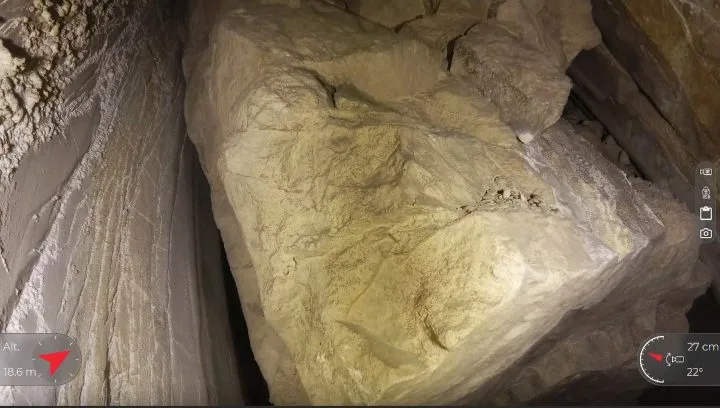
Industry: Mining
Mission: Personnel at a major mining operation in Colorado encountered a large hangup in an ore pass that was so big it was preventing any ore from falling down the pass.
Results: After two months of exploratory drilling and blasting mining personnel still couldn’t diagnose the problem. But with the help of the Elios 3’s 3D Live Map, they were able to see the cause of the hangup and its exact location in just ten minutes.
GPS-Denied Drone Significance: As with the stockpile measurement at a salt mine covered above, this mission was entirely underground, making the use of a drone that relied on GPS impossible. Only a GPS-denied drone would have been able to operate in the ore pass in order to find the cause of the hangup.