3D Maps From Elios 3 Help Mining Operation Find Cause Of Ore Pass Hangup In 10 Minutes
A large mining operation used the Elios 3 to identify the cause of a hangup in an ore pass in just ten minutes, helping them pinpoint its exact location and visualize the clog in a 3D map.Benefits in a Nutshell
|
Access The Elios 3 was able to fly directly up the ore pass and provide both visual and LiDAR data represented in a 3D Live Map showing exactly what the hangup looked like, providing crucial information for determining its cause. |
Speed Time needed to find the cause of an ore pass hangup was reduced from two months to just ten minutes. |
Precise Locational Data The Elios 3’s 3D Live Map and its geolocational data allowed mine personnel to see exactly where the hangup was located and how it was situated in the ore pass, potentially avoiding weeks of wasted labor in drilling exploratory holes to pinpoint its location. |
In mining operations, personnel working on an extraction level will use LHDs (called muckers) to transport ore from a draw point to an ore pass, which is a vertical raise through which ore falls.
Ore then falls down these passes, combining into a single raise. From that single raise the ore falls further to a haulage level, where large transportation trucks will load portions of it using a truck chute, taking it to a crusher for processing.
This entire operation is called an ore flow system. The job of the system is to move ore from higher up in the mine, where it has been extracted, to lower down in the mine, where it can be crushed.
For the mining operation to function, it's essential that ore raises stay open and unclogged.
But sometimes a clog—also called a hangup—can occur, and it will then be the job of mining personnel to identify the location of the clog and remove it as quickly as possible so the system can continue working.

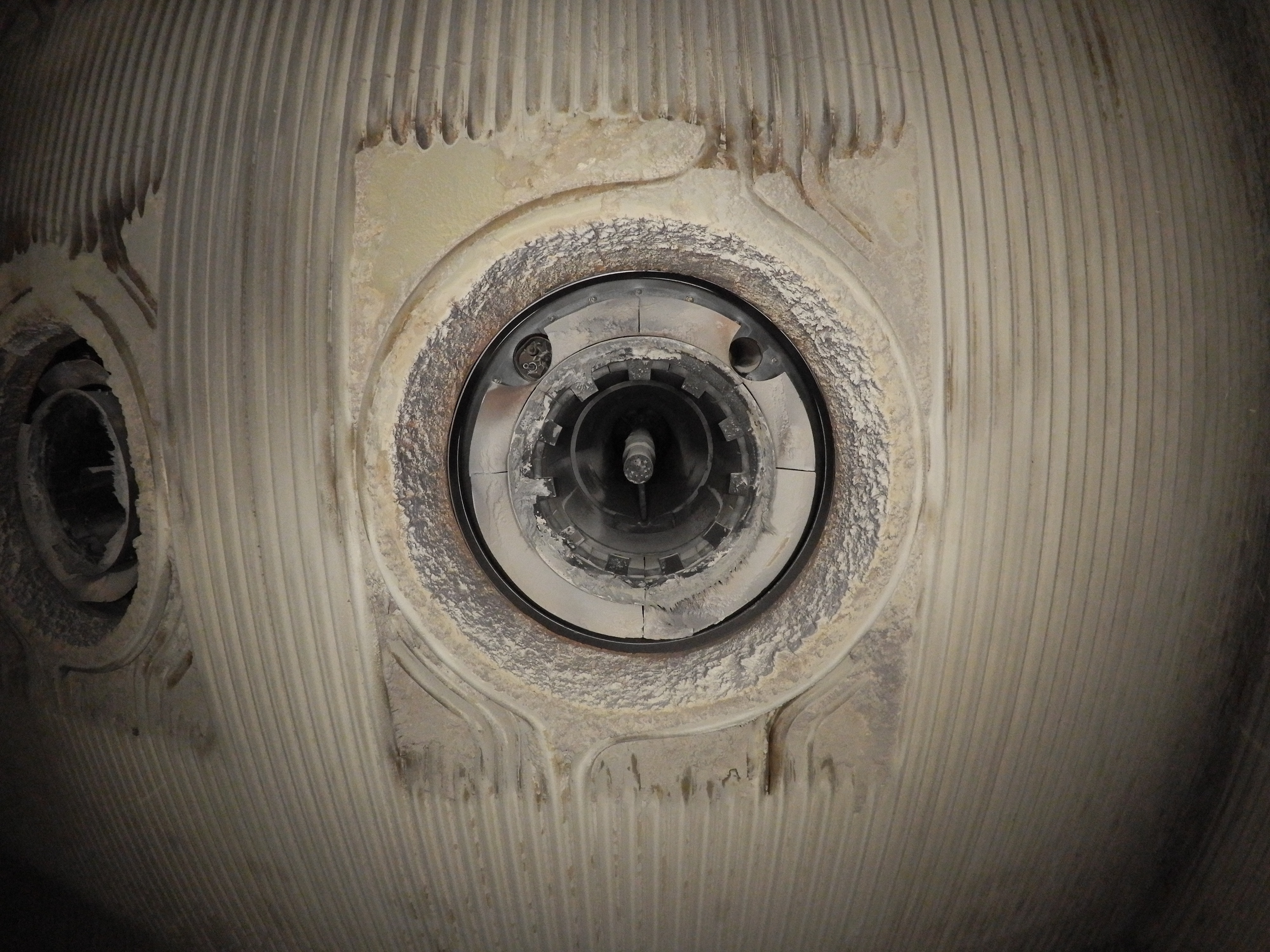
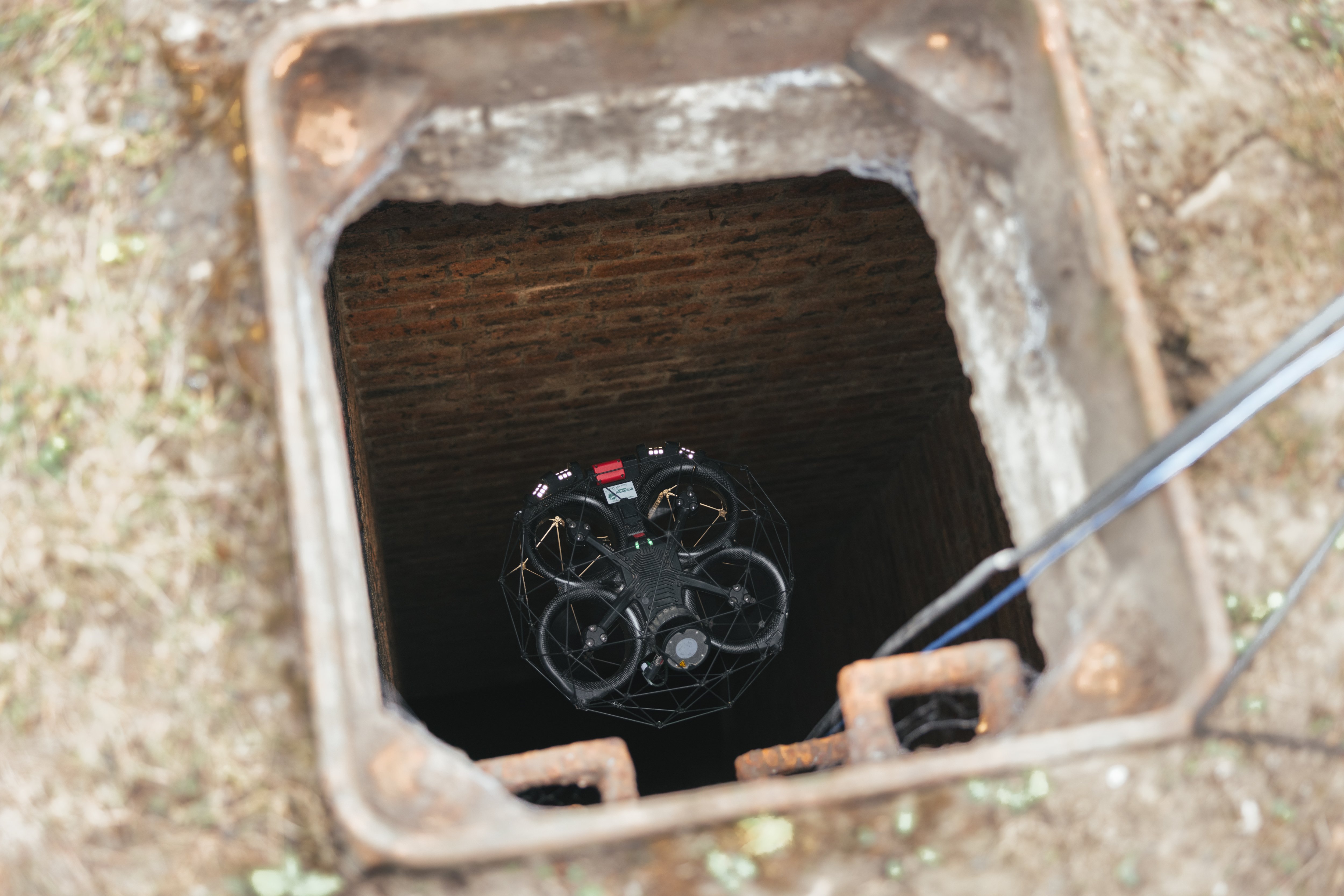
Picture of a hangup taken by drone for the investigation covered in this case study
Investigating an Ore Pass Blockage
Personnel at a major mining operation in Colorado encountered a large hangup in an ore pass that was so big it was preventing any ore from falling down the pass.
Often, these kinds of clogs are found quite close to the truck chutes—the place where the ore exits the raise and is collected by trucks for transportation to be crushed.
But after looking up the raise, personnel in the mine couldn’t see anything in the truck chute. This meant the clog was located somewhere out of sight, farther up the raise.
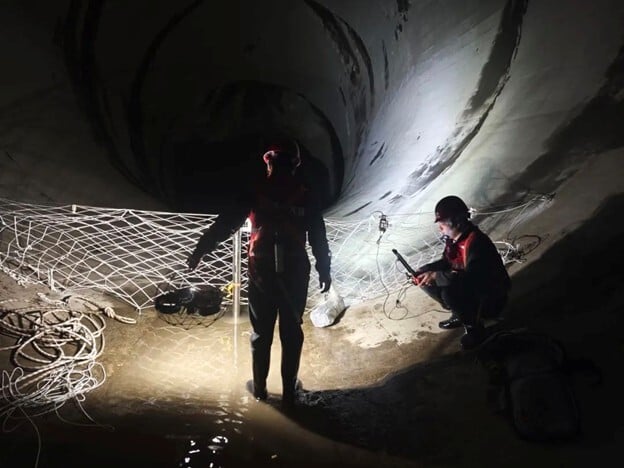
To find the clog, personnel started by feeding a CMS scanner into the raise through a small access hole in the chute.
The scanner’s data provided a low density point cloud of the raise, and they could see that the general location of the hangup was about 27.5 meters (90 feet) up the raise. Using this information, they began drilling exploratory holes of 12 to 21 meters (40 to 70 feet) long from a higher production level into the ore pass and then feeding a sewer camera (a small, finger-diameter camera) into them, trying to find the exact location and nature of the clog.

A CMS scan from an access hole in the chute
When they finally found the mass that they believed was the hangup, they began trying to clear it.
The process used to clear the hangup was similarly exploratory as that used to find it. Personnel drilled long holes into the area where they believed the hangup to be, verified their location with a CMS scanner and a sewer camera, and then fed what were essentially pipe bombs—pieces of PVC loaded with ANFO—through these holes to blast the mass apart.
It was important to use very small charges to try and shake the mass loose, rather than just blowing up the entire thing, since a larger explosion could have impacted the integrity of the raise itself.
But despite repeatedly drilling holes into where the hangup was believed to be, dropping small charges into it, and getting small bits of jumbled material to fall out of the bottom of the truck chute, the raise remained clogged. For two months these attempts to clear the hangup went on, with no success.
After two months, the area of the mine where the clogged raise was located became exhausted and upper management decided to stop working it. This meant that the clogged ore pass system was no longer needed, and the area was abandoned without ever truly understanding where the clog was or what it looked like.
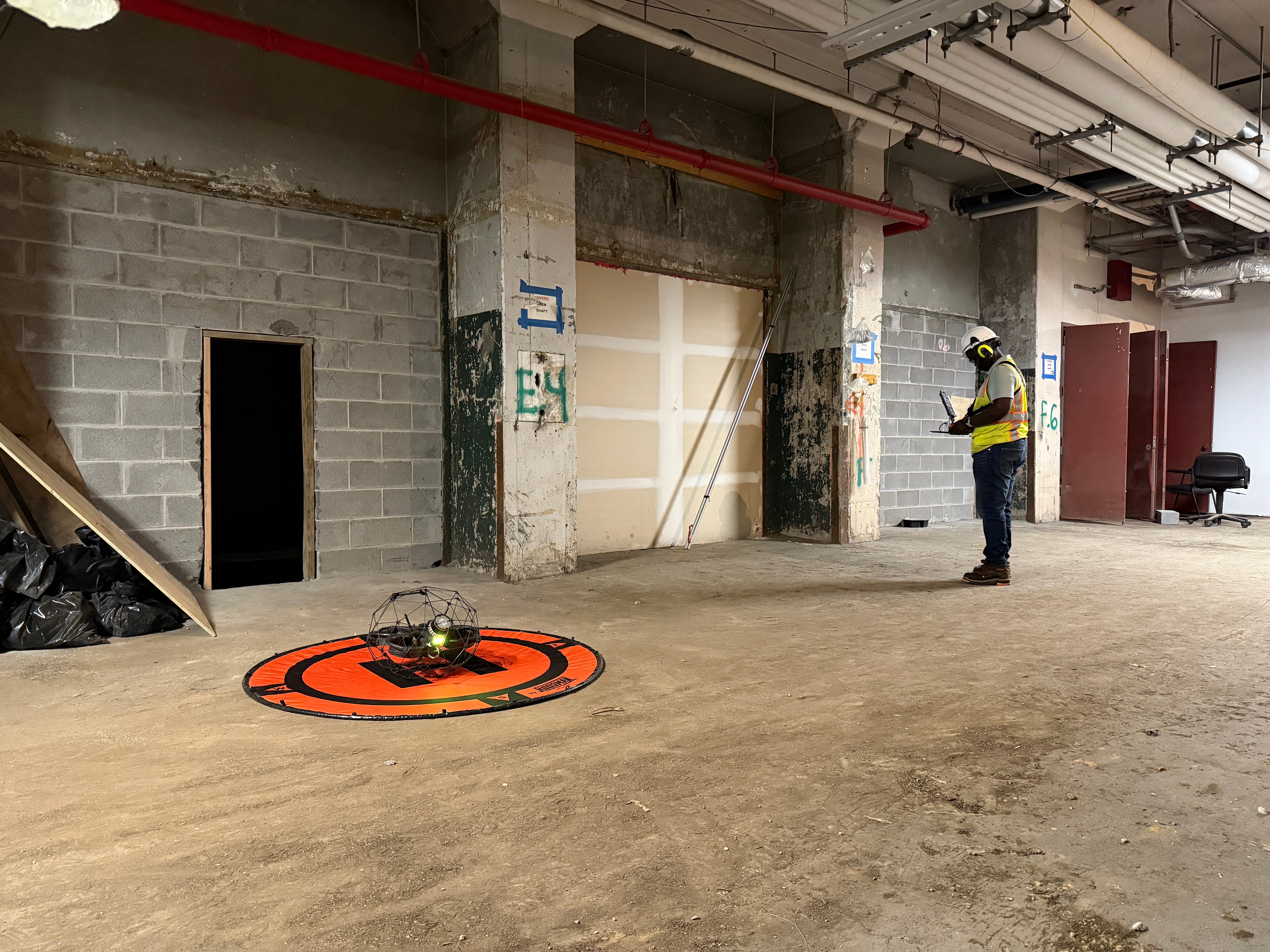
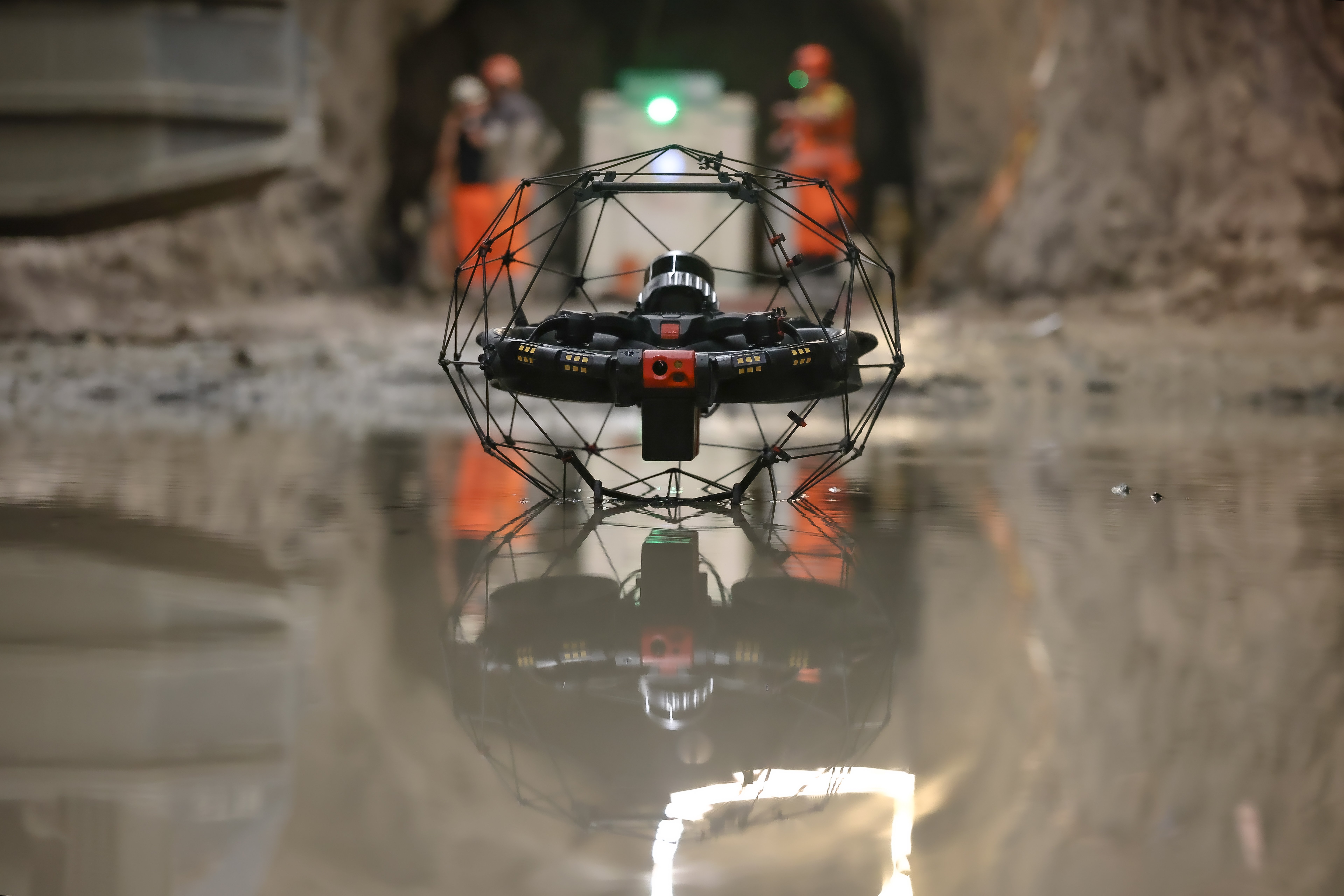
Remote Inspection of an Ore Pass with a Drone
Some time later, pilots from Flyability visited the mine to demonstrate the Elios 3’s capabilities, and were asked if they could fly up the raise to examine the hangup.
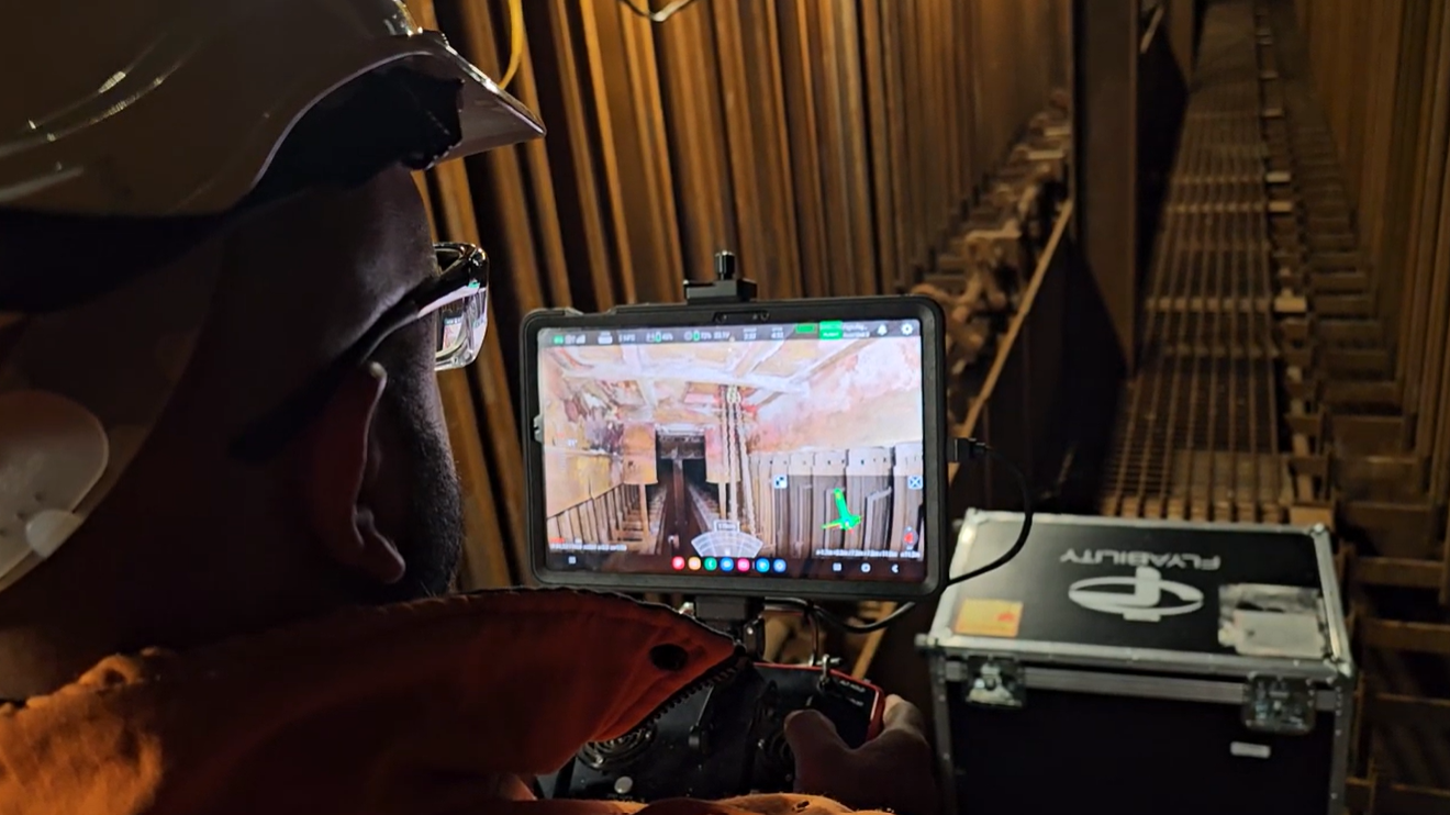
The Elios 3 provides pilots with both a live visual feed and a 3D Live Model on their tablets, allowing them to see what the drone is seeing visually and to see what the surrounding environment looks like in a 3D model, at the same time.
Because of these two features, mine personnel believed that the Elios 3 might be the perfect solution for understanding the location and nature of the hangup.
Impact of an Ore Pass Inspection with the Elios 3
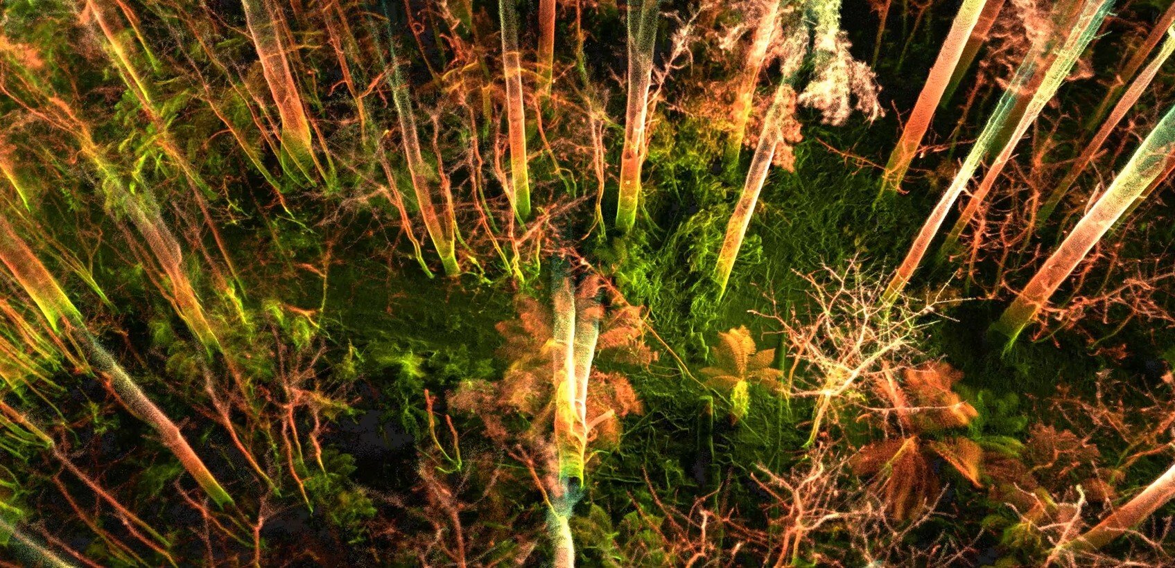
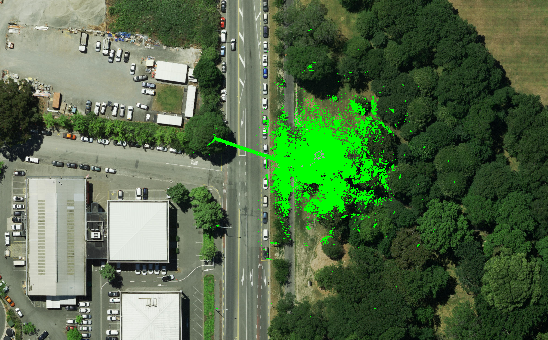
Within ten minutes, geolocational data on the Elios 3’s 3D Live Map showed them exactly where the clog was located in the raise.

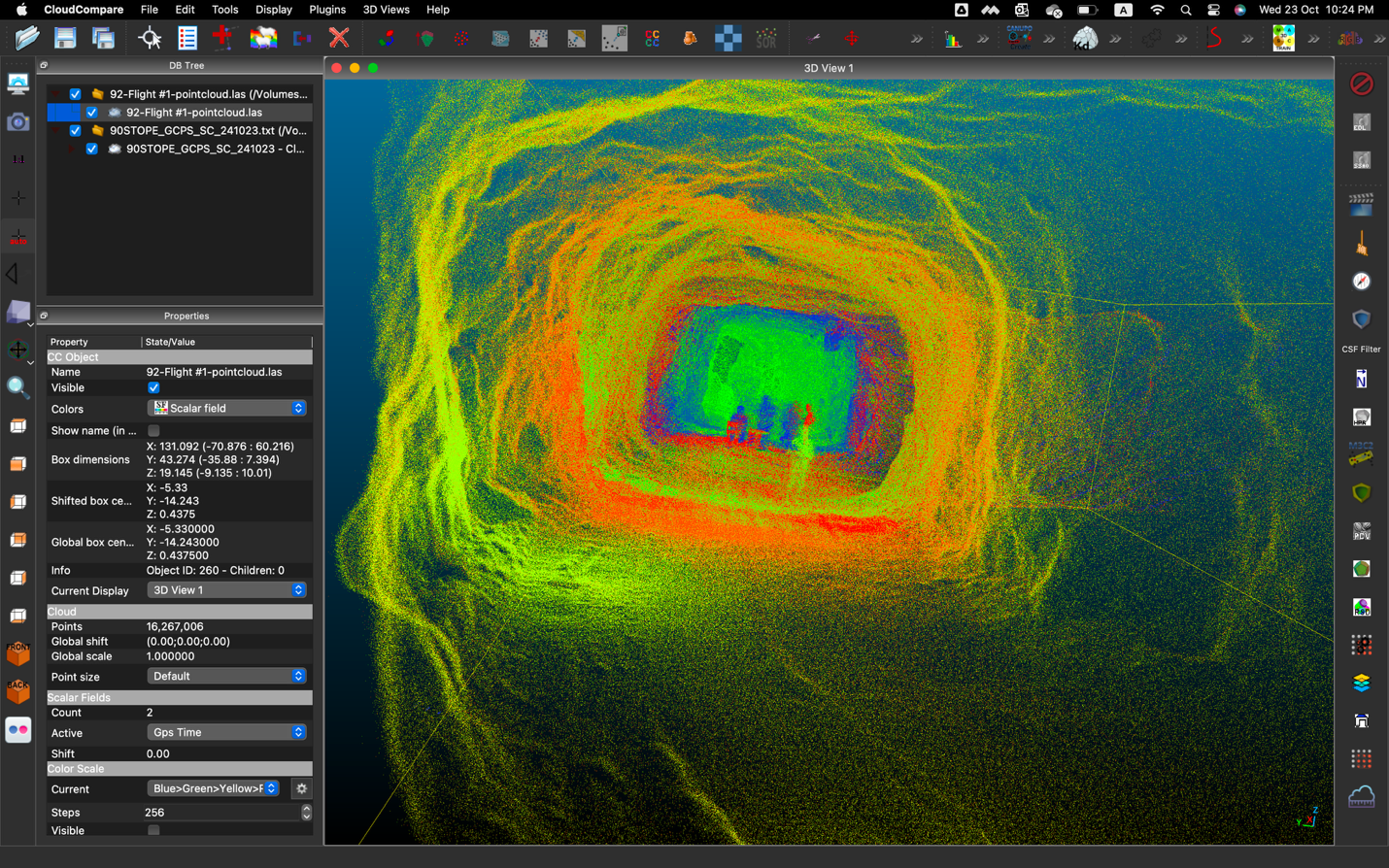
A 3D model of the clog in the chute made from the Elios 3's LiDAR data
Using the Elios 3, personnel at the mine could see that the hangup was caused by a single, giant rock that was still completely intact. In their work to try and clear the raise, they had believed the clog was caused by several large individual rocks keyed together, not a single massive one.

This information would have been crucial for the efforts to unclog the raise—instead of trying to shake the clog loose with several small charges they would have systematically drilled into the single, large mass and loaded a coupled explosive charge into it. If this approach had been taken, the mass could have been fractured into smaller pieces, and the raise could have been cleared.
Here are all the benefits the Elios 3 provided for identifying the cause of the hangup:
- Speed. Time needed to determine the cause of the ore pass hangup was reduced from two months to just ten minutes.
- Access. The Elios 3 was able to fly directly up the ore pass and provide both visual and LiDAR data represented in a 3D Live Map showing exactly what the hangup looked like, providing crucial information for determining its cause.
- Precise Locational Data. The Elios 3’s 3D Live Map and its geolocational data allowed mine personnel to see exactly where the hangup was located and how it was situated in the ore pass, potentially avoiding weeks of wasted labor in drilling exploratory holes to pinpoint its location.
- Reduced labor. If the Elios 3 had been used to find the hangup at the start of their work, the amount of labor needed to remove the clog would have been reduced from over two months to less than two weeks.
- Reduced downtime. The prolonged time in which the clog made the ore pass unusable led to lost productivity from having to divert loaders to another ore pass system in order to transport ore to the crusher, which created a huge loss of production efficiency and resulted in lower tonnage rates for that two month period. If the Elios 3 had been used to find the hangup, the downtime for the ore pass system would have been significantly reduced, resulting in significant savings from shortened downtimes.

The Impact of Drones in Mining
Given the success of the Elios 3 for finding the ore pass hangup, personnel at the mine plan to use it to investigate hangups in the future.
They also plan to begin using the Elios 3 for LiDAR and visual data collection in other inaccessible areas throughout the mine.
At the moment, they have identified several scenarios in which the Elios 3 could significantly decrease downtimes and work hours by providing precise data to inform their work, while also increasing safety and the accuracy of the data they collect.
As they begin implementation, personnel at the mine anticipate finding many more use cases for the Elios 3 within their mining operations.
.jpg)
-Jan-16-2026-10-59-56-8006-AM.png)
.jpg)
.png)