Surveying Sewers 4X faster with the Elios 3
BENEFITS IN A NUTSHELL
|
ACCESS There was no easy way to reach this sewer without the Elios 3. Access would have involved a bigger team, rope access, and an emergency rescue team on standby. |
SAFETY The ability to enter the sewer remotely with 0 confined space entry saved hours of work and kept the surveying team safely on ground level. |
|
SPEED The survey with the Elios 3 was completed in half a day, compared to 1 full day of preparatory surveys and 2 days of traversing the 60-meter pipe. |
ACCURACY Academy Geomatics achieved survey-grade results, creating a digital twin of the model that was accurate to 20 mm of reality despite a 10-meter elevation change and 60-meter tunnel length. |
Ever the innovators, humans were building sewers as far back as 5,000 years ago. Sewers today keep our cities clean and populations healthy. However, around the world, sewer operators and owners are running into similar challenges: the infrastructure is aging, under pressure, and existing condition reports are outdated. In some cases, hand-drawn maps are the only record of a sewer’s position. The older maps are often inaccurate and share little to no information about the sewer’s condition. The solution? Georeferenced sewer surveys that accurately map the sewer’s position, dimensions, and, if possible, its condition as well. Unfortunately, these surveys are challenging, often requiring days of work underground and in confined spaces with high levels of danger. This work is critical, as new construction above ground has to wait for the presence of sewers to be confirmed so the pipes aren’t damaged by the new buildings. Drone sewer surveys, such as with the Elios 3, are speeding up the sewer survey process while eliminating the risks associated with human entry. Academy Geomatics explains exactly how this works in this detailed case study.
Surveyors Using Drones Underground for Sewer Mapping
Academy Geomatics is a professional surveying company backed by 35 years of experience. Operating across the UK, their team uses laser scanners, total stations, drones, and other equipment to accurately survey everything from building extensions to sewers. In the Spring of 2025, they were asked by Northumbrian Water to survey a sewer pipe in a stretch of land beneath a footbridge marked for potential reconstruction. The local council aimed to improve the post-industrial landscape in that area and needed accurate infrastructure records before they could begin work.
.jpg?width=5000&height=3335&name=01-12-29-04%20(1).jpg)
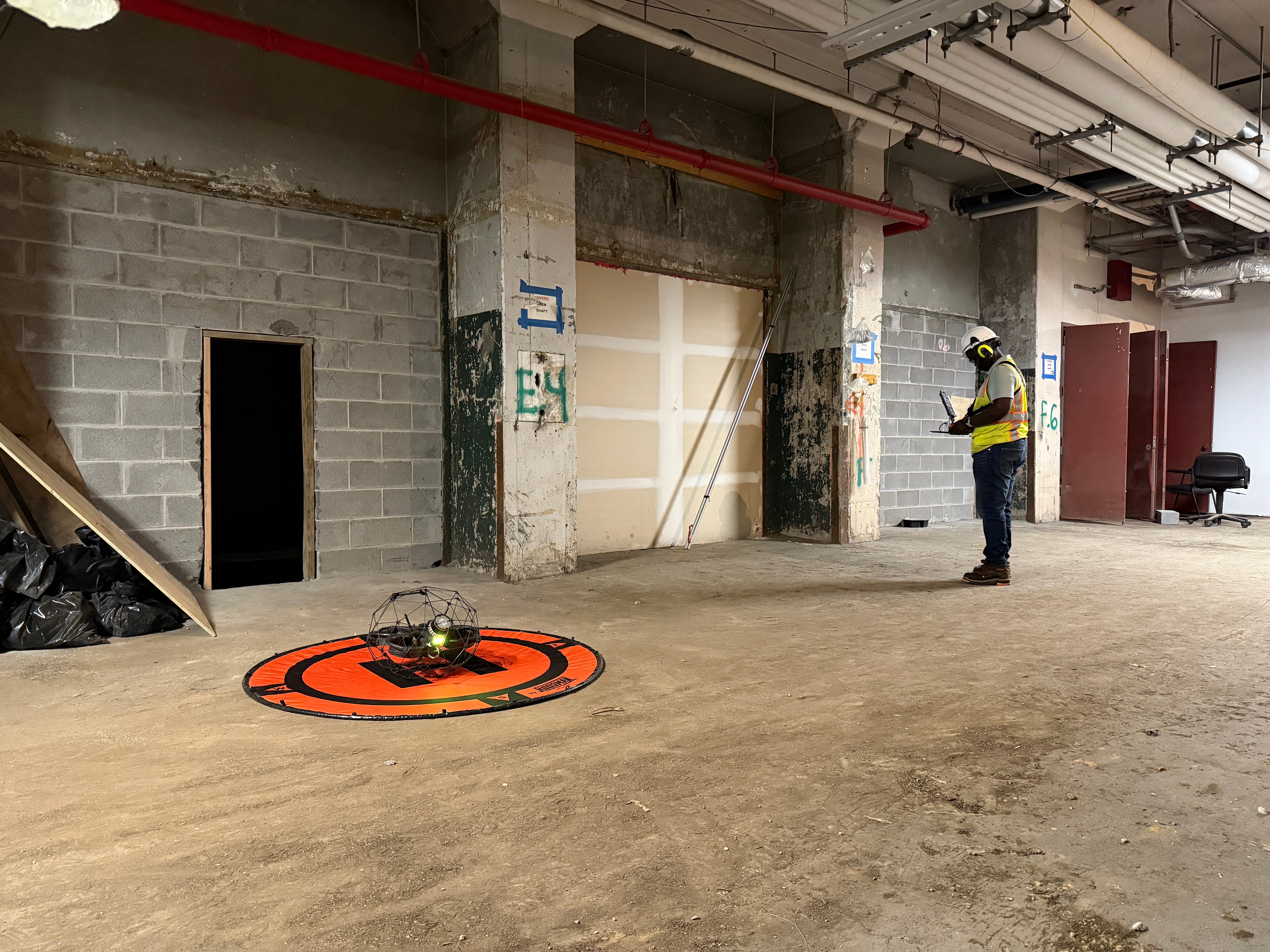
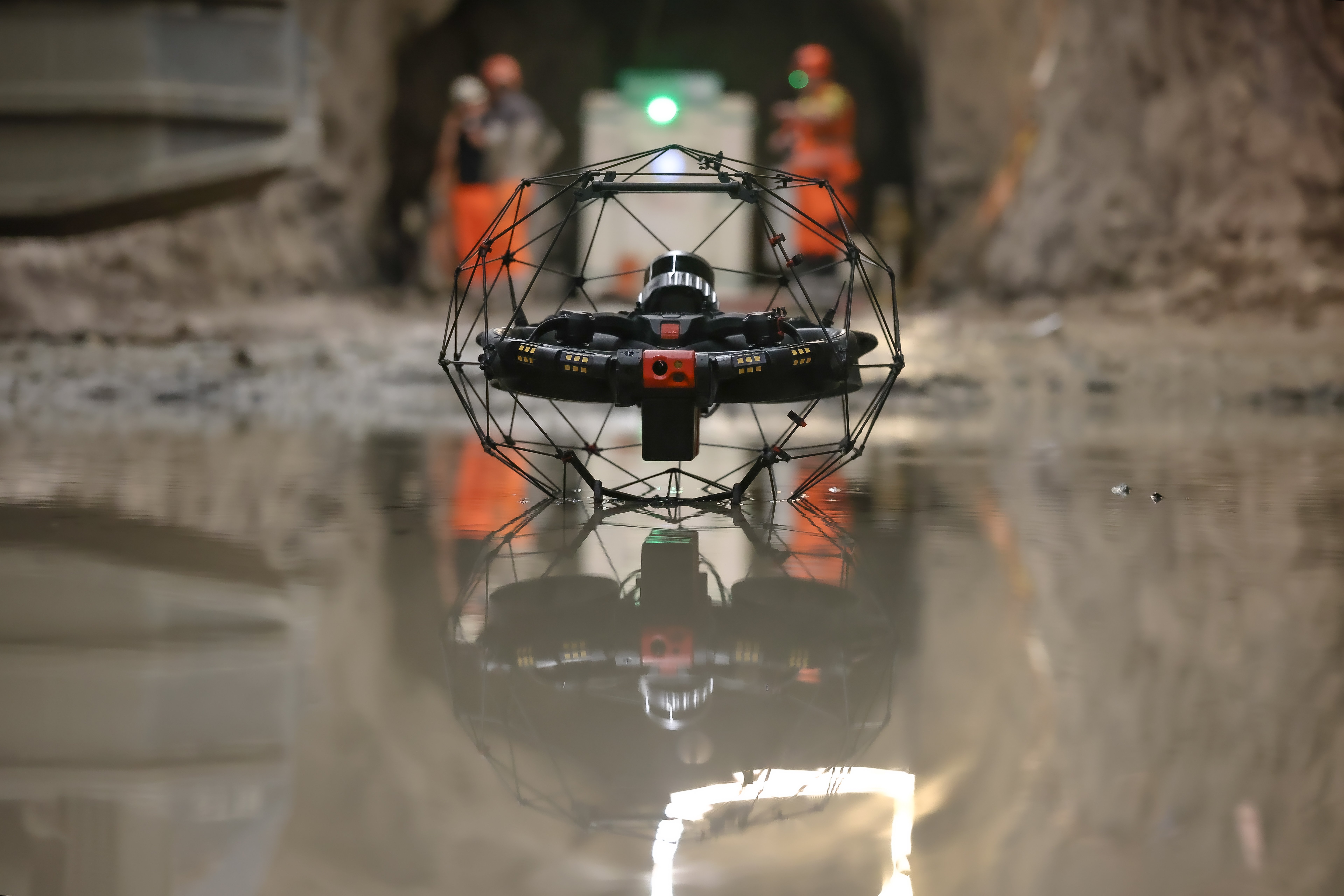
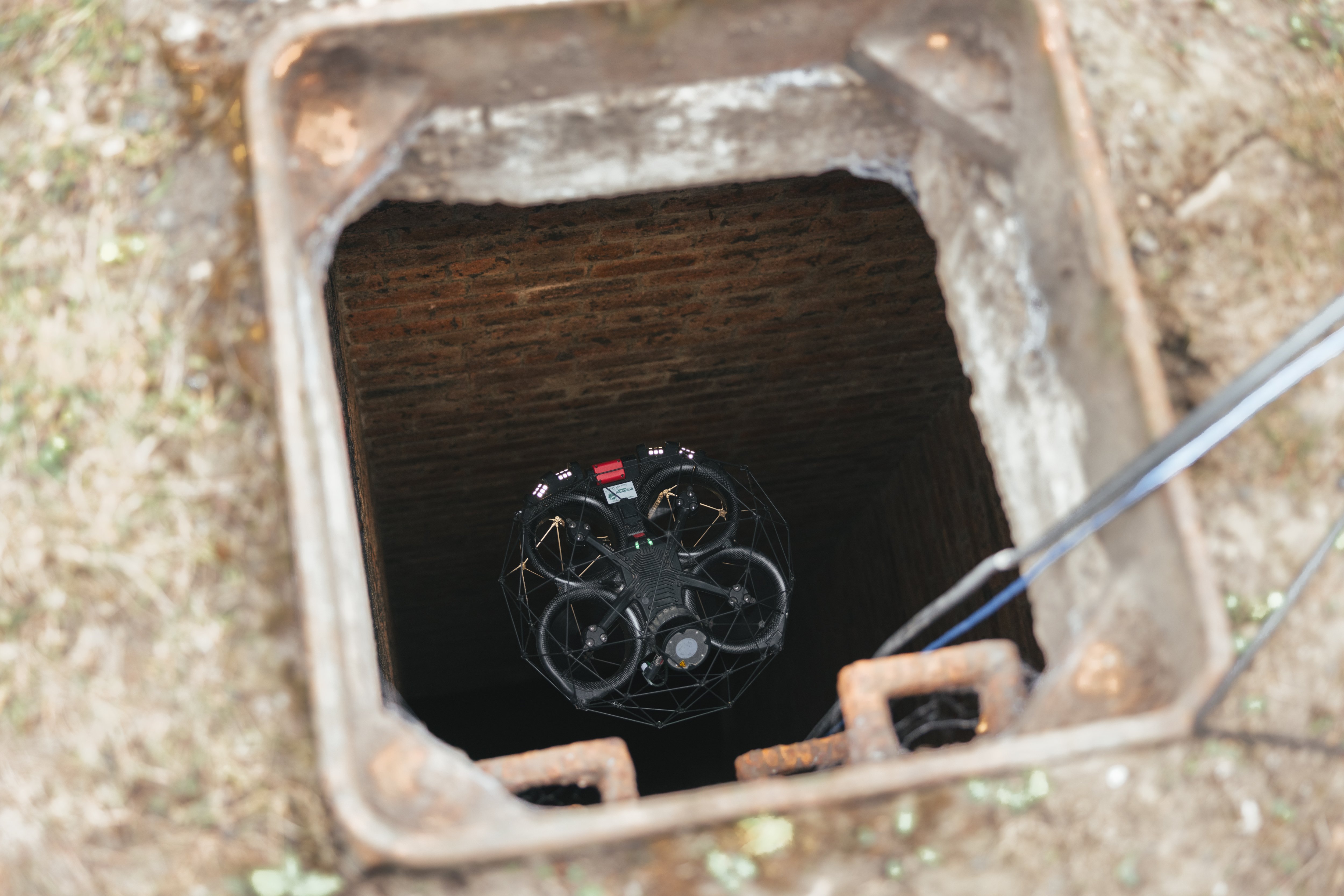
The Elios 3 being flown down the manhole by the Academy Geomatics team
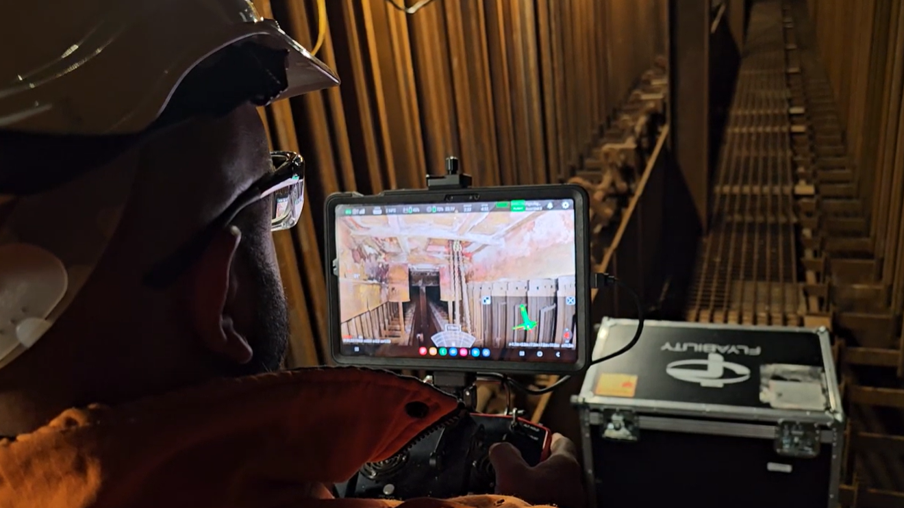
Academy Geomatics was asked to determine the condition of the sewer as well as its location. They needed to check if it was positioned as expected and see if surface run-off was entering the sewer directly or via a chamber. The Academy Geomatics surveyors planned to use the Elios 3 drone for this mission, which would enable them to get access to the hazardous space without putting their team at risk in the unknown conditions.
Why is the Elios 3 Used for Drone Sewer Surveys?
Despite sewer surveys being challenging undertakings, these projects are necessary to keep utility management flowing smoothly. The Elios 3 offers unique features that make it perfectly suited to simplify sewer surveys. The drone's benefits from a combination of hardware and software, including:
- Rugged, collision-tolerant design: To fly underground, the Elios 3 has to be tough. Thanks to its collision-tolerant cage and custom firmware that recognizes and recovers from impact, the drone can be flown with confidence beyond the visual line of sight and inside sewers.
- High quality data: The Elios 3 is equipped with a centimeter-accurate LiDAR scanner and 4K camera. Together, these tools offer life updates on the conditions around the drone as well as detailed information for inspections and surveys. The quality of the data is accepted by regulatory boards, making it clear that remote access can still provide the critical data needed.
- Custom software integrations: Flyability’s Elios 3 has a Surveying Payload that includes FARO Connect, ready for processing and managing the point cloud. In addition, Flyability have an integration with WinCan Web, one of the most widely used sewer management software programs. This means that data collected with the drone can be used in industry-recognized formats.
Planning a Georeferenced Sewer Survey with Drones
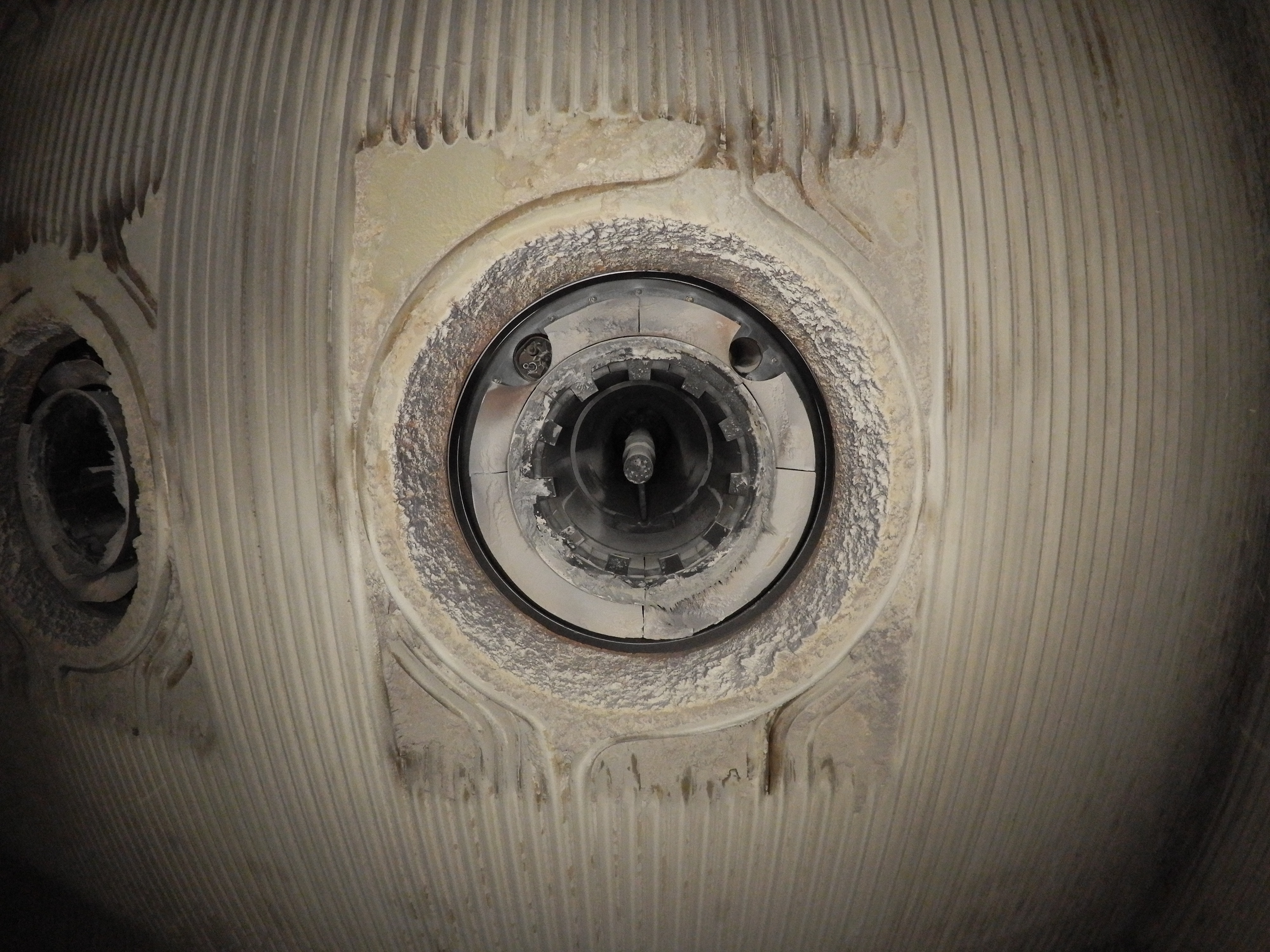
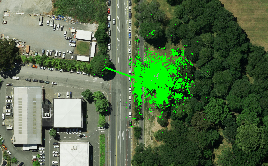
This sewer had 2 manholes with a connecting pipe between them. Each manhole had 10 meters of depth before the tunnel, which stretched roughly 60 meters between them. The Academy Geomatics team planned to gather terrestrial scans above ground and use a total station to georeference their results. They would then fly the Elios 3 below ground to gather data inside the tunnel and combine the point clouds in post-processing.
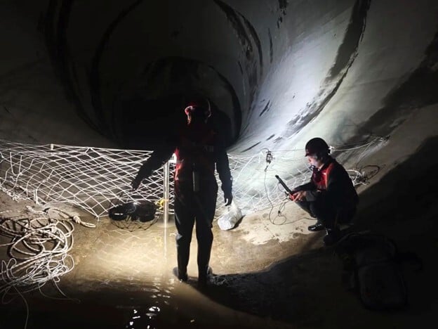
The team used a Trimble S7 total station to georeference checkerboards across the site before using a Leica RTC 360 laser scanner on an invertible scan tripod. They scanned the area above ground and then, using the tripod to lower the scanner down, below the top level of the manhole. This inverted scan would create overlap between the laser scanner point clouds and the Elios 3 ones for easy merging later. Before deploying any equipment inside the sewer, they tested the confined space for explosive gases to ensure there was no risk in this area.

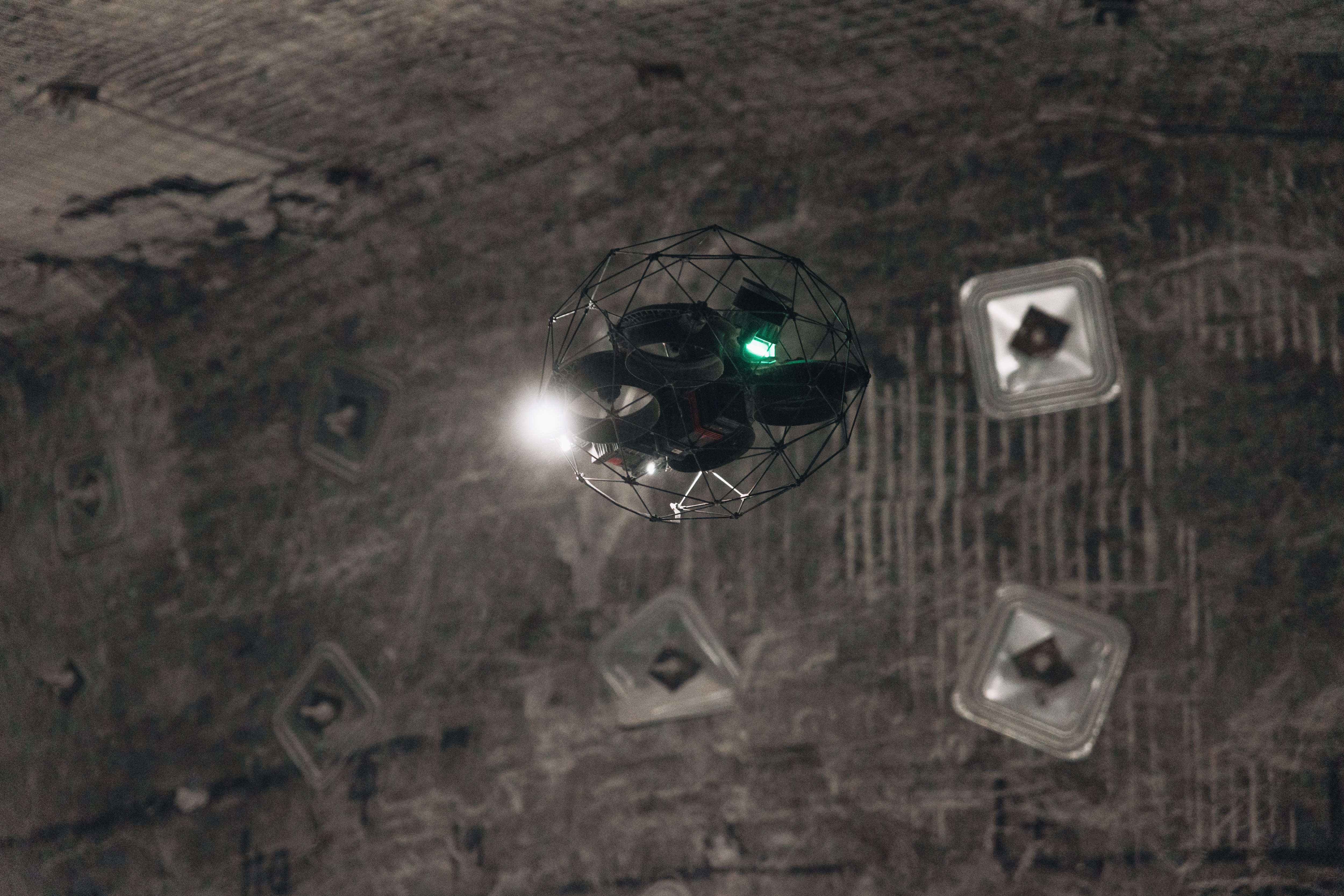
The Elios 3 slowly descending into the manhole under the guidance of an Academy Geomatics pilot
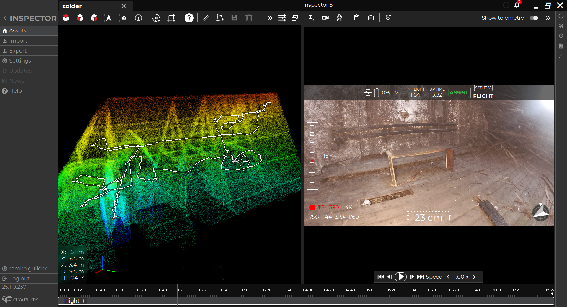
Next came the Elios 3 flights. The Academy Geomatics pilot completed 4 flights with the drone. The first was a SLAM flight, moving slowly to gather data while also scouting the environment. The second flight was focused on gathering inspection data via video. The final two flights were SLAM-focused flights, optimizing LiDAR data collection with the drone’s Surveying Payload to ensure they had complete coverage of the space. The structure of this sewer, in particular the 10-meter descent, could pose a challenge of SLAM scanning, which is why the Academy Geomatics team followed best practices to ensure they had no slippage in their results. Their Elios 3 is also equipped with the flammable gas sensor, alerting them to the presence of over 14 dangerous gases and giving them an additional safety measure as they operate beyond the line of visual sight underground. In this project, their sensor detected no hazardous gases and the mission was completed smoothly.
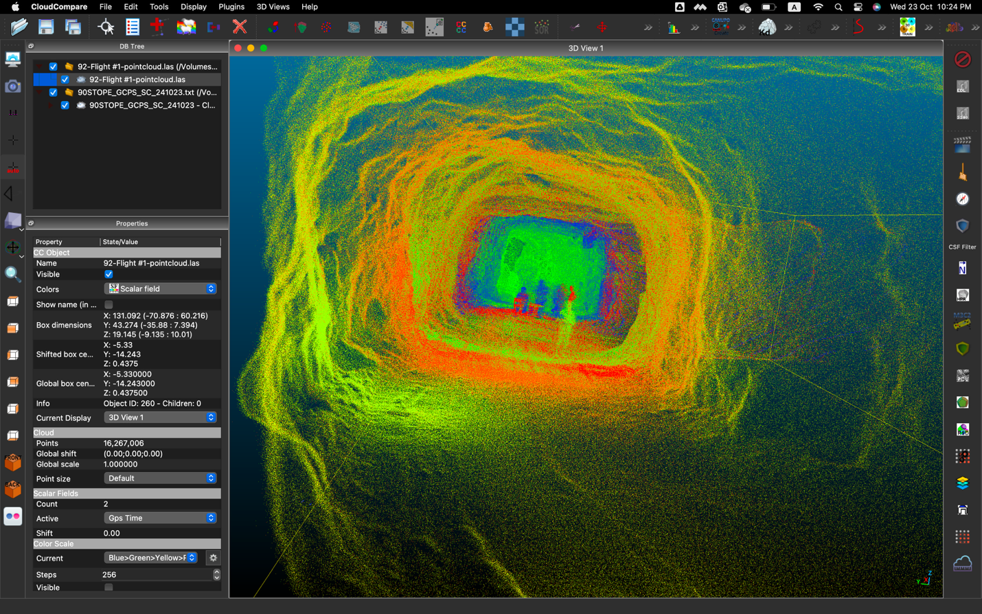
After data had been collected on-site, the team returned to the office and imported the Elios 3 data to Inspector 5 and then FARO Connect. After some filtering and tidying of the point cloud, the point clouds from the Elios 3 and laser scanners were all uploaded to CloudCompare where they were merged to create a final result. This was then imported to AutoDesk Recap for the last stages of analysis before it was shared with the client as a single, final point cloud.
Impact of Using Drones for Georeferenced Sewer Surveys
Academy Geomatics' entire survey, including the work with the Elios 3, was completed by just 2 people in half a day. This is a huge improvement compared to traditional methods, where it would take a full day to do the initial scans and another 2 days to traverse the sewer on foot - if it was even safe to do so.
The team on this project, led by Mark Anderson, a co-director of Academy Geomatics, commented on the speed of results possible with the Elios 3. “The drone allows us to get data quickly and safely, massively cutting down on the time we need for rope access as well as costs for having rescue teams on standby. We can survey 4 large manholes in a day with the Elios 3, compared to just 1 using traditional surveying tools.”
The results from the Surveying Payload continually impress both Academy Geomatics and its clients. “We found our Elios 3 point cloud in this project was just 20 millimeters off the terrestrial laser scans, which is a very good result and, in the context of this project, meets survey-grade requirements. Our client can use a much larger range for planning construction, but these results make it easier to work with precise knowledge of exactly where the sewer pipe is with accuracy to within 2 centimeters,” explains Mark.
Full video: see how Academy Geomatics completed this project from start to finish
Offering Underground Surveying Services
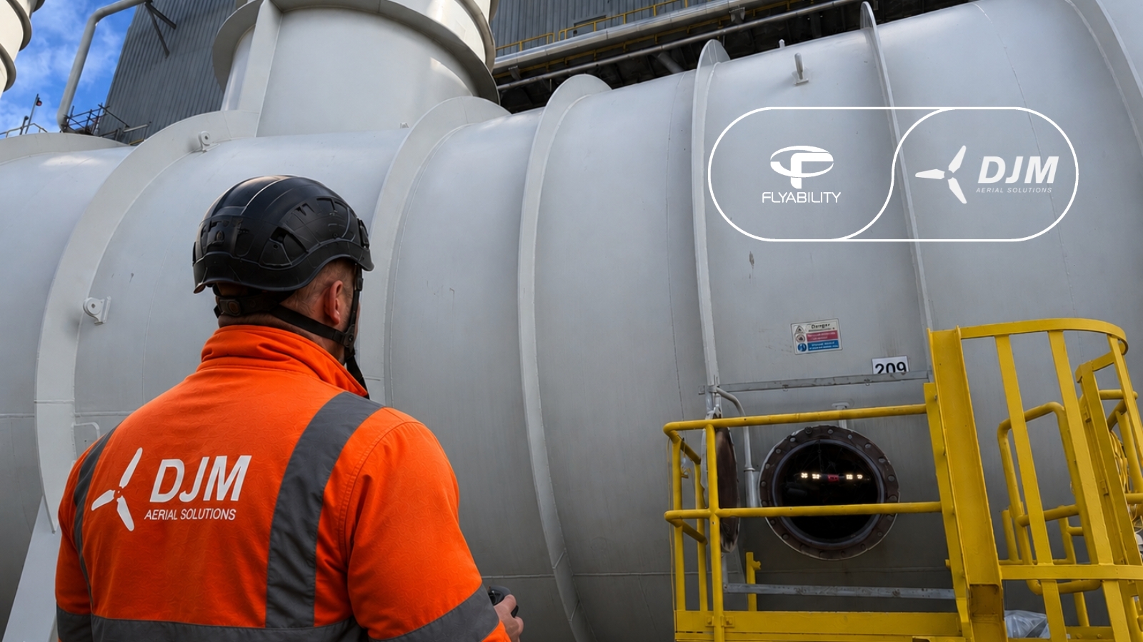
Mark and the Academy Geomatics team have found that working with the Elios 3 makes their work easier by cutting unnecessary risk exposure and work in confined spaces. There is also a cost savings from the faster work, enabling them to take on more assignments, and not needing confined space rescue teams. Their quality of work and results has seen them complete multiple assignments for this client, and even partner with other surveying companies who ask Academy Geomatics to use their Elios 3 to gather data in challenging environments.
As Academy Geomatics continues to operate across the country, they are expanding the use cases of its Elios 3 drone and experimenting with its newest features, including Smart Return-to-Home and Resume Inspection. “This tool helps us get the data we need without compromising on accuracy,” explained Mark. It’s clear that the Elios 3 is taking on a substantial role within their surveying operations, opening the door to safer, faster, and more efficient missions even in the most difficult environments.

.jpg)
-Jan-16-2026-10-59-56-8006-AM.png)
.jpg)
.png)