Mapping Alcatraz: Digitizing The Notorious Prison
Benefits In A Nutshell
|
Access Areas that were previously inaccessible for up to 100 years were reached with the Elios 3 with no safety risk to personnel. |
Safety The drone kept teams out of confined spaces or potentially hazardous environments, including wastewater storage. |
|
Data Quality The Elios 3's LiDAR provided clear visuals that are being compiled as part of a wider project to digitize the entire island. |
Reporting The results of this project are being used to plan the effective management of Alcatraz and protect it from damage due to climate change or high tourist footfall. |
Pete Kelsey and his company VCTO Labs is one of the giants of story telling by using drone mapping and digitalization in the USA. He has a particular focus on projects to do with research, such as cultural heritage or historical analysis. This job has taken him across the United States of America, mapping the secrets of Pearl Harbour as well as investigating Skinwalker Ranch.
For over a decade, Pete Kelsey has had one dream: digitizing an entire National Park. There are 63 across the United States, ranging in size and purpose. In 2023, Pete was put in touch with a park archaeologist at one of the most iconic parks there is: Alcatraz.
Planning To Digitize A National Park With Drones
Alcatraz is a tiny island off the coast of San Francisco. In the 1930s, it was considered the most fortified and secure prison in the world. Escape from this location was virtually impossible, which explains why it has been used as a prison of sorts for almost its entire history, including during the American Civil War in the 1860s. However, in the 1960s, Alcatraz was decommissioned as a prison. Then in 1972 it was added to the Golden Gate National Recreation Area and opened for public tours in 1973. Since then it has been under the management of the National Parks Service.
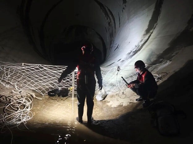
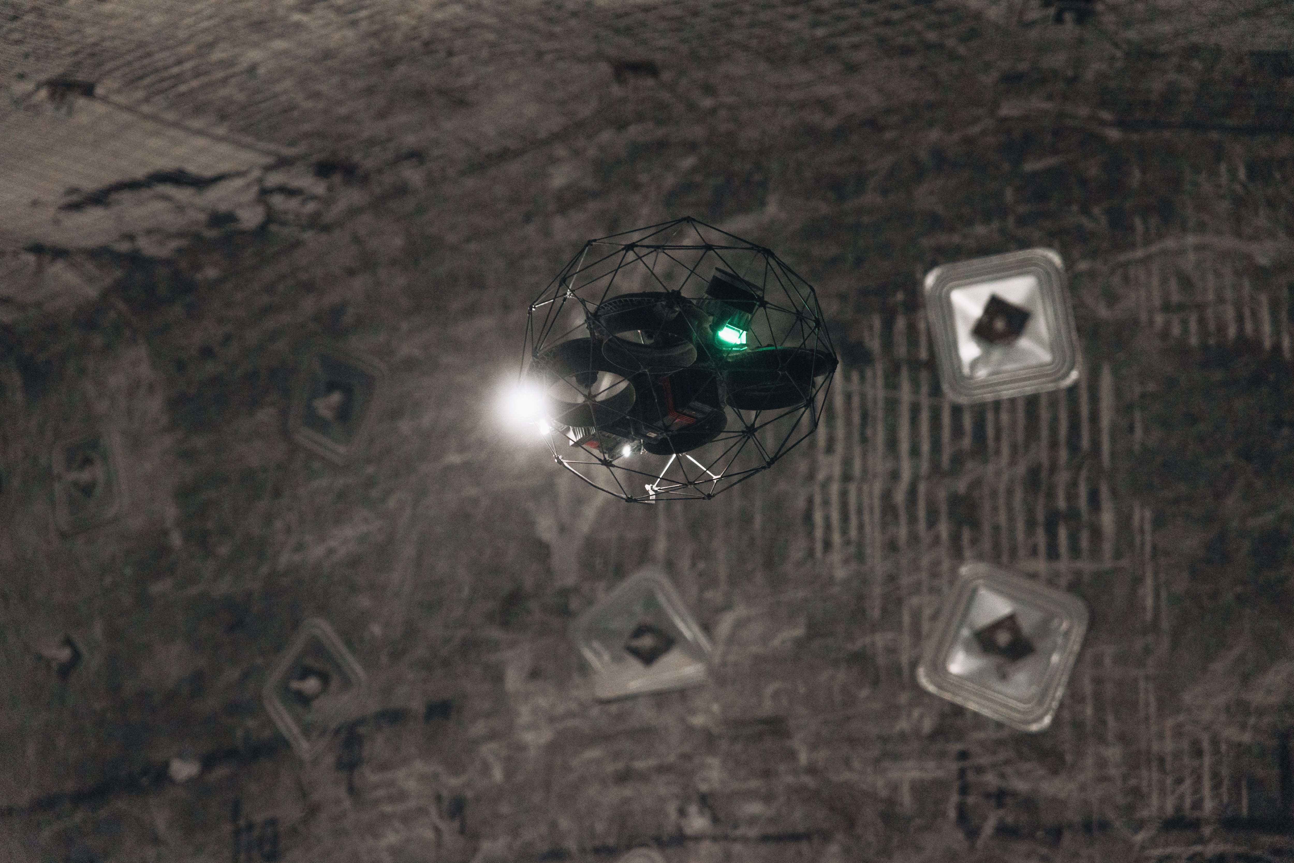
.png?width=875&height=656&name=Geoff%20H%20at%20Confined%20Space%20_%20Dungeon%20(1).png)
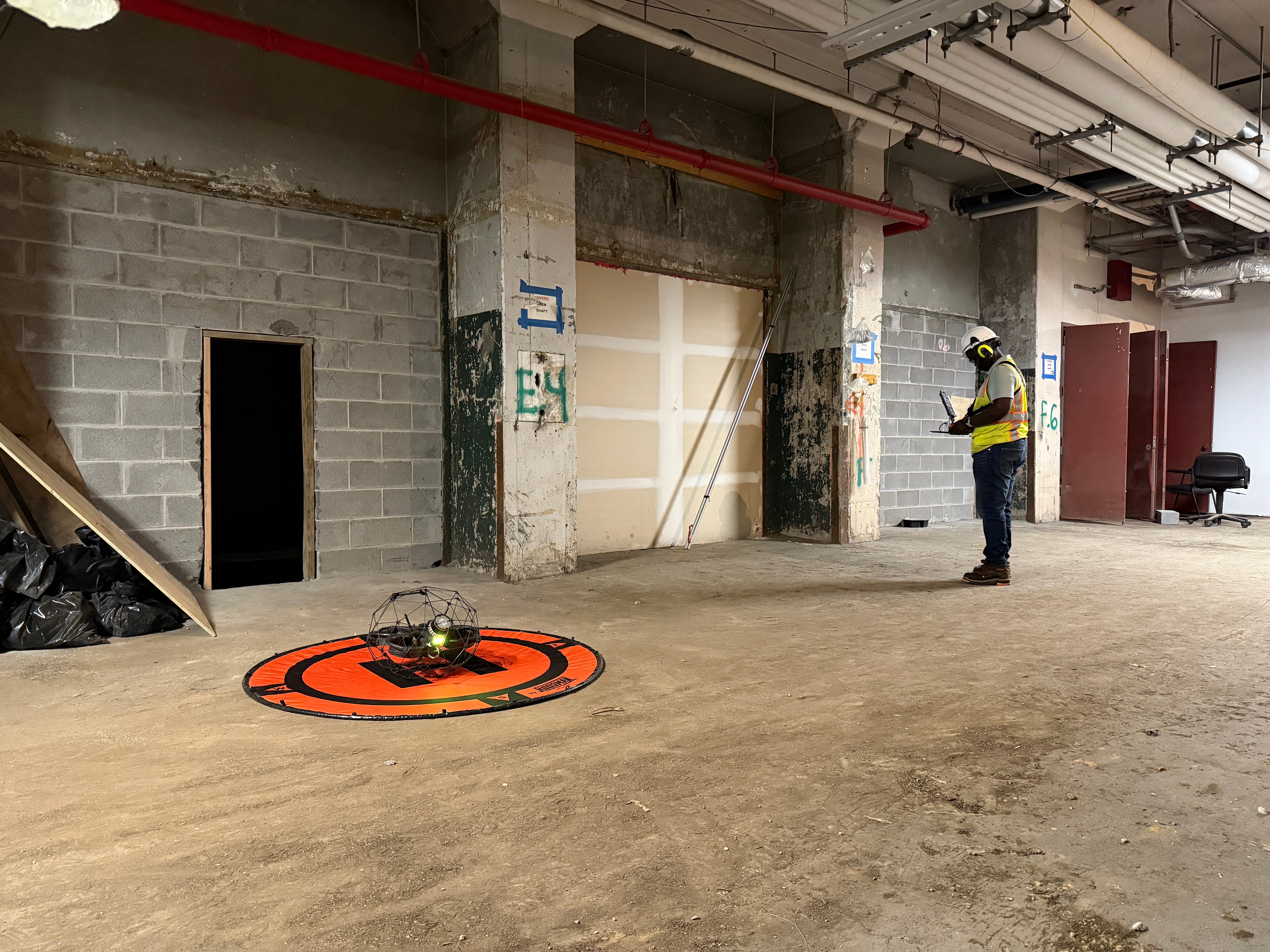
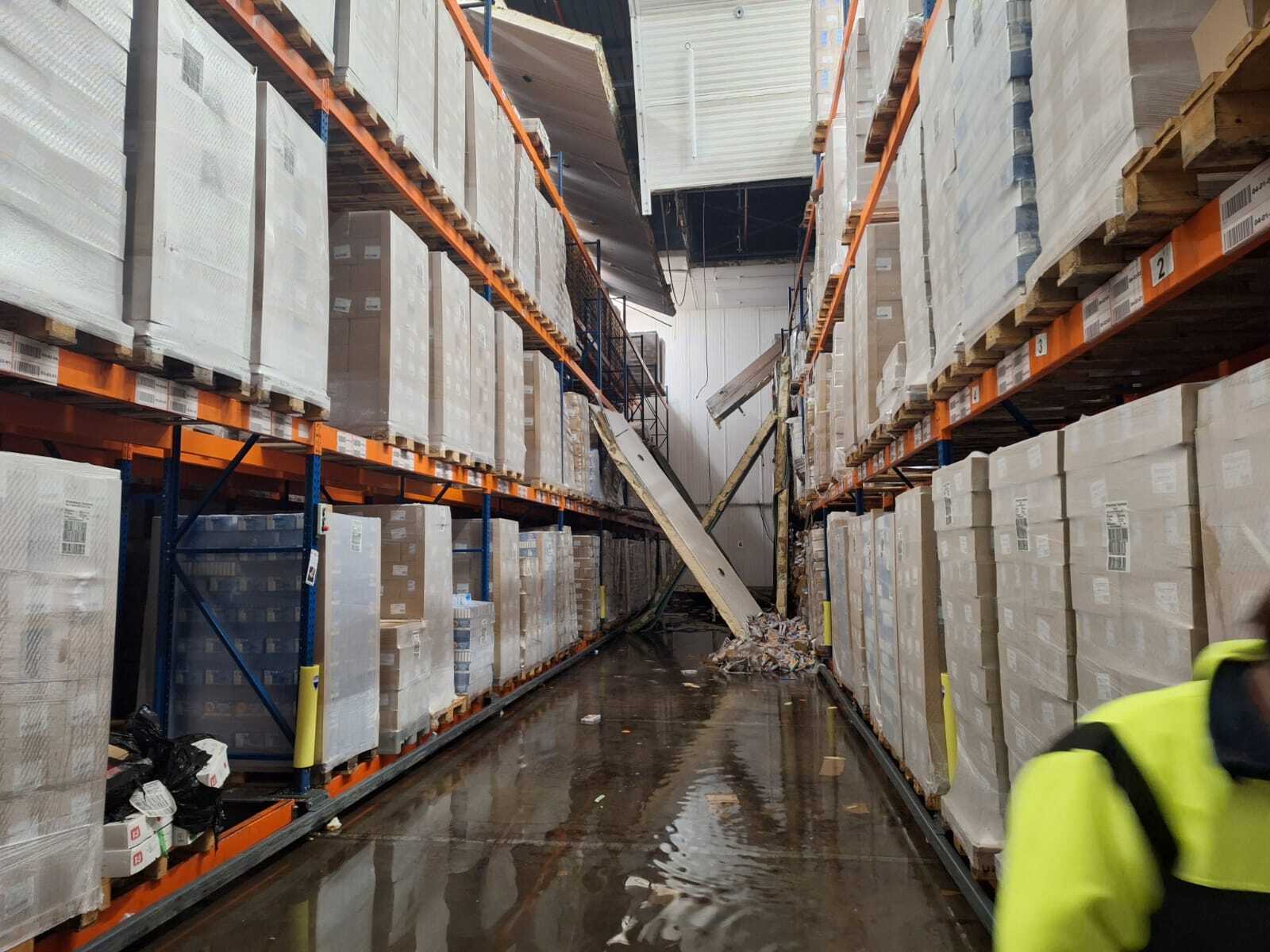
The Elios 3 offers access to areas not safe for human entry, including confined spaces such as the dungeons of Alcatraz
Pete Kelsey pitched the idea that his company, VCTO Labs, along with a team of volunteers across the mapping and surveying sectors could create a virtual national park. The plan was to create a scientific resource that could be used for managing the island, identifying maintenance needs, and accessing dangerous locations that are not possible to reach safely. It could also be a potential tool for tourists, providing digital access to locations currently closed to the public, as well as creating a resource that can be viewed from afar for people who cannot visit the site. Finally, the environment and buildings on Alcatraz face the risk of being worn down/damaged. With rising sea levels combined with over 1 million visitors per year, the island is under significant pressure and faces threats from both people and climate change. The digital version of Alcatraz could help detect these issues, plan responses, and identify stress points. This could also include creating a resource that could be used for change detection.
It took Pete 9 months to secure the specific permits necessary for the project, including a drone permit as drones are typically not allowed in the national parks. Once he had the permission for the project, he needed to assemble a team.
Assembling A Specialized Drone Mapping And Surveying Team
.jpg?width=263&height=350&name=1000018059%20(1).jpg)
Pete reached out to his network to find a team who could assist him. He needed drone-based LiDAR specialists, drone-based photogrammetrists, terrestrial laser scanners, people who used SLAM, and more!
Every single person who took part in the project did so on a voluntary basis, excited to be involved in this industry first. As part of the team, Pete included Matt MacKinnon from UAS Inc. in Ontario. With days to go before the project, Matt suggested bringing the Elios 3 in case they found confined spaces that could not be easily accessed. Pete hadn’t seen an Elios at work before but welcomed the addition of yet another powerful tool for the project. Everyone was excited - and everyone knew that no 1 tool could do it all.
Over the course of 3 weeks, Pete and the team of volunteers gathered data over every inch of Alcatraz's rocky island and the buildings around it. There isn’t an infrastructure to house guests in this National Park, so instead they slept in old jail cells. The project brought together experts from across the United States and as far as Australia to accomplish its goal.
The Elios 3 At Alcatraz
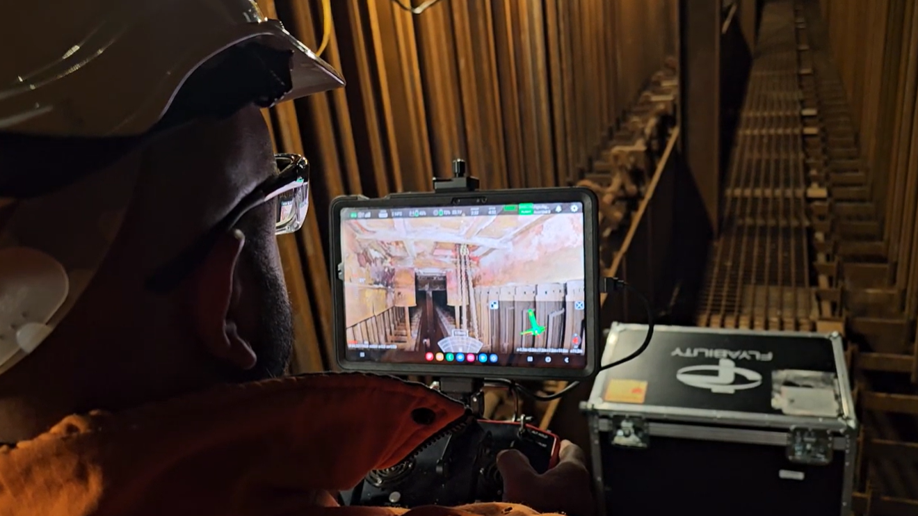
Pete Kelsey had not used the Elios 3 before, however Matt and pilot Geoff Helloin from UAS Inc recommended the drone be brought onboard. This is because it would be ideal for inspecting confined and challenging spaces that may not be safely or easily accessed by the team. With the intention to digitize the entirety of the island from top to bottom, the Elios 3 was a vital tool in finding a safe way to collect the necessary data to get the full picture of Alcatraz. This is because the Elios 3 can fit into spaces as small as 50x50 cm while gathering both LiDAR and visual data to empower detailed analysis of even the most hard-to-reach areas.
There were 3 planned applications for the Elios 3 at Alcatraz. All of the island needed to be digitized, from the inside out. Several structures are currently shut to the public, and some are even restricted from staff accessing them due to the potential safety risks. Pete and UAS Inc deployed the Elios 3 in several of these locations.

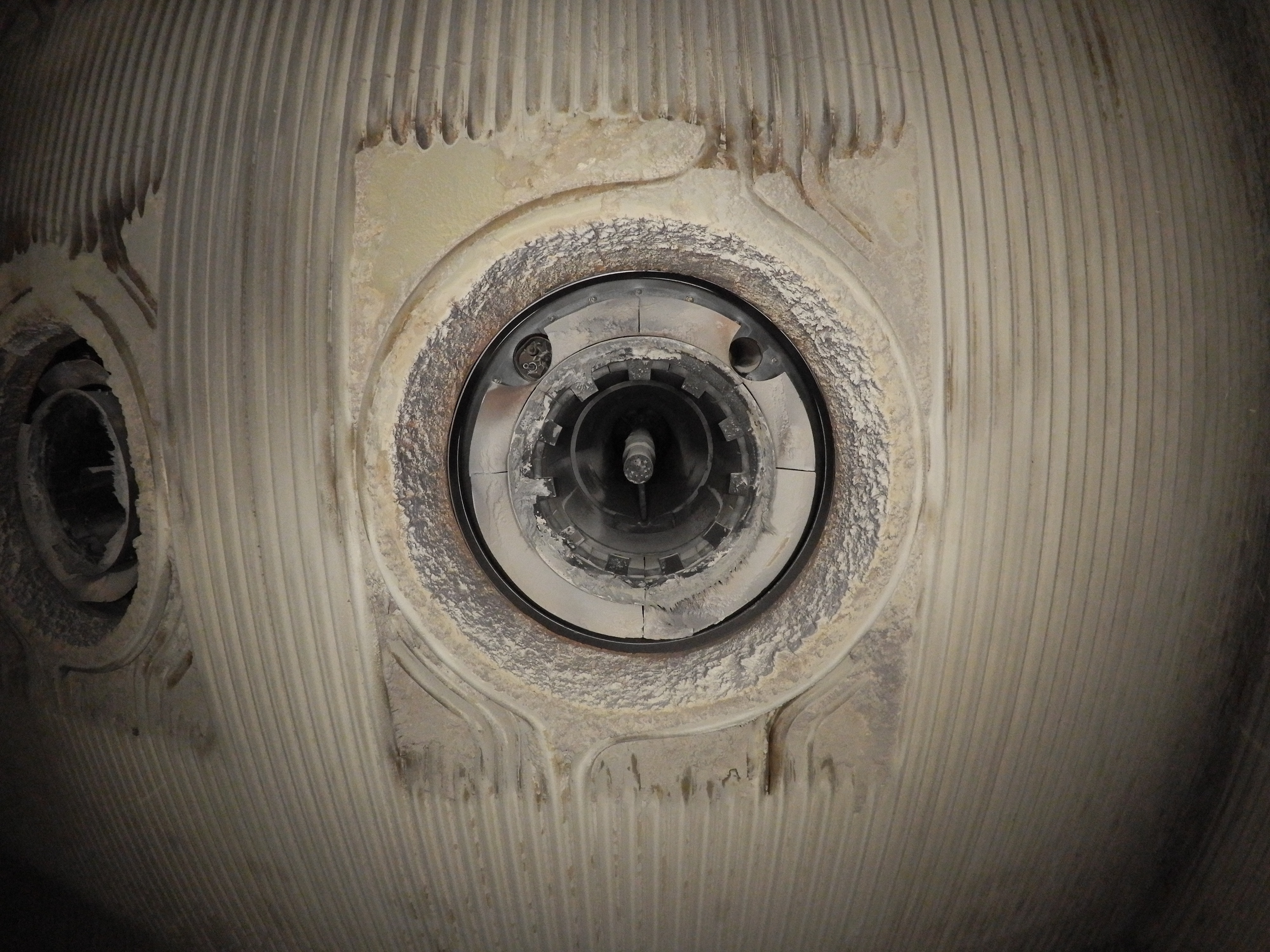
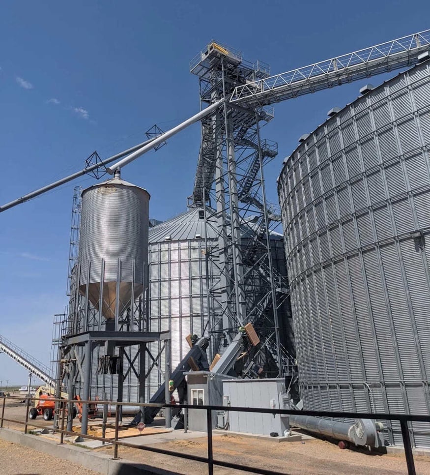
The powerhouse stack was captured with the LiDAR scan by the Elios 3
The old powerhouse on the island is currently shut down and off-limits to the public. It used to be where they generated all the electricity for the island, and has several hazards inside it. There are 2 oil-fed boilers, chimneys, and heating, ventilation, and air conditioning (HVAC) systems. The infrastructure ranges in age, with some of it being 100 years old. It was not possible to laser scan from the ground, or fit a typical rotary drone into the space. The Elios 3 was their only tool that could safely gather the LiDAR data in this space. They also flew up the smoke stack in the power house, pictured above.
.png?width=221&height=295&name=PK%20and%20E3%20(1).png)
The next spot they used the Elios 3 was behind a barred door. It was a thick, jailhouse-like barrier that had been sealed for decades. This structure is one of the oldest parts of the island, dating back to the civil war. No one goes behind that door due to risk of dangerous chemicals or materials, as indicated by signs on the door. However, Pete’s team carefully opened the door and managed to send the Elios 3 inside. They discovered a civil war era dungeon and used the Elios 3’s LiDAR to create a 3D model of it. This was the first time anyone had seen this space in decades, and made the archaeological team very excited.
Image right: Pete Kelsey pictured with the Elios 3 at Alcatraz
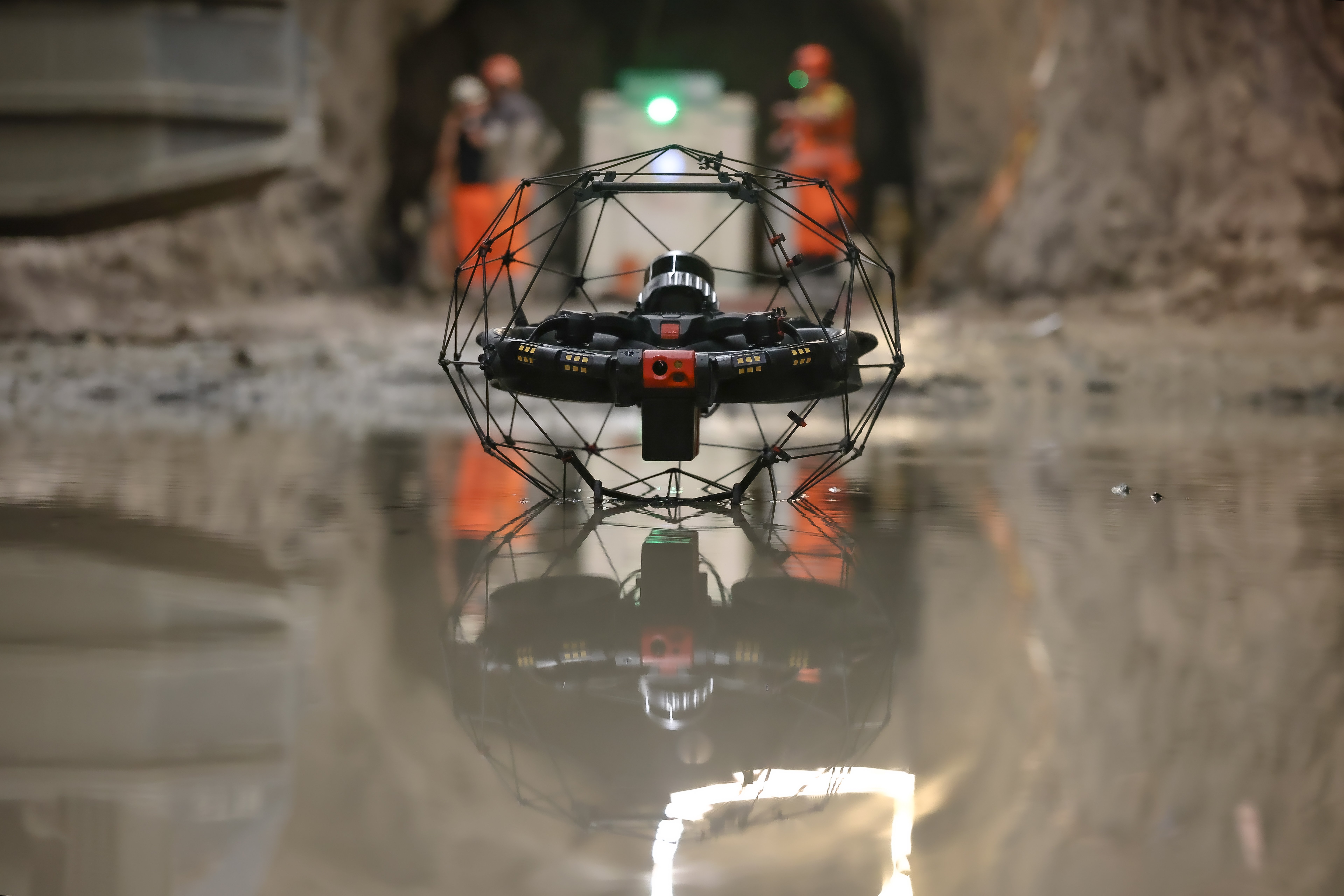
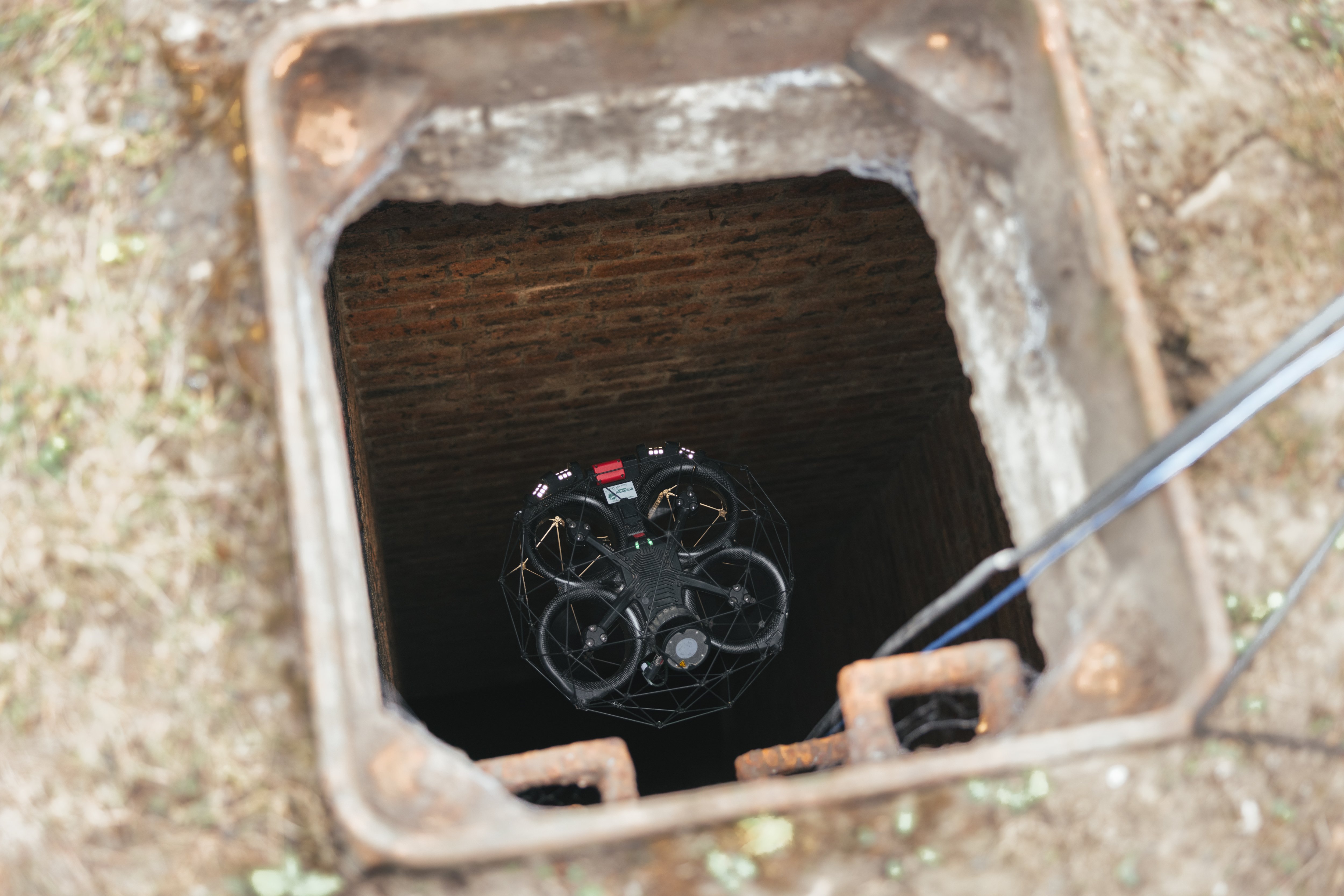
Finally, one of the park rangers approached Pete’s team to ask if they could inspect some old cisterns. No one had been able to safely enter or inspect them for a long time, and they hoped that Pete’s team could find a solution. The cisterns were accessed via 2 manholes on the northside of the island, which is currently rarely used. The structures are two huge concrete boxes buried underground, and the space between the ceiling of the box and the stagnant water is a maximum of 4 feet (just over 1 m). The ranger wanted to learn about the piping network in and out of the cisterns, but has no existing records to go off. UAS Inc’s Elios 3 pilot Geoff Helluin flew both of the cisterns with ease, astonishing the ranger and Pete. The Elios 3 quickly gathered a clear image of the space.
How The Elios 3 Simplified Drone Mapping Alcatraz
All of the data from this project from the various data collection tools is being merged with a supercomputer from AMD. Pete has highlighted the value that the Elios 3 added to this mission.
“I hadn’t seen the Elios 3 in action, but couldn’t believe the access it gave us. Many of these sites would not have been accessible without the Elios 3, and it saved us a huge amount of time and kept the team safe. I’m astonished by what the Elios 3 can do.”
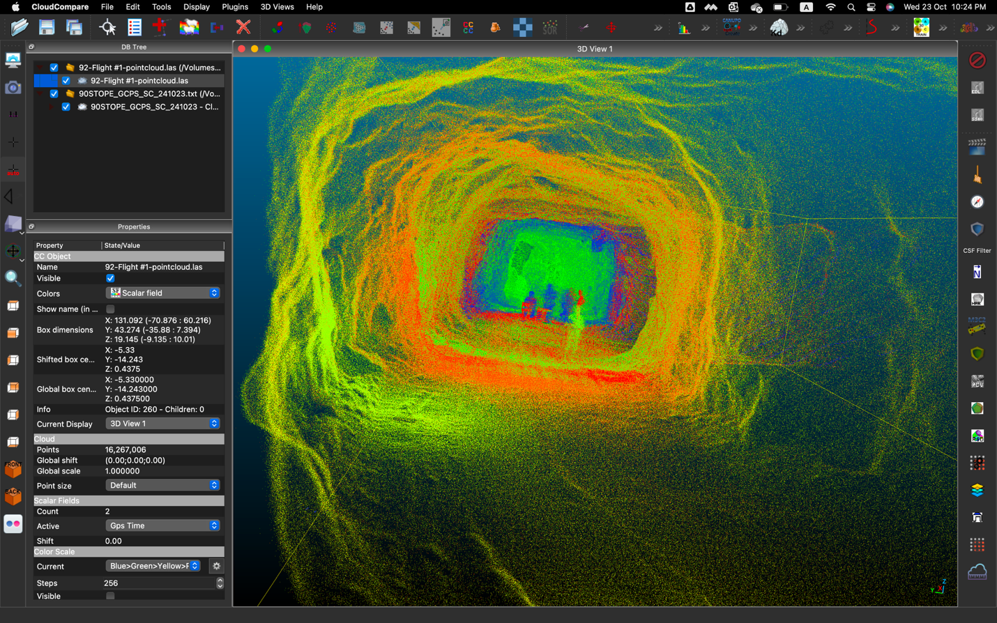
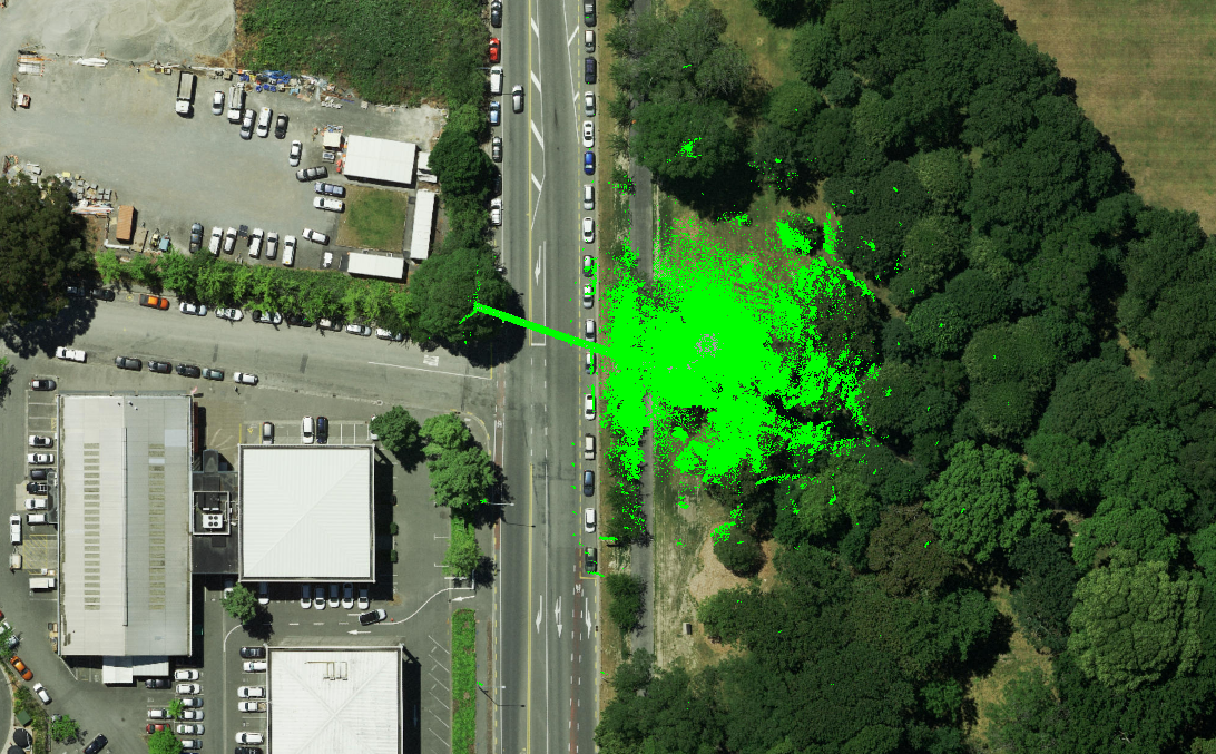
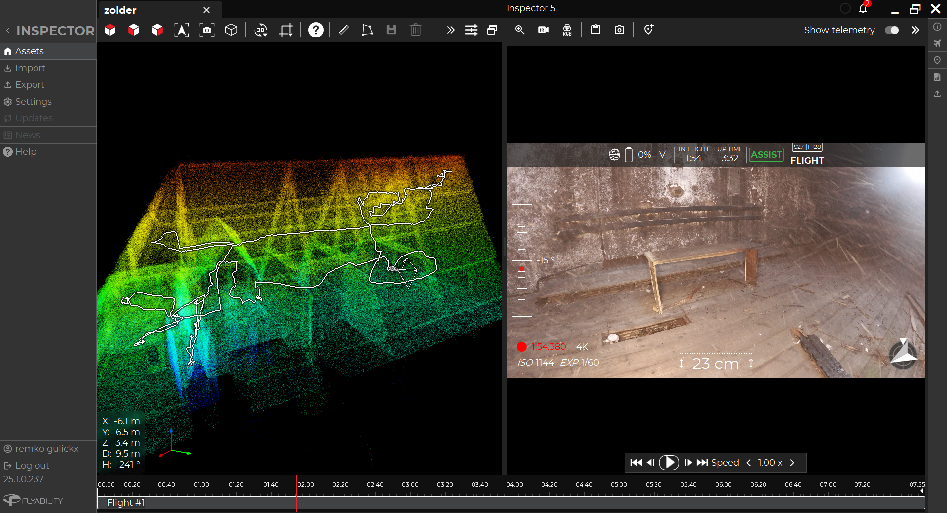
A compilation of the LiDAR data capture with the Elios 3 on Alcatraz
This project by Pete and his colleagues will be a first for the US and set an exciting precedent for creating digital versions of National Parks that can be used for education, outreach, research, and park maintenance. This use of a variety of tools to achieve the overarching goal also demonstrates the exciting advancements we have made with modern technology.
Discover more about the Elios 3 and its applications

.jpg)
-Jan-16-2026-10-59-56-8006-AM.png)
.jpg)
.png)