Oil & Gas
 Power Gen
 Chemicals
 Mining
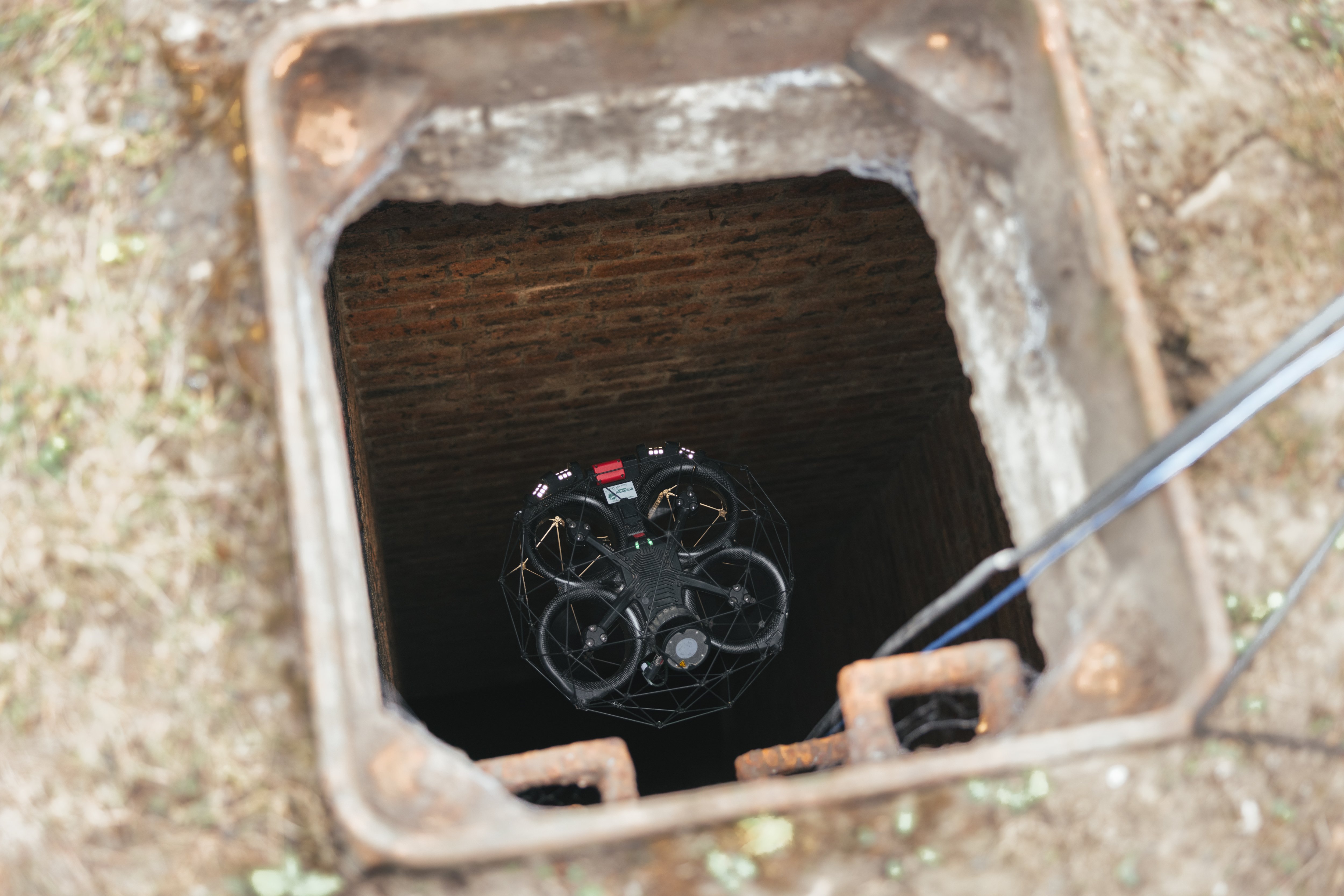
 Sewers
Elios 3 Helps Luxembourg 3D Map Slate Mine Turned Into Museum
Luxembourg's division of Mines, Mining, and Quarries used the Elios 3 to 3D map an old slate quarry that was being turned into a museum.
Benefits in a Nutshell
|
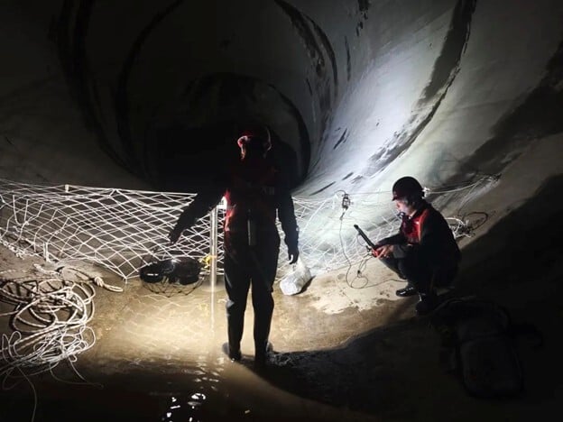
Safety Using the Elios 3 to capture LiDAR data inside the quarry or mine’s galleries allowed authorities to map areas they could not safely enter.
|
Indoor 3D Maps 3D maps were essential to map the mine but it was hard to achieve with a handheld LiDAR scanner, and making them with aerial photogrammetry would have been a slow and challenging process. The Elios 3’s LiDAR sensor allowed Luxembourg authorities to make 3D maps of all the mine’s chambers quickly and efficiently. |
Stability determinations Data from the 3D models helped calculate data like the thickness of the ground in order to make stability determinations. |
Planning to map disused mines
Hundreds of years ago, mining extraction and underground quarrying activities were the biggest industry in the country of Luxembourg.
Some of these mines and quarries have been converted into museums where visitors can take tours of the mines, learning how they were once used and the history of their importance to the country’s economy.
For this reason, it’s crucial to government officials to ensure that any mine opened for tourism has been thoroughly inspected and approved for entry from a safety perspective.
It’s also important to map these mines, since they are so old that few of them have detailed maps available.

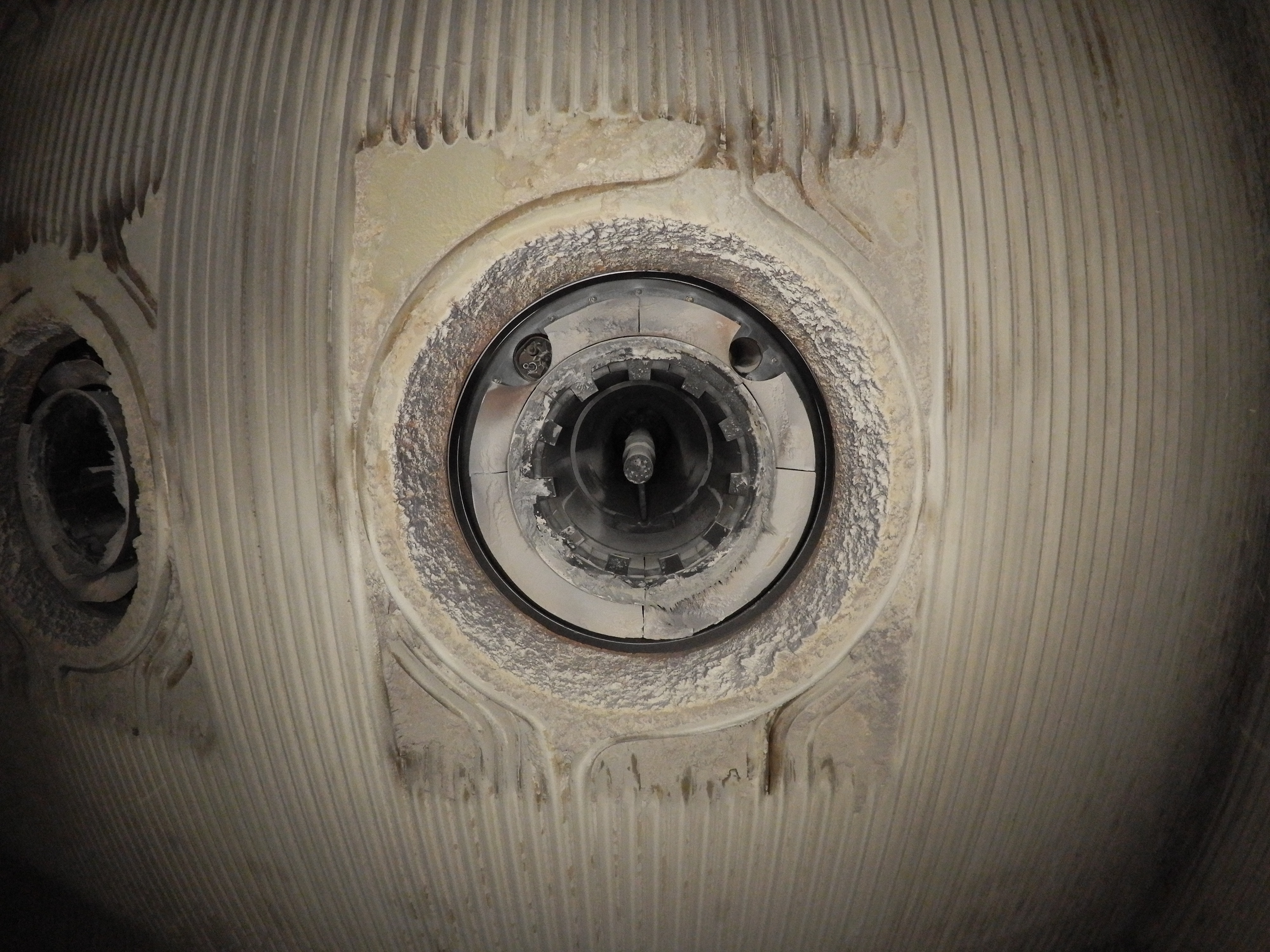
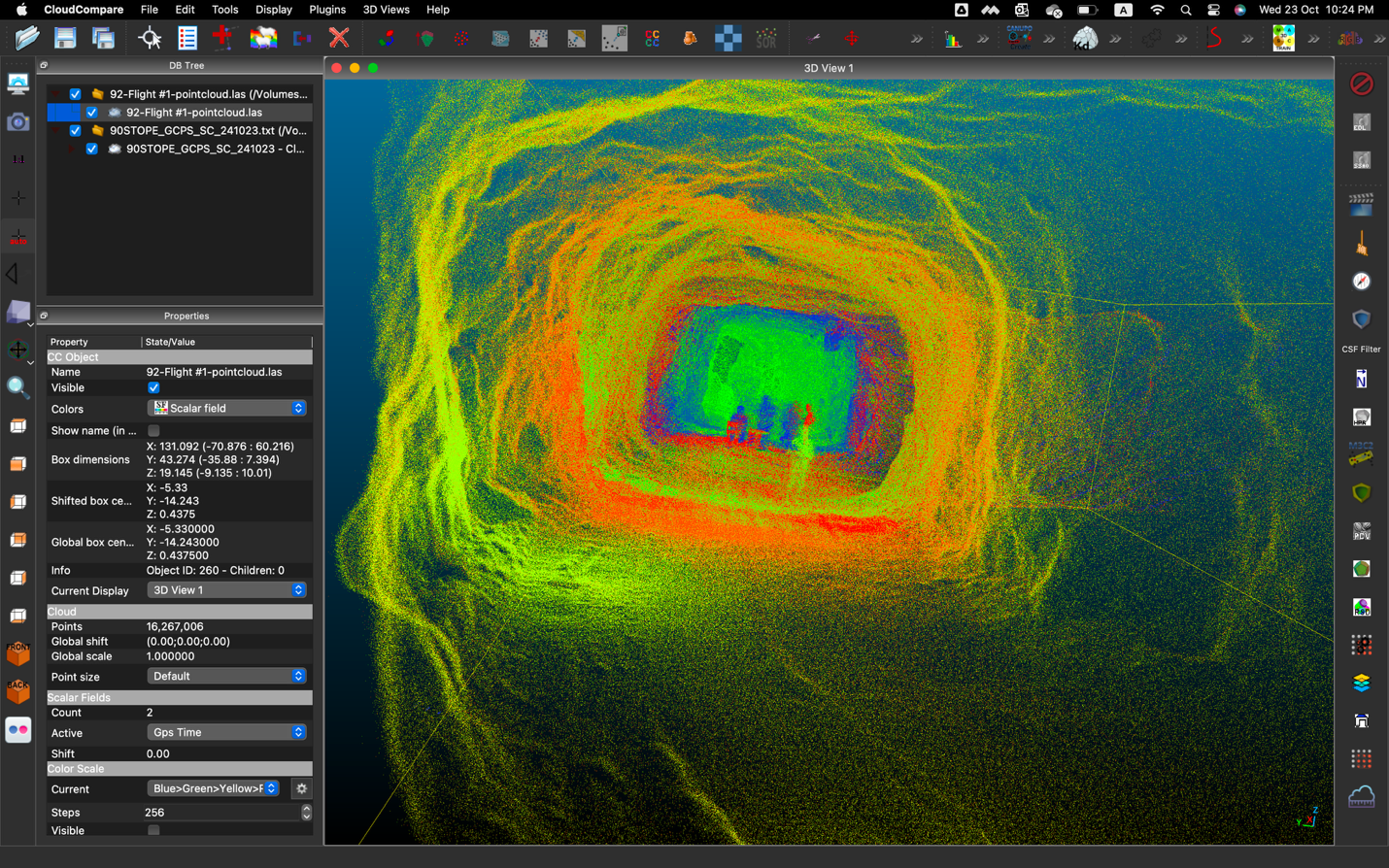
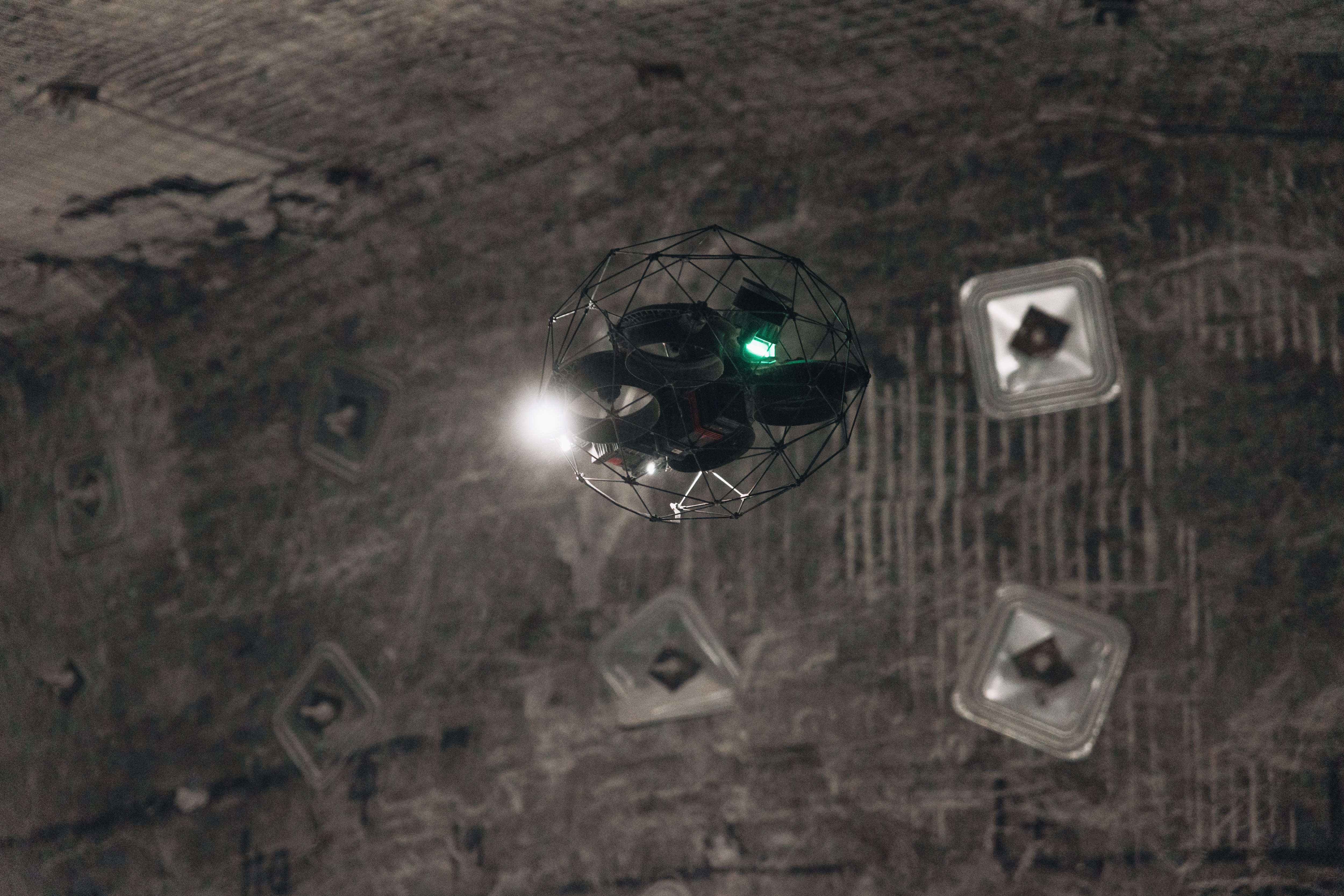
Picture taken within the slate mine by the Elios 3
Planning to 3D map a slate mine
A new division in the Luxembourg Ministry of Labor called Mines, Mining, and Quarries under the responsibility of Pierre Schmitz and Hervé Lestang was tasked with overseeing safety in mines, including those that have been turned into tourist attractions.
The new division has two primary duties:
- Update relevant laws. Luxembourg’s laws related to mining and safety date back to the 1800s, and are in need of being updated to reflect current realities.
- Conduct inspections. Officials from the new division spend much of their time in the field collecting data related to safety inside various mines throughout the country. They also create maps of the mines as part of this work.
These two tasks are deeply interconnected. Data collected in the field will inform the writing of the new laws, and the new laws will describe and help enforce best practices around safety and management being honed in the field.
When administrators of an old mine want to turn it into a museum, they will contact the division of Mines, Mining, and Quarries and ask for their approval. The process typically requires a safety inspection of the mine. It also requires the creation of maps, since the mines are old, which means that a lot of data is missing and existing maps are not accurate.
Using drones for mapping underground mines
Inspecting and mapping these mines represents a good opportunity to use a drone or robot for data collection.
Mining presents specific challenges for this work like low lighting, the presence of dust, and the absence of GPS.

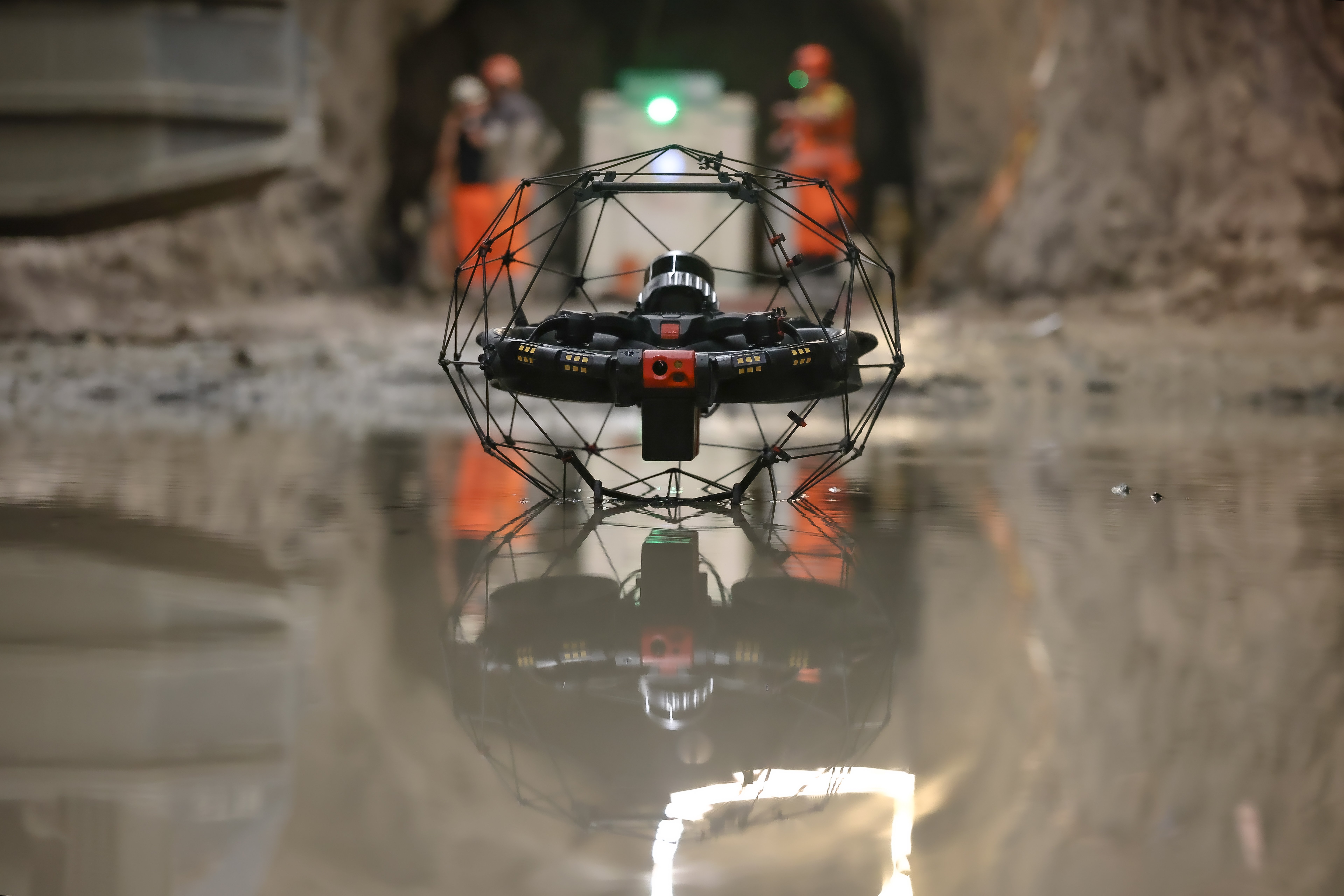
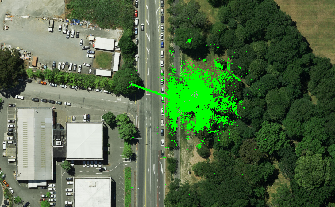
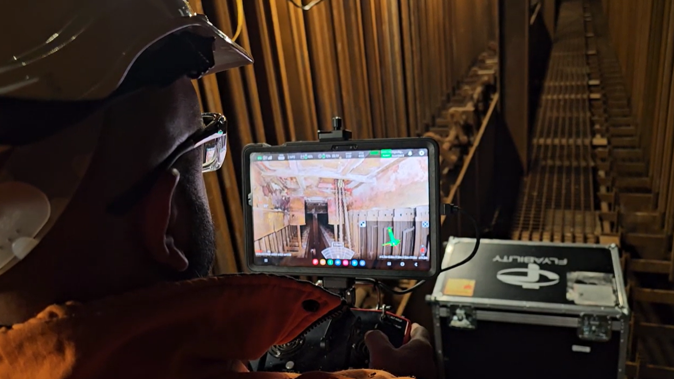
The Elios 3's 3D Live Map helps pilots fly in very dusty environments
Authorities from the division of Mining wanted to create 3D models of a slate mine. They knew that handheld LiDAR would not work given the dangerous areas they wanted to map. Using photogrammetry with visual data collected by drone was also not a good option, since it would be incredibly time consuming, requiring a large number of flights close to the mine’s walls and the processing of a huge amount of data.
Luxembourg authorities decided to test Flyability’s Elios 3 to map the mine. The Elios 3 is an indoor drone equipped with a LiDAR sensor that allows it to create 3D maps in real time, while in flight. These maps are made using SLAM (Simultaneous Localization and Mapping), technology that lets the drone locate itself in three dimensional space as it flies.
Of all the ways that the mines could be mapped, LiDAR was the most promising option.
The goal was to see if the Elios 3 could create 3D maps that would meet all the needs of the division.
Success of drone mapping in a slate mine
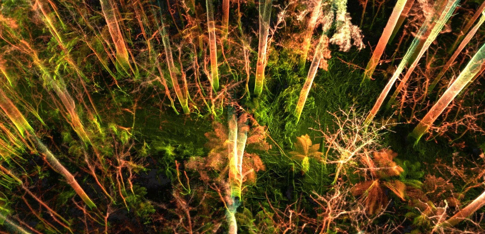
The test flights and resulting 3D models were a success. Several flights were performed in various parts of a slate quarry, producing 3D models that were sufficiently detailed. Since the models were produced as the drone flew, mining authorities could have them immediately after each flight, with no time needed for processing.

In many instances, the Elios 3 was used to fly into areas that were completely inaccessible to humans, either because they were too dangerous to enter or because the entrypoint was too small for human entry.
Here are the benefits that were realized by using the Elios 3:
- Detailed 3D models. The 3D models created by the Elios 3 provided all the information to create maps of the mine, including data on the width, length, and volume of various sections of the mine.
- Safety to workers. By using the Elios 3, we were able to remain safely outside of any potentially unstable areas within the mine while collecting the data they needed to do their work.
- Stability determinations. The 3D models also provided data to help calculate the depth of the mine and the thickness of the ground above it. This data is crucial for measuring the amount of stress present in a given section of the mine, which in turn helps determine how stable that area is.
- Rugged operations. Despite the challenging circumstances the mine presented, including low lighting, dust, and a lack of GPS, the Elios 3 performed well and executed all the work needed.
- Marketing materials. The 3D models also provide interactive depictions of the mine that can be used to attract new visitors.
.jpg)
-Jan-16-2026-10-59-56-8006-AM.png)
.jpg)
.png)