Oil & Gas
 Power Gen
 Chemicals
 Mining
 Sewers
Elios 3 Helps Inspect, 3d Map Inaccessible Shaft Below Newcastle Central Station
Following guidance from COPTRZ, inspectors from Nexus Rail used the Elios 3 to 3D map a dangerous, inaccessible area beneath the Newcastle Metro Station.
Benefits in a Nutshell
|
Speed The Elios 3 was able to collect all the data needed in just one 8-minute flight. |
Digital Twins The Elios 3’s LiDAR data was used to create digital twins of the entire underground area at the metro station, allowing other stakeholders onsite to visualize defects in the area and track changes to them over time. |
Access The Elios 3 was able to enter an underground void at the metro station where human entry wasn’t possible.
|
Introduction
Nexus Rail is an infrastructure maintenance company based in the U.K. To source its technology, the company works closely with COPTRZ, the top drone specialists in the country.
One of the biggest areas of focus for Nexus Rail’s maintenance work is the metro line in Newcastle, England, a network of underground subway trains, rail lines, and stations that provides transportation throughout the city.
Newcastle Central Station is a hub for Newcastle ‘s metro system. The station first opened its doors in 1850, and it’s listed as a Grade 1 building, a designation signifying that “the site is of exceptional national, architectural or historical importance.”

Newcastle Central Station
Inspections are a crucial part of Nexus Rail’s maintenance work, and it periodically conducts inspections of the infrastructure at the Newcastle Central Station. These inspections are typically performed in person, with inspectors entering the underground areas where the lines run to collect visual data.
But this traditional approach isn’t always ideal, since it can expose inspectors to the hazards of confined space entry and work at height on scaffolding. Further, some parts of the train station can’t be entered by a person, which makes it challenging to maintain them.
Customer Needs
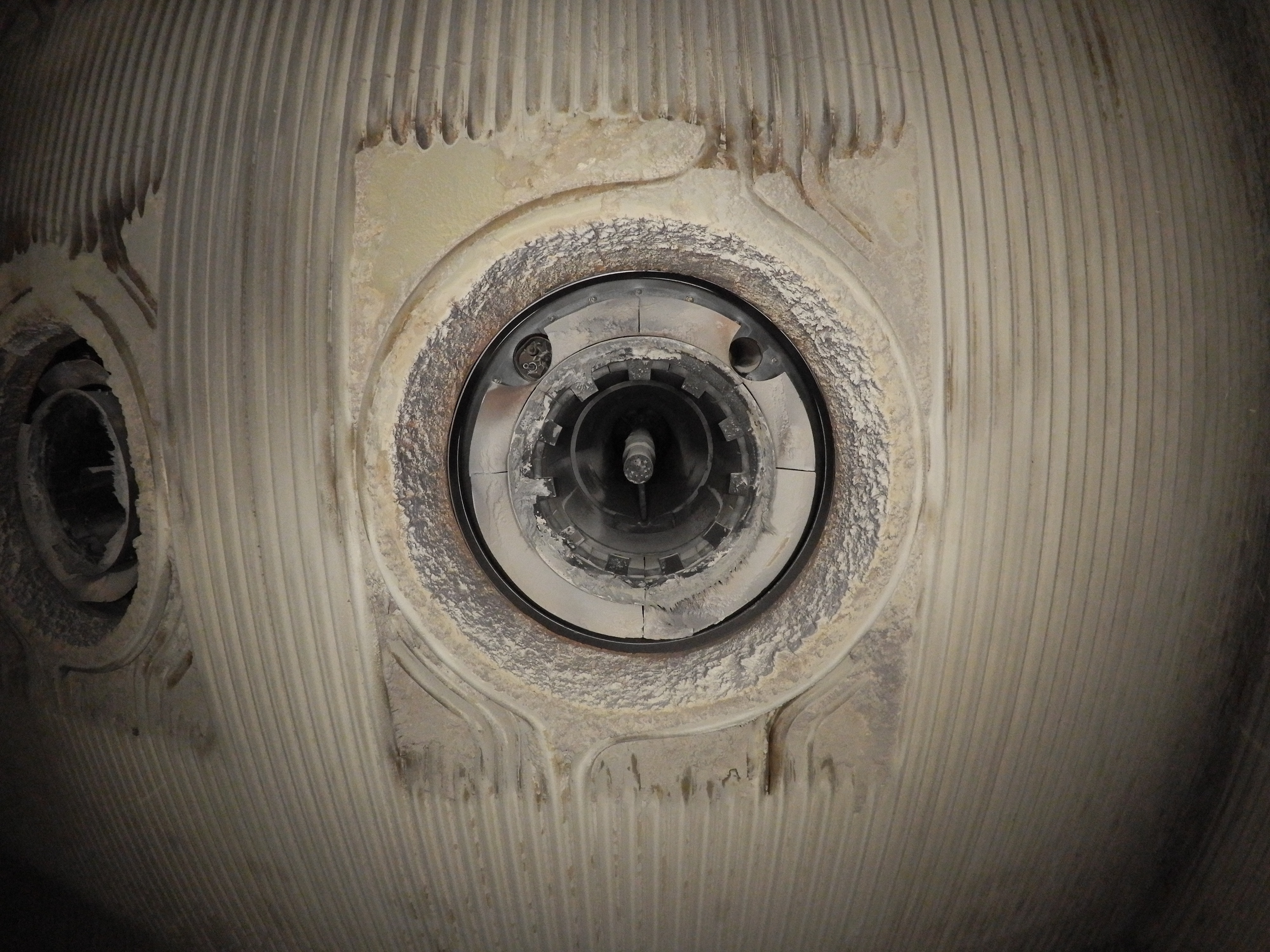
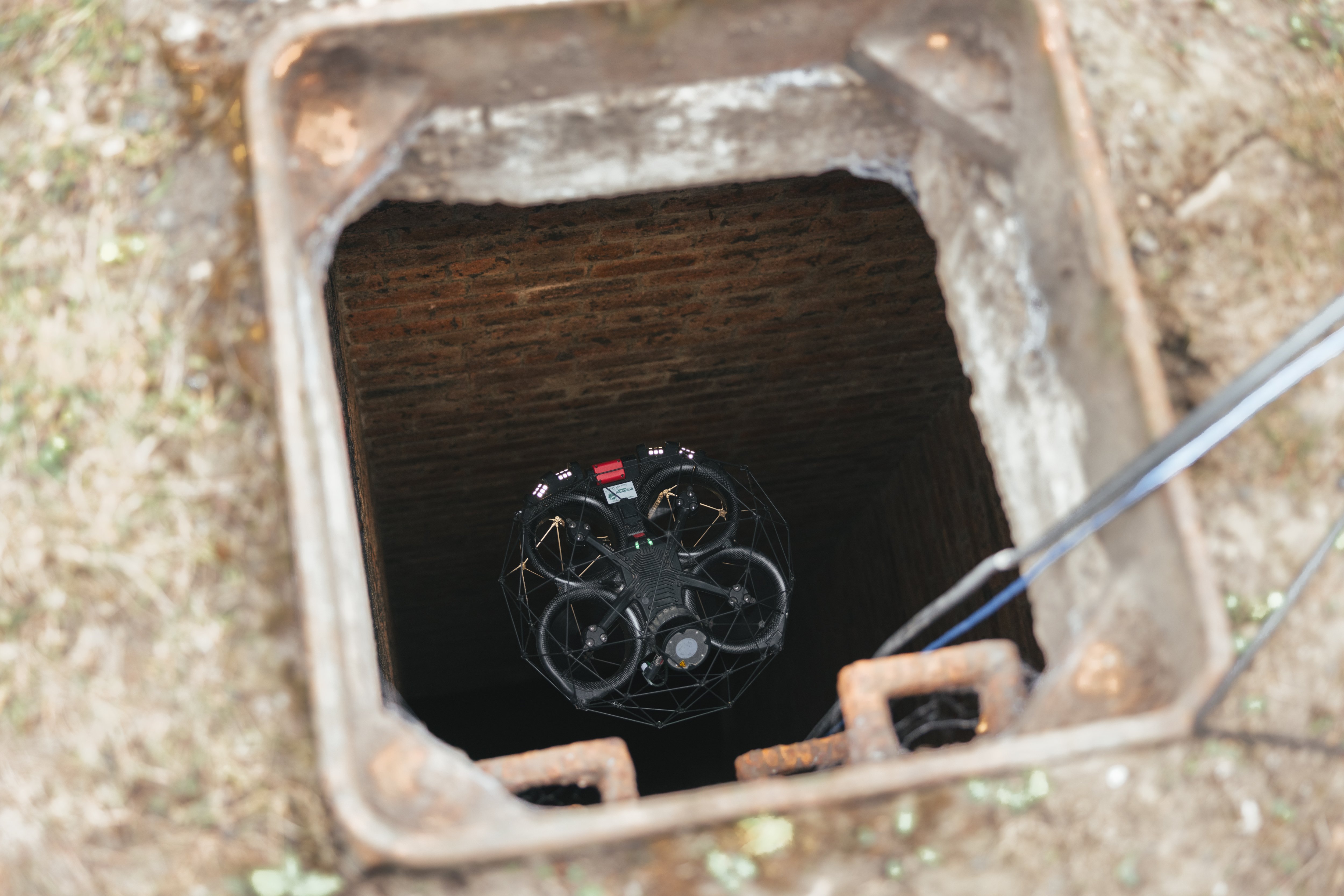
Inspectors at Nexus Rail wanted to collect visual inspection data inside a shaft located in a void below the Newcastle Central Station, in a place where human entry was impossible.

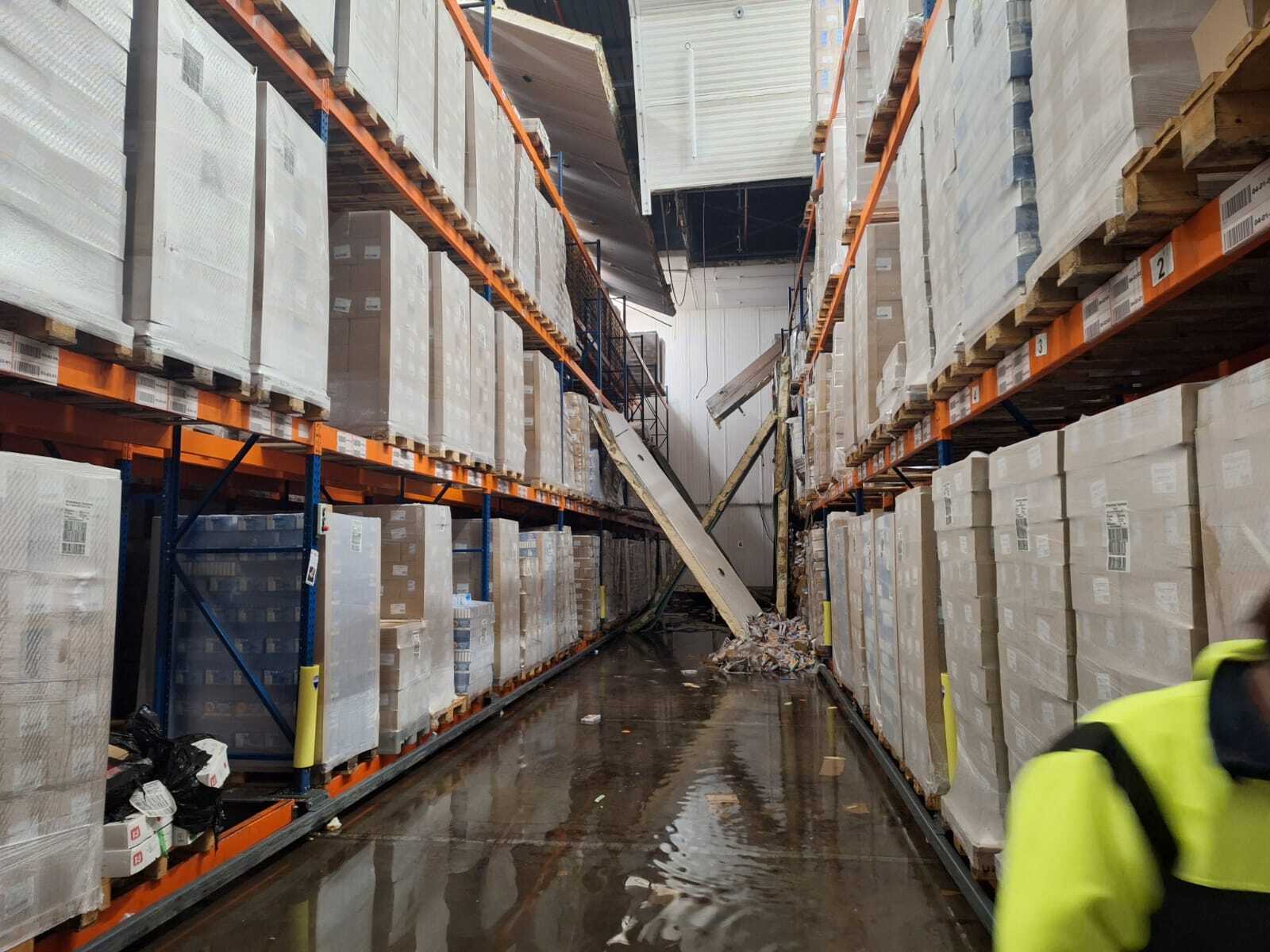
A photo taken by the Elios 3 below Newcastle Central Station
Water damage was suspected in the shaft. Nexus Rail personnel needed the visual data so they could assess the damage and create a maintenance plan to make sure it was addressed.
Nexus Rail inspectors believed a drone might be able to collect the data they needed but there were several challenges to consider, including:
- Dust. The area was very dusty, so much so that it might blind the drone.
- Darkness. The area was completely dark, so the drone would need a robust lighting system to see and collect visual data.
- Weak signal. There were several cement structures between the area in the station, where the pilot would stand, and the area below where the drone needed to fly, presenting challenges for maintaining the drone’s signal.
- Access. The potential damage was located in a shaft found in an area that was partially blocked and extremely narrow, making it hard to enter.
- Flight path. To gain access to the area Nexus Rail wanted to inspect, the drone would have to fly down a long, intricate stairwell, into a machine room, down another long flight of stairs, and then through an access hatch.
Solution
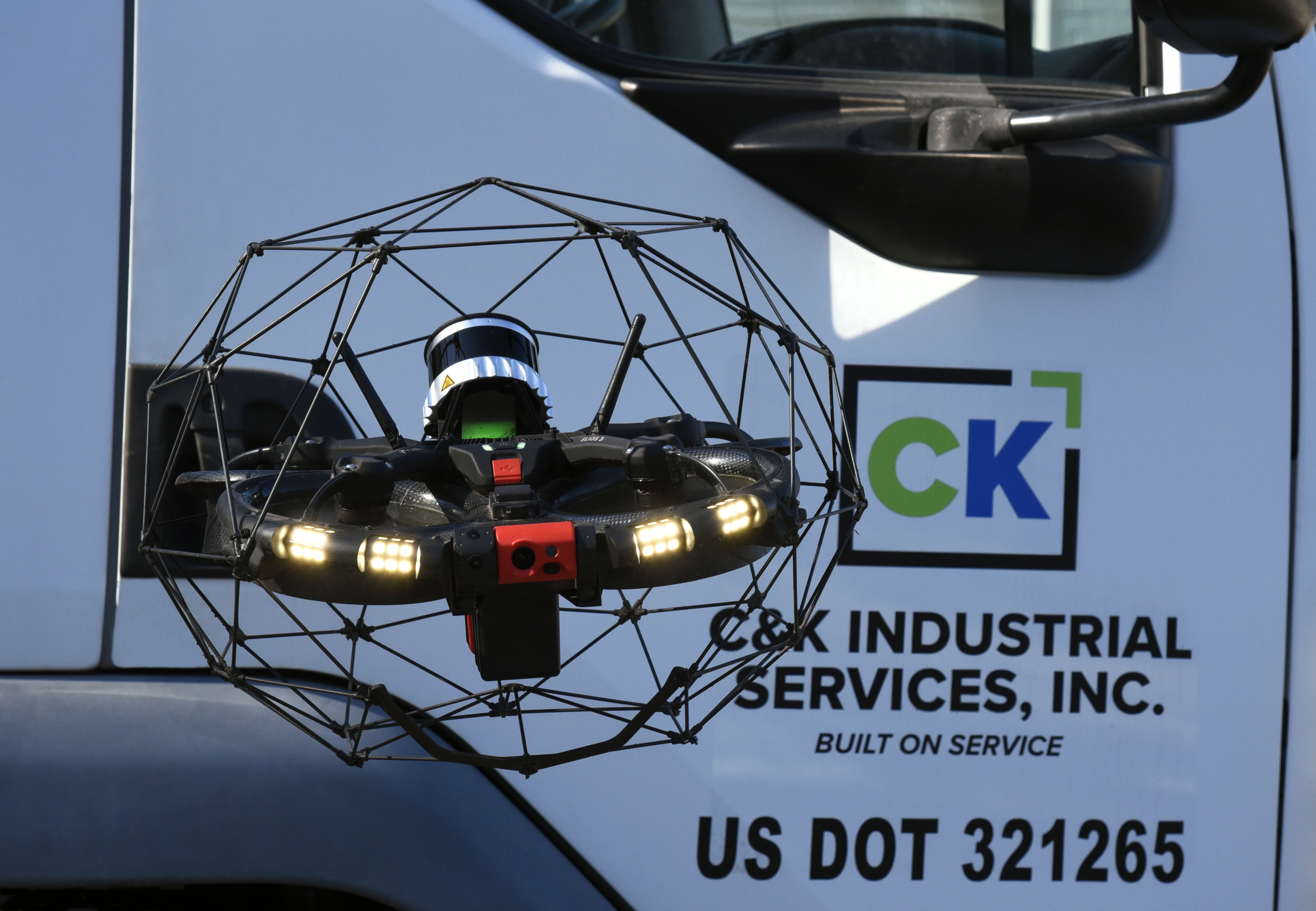
Inspectors at Nexus Rail shared these challenges with their contacts at COPTRZ, who quickly identified a solution: the Elios 3.
The Elios 3 is a drone that was designed for confined space entry. The COPTRZ team believed it would be able to enter the narrow shaft and provide sufficient lighting with its 16,000-lumen lighting system to collect the visual data inspectors needed. They also believed its signal would be strong enough to complete the flight despite the intervening cement.
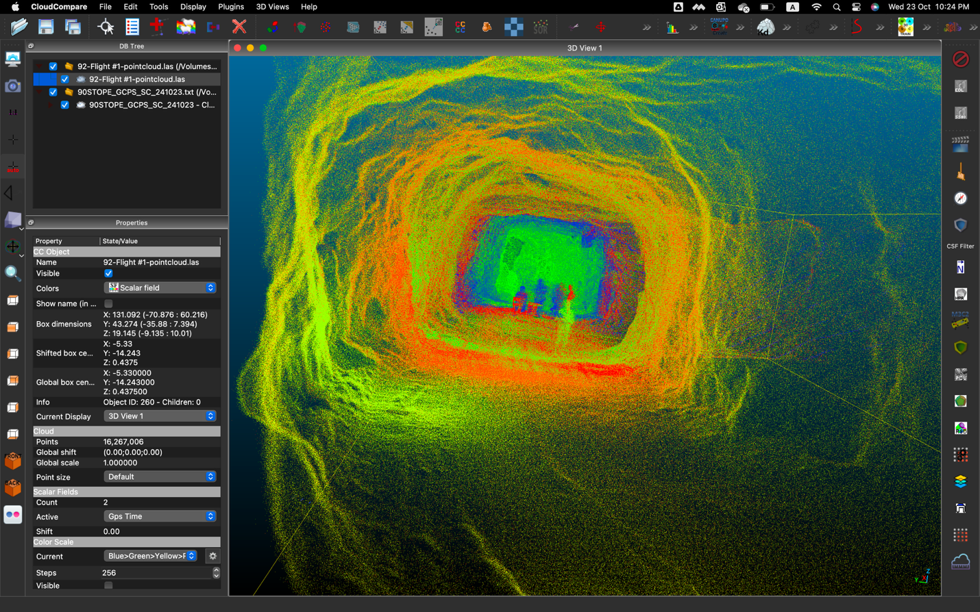
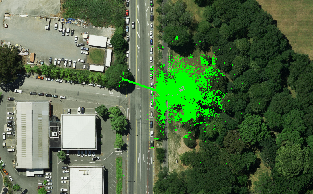
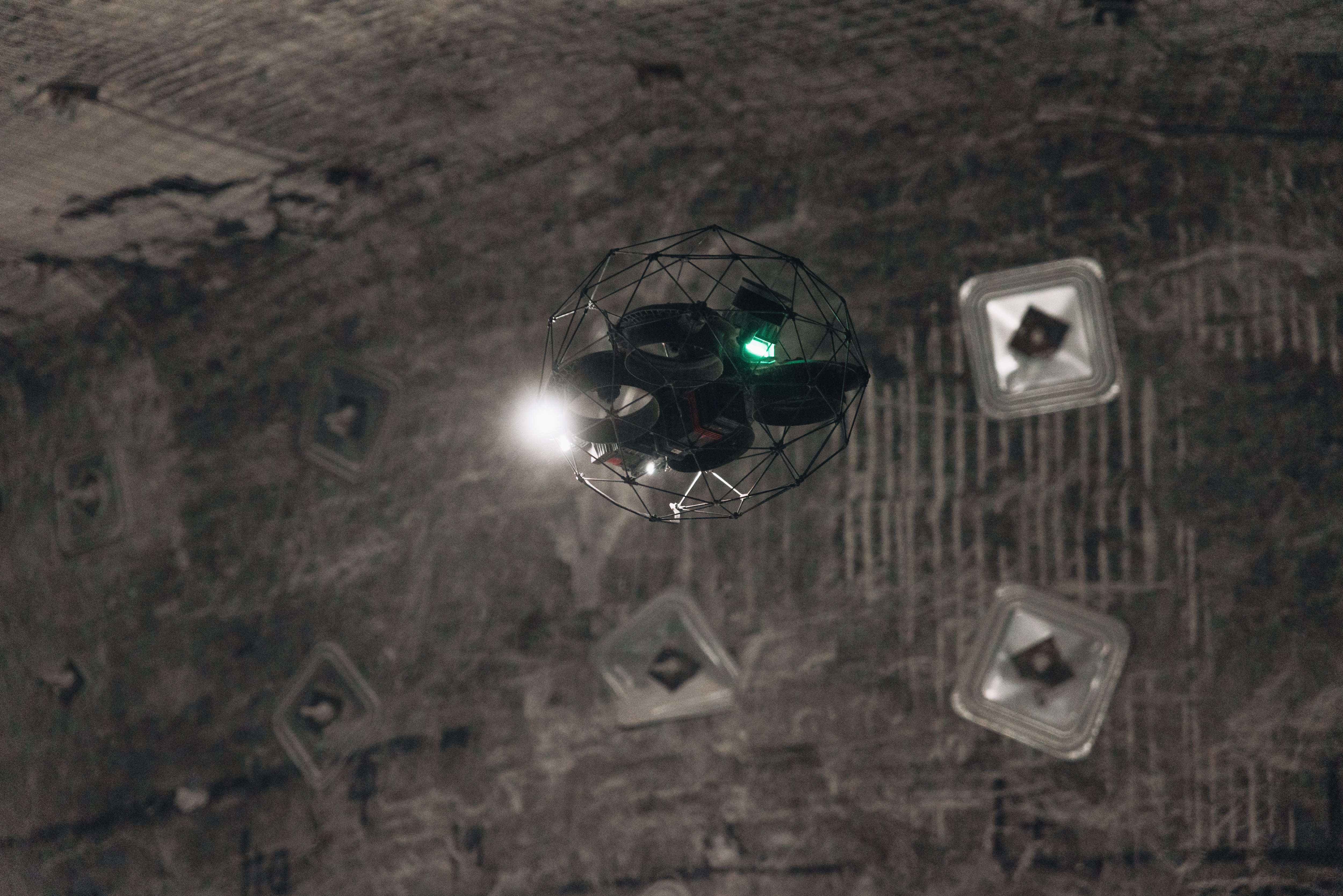
To address the challenge of flying in dust, the COPTRZ team knew that the Elios 3’s 3D Live Map would allow them to pilot the drone even if there was a large amount of dust in the air. When the Elios 3’s visual feed is blind due to dust, pilots can use the 3D Live Map to see where the drone is within an asset and fly it back out.
The 3D Live Map is a 3D model created in real time, as the drone flies, made using LiDAR data the Elios 3 collects within the environment. The Elios 3’s tablet allows pilots to see both the 3D Live Map and the visual feed at the same time, choosing which one they want to enlarge.
Results
The mission was a success.
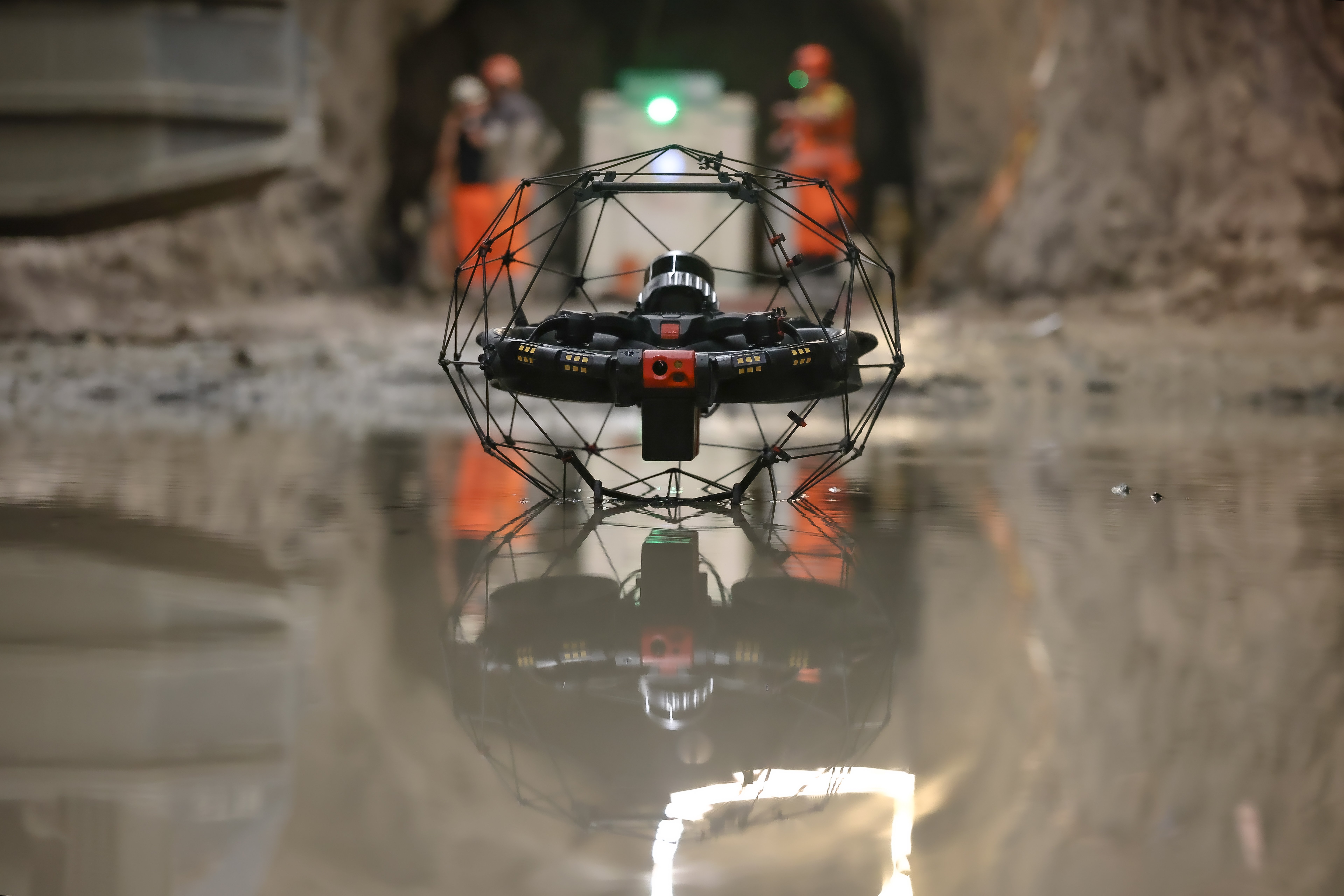
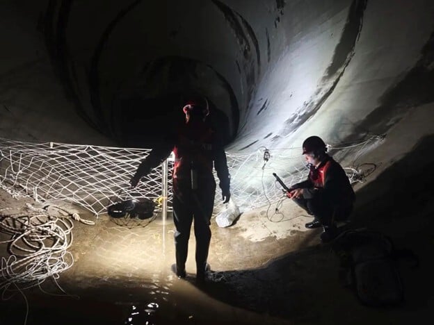
Standing in a public area on the main floor of the Newcastle Central Station, a pilot from Nexus Rail flew a long, maze-like path all the way through the access hatch and into the underground void where the metro tracks are located.

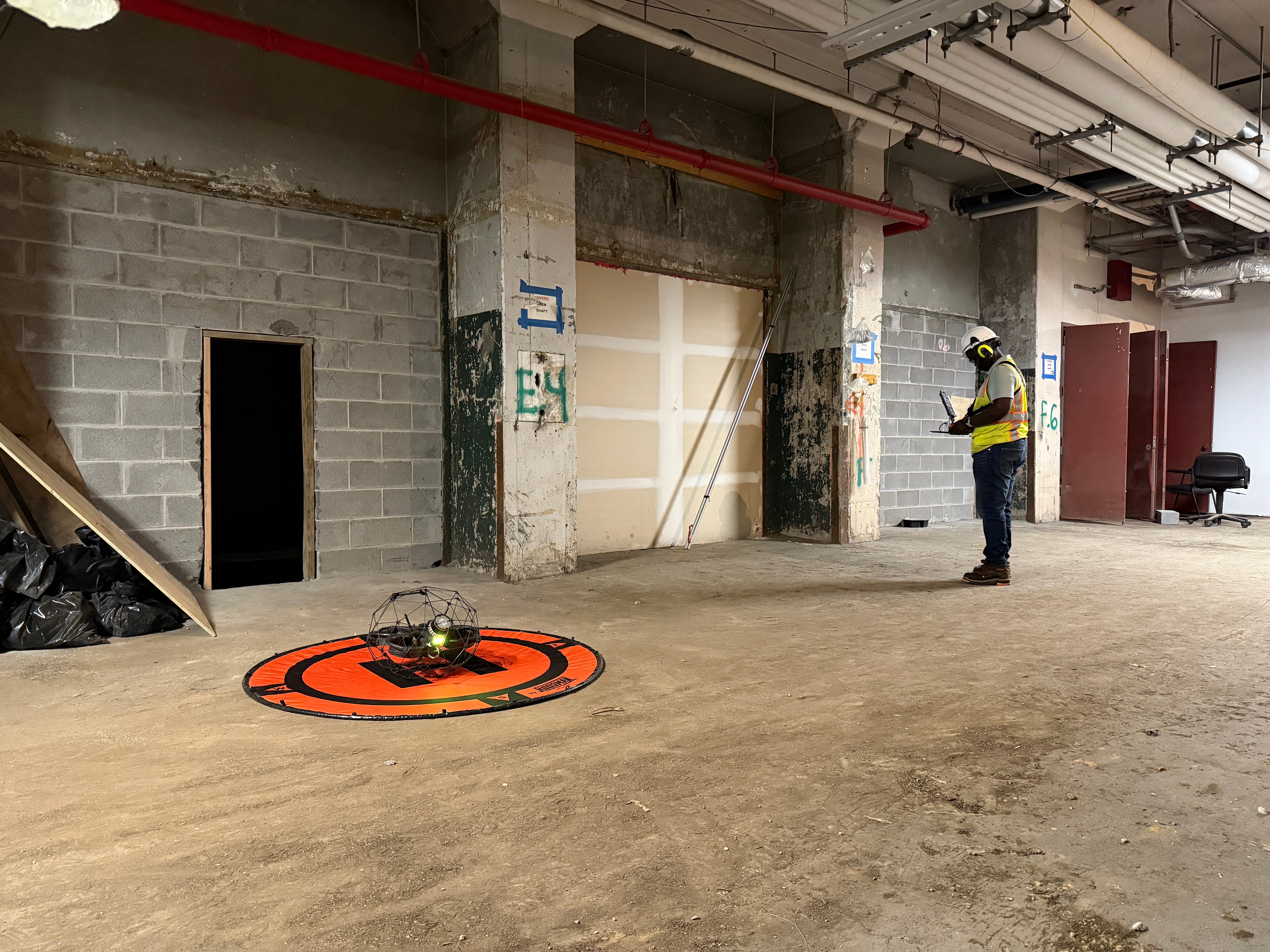
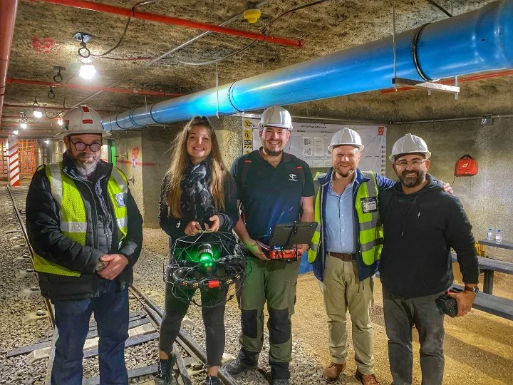
Nexus Rail and COPTRZ prepare to fly the Elios 3 at the Newcastle Station
Once there, inspectors flew into the shaft that needed to be inspected, collected the visual data they needed, then flew back out. The entire flight took just eight minutes and was performed with a single battery.
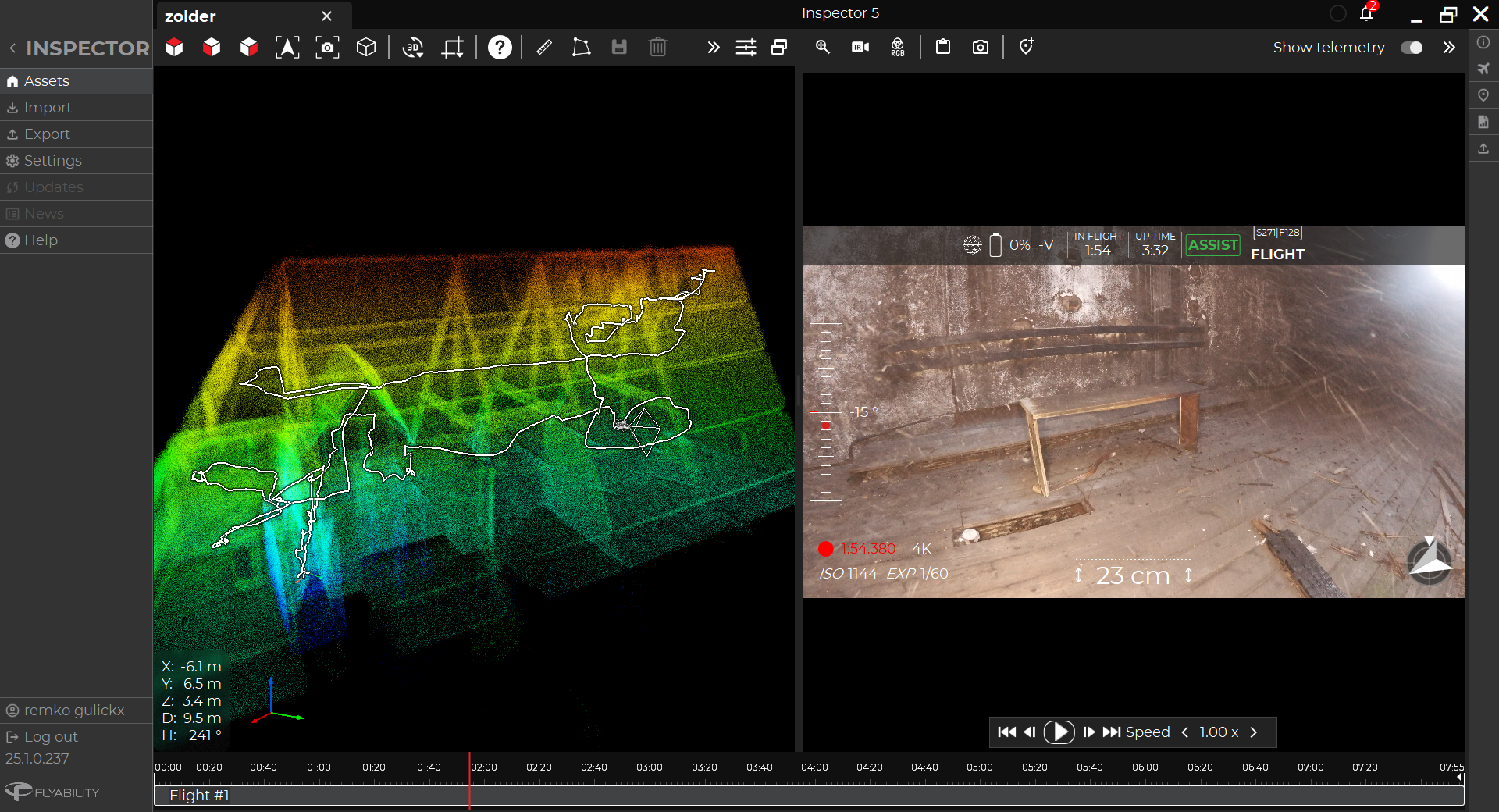
In just five minutes, the COPTRZ team was able to process the Elios 3’s LiDAR data on Flyability’s Inspector 4.0 software, pinpointing the locations of flooding and other defects in a 3D model of the underground environment. Inspector 4.0 also provided still images of these spots, including images of flooding and of rusted parts of the stairwell leading down to the void.

A photo taken by the Elios 3 below Newcastle Central Station
Here are all the benefits the Nexus Rail team realized by using the Elios 3:
- Digital Twins. The Elios 3’s LiDAR data was used to create digital twins of the entire underground area at the metro station, allowing other stakeholders onsite to visualize defects in the area and track changes to them over time. These 3D models could then be used by inspectors to create CAD drawings of machinery and ductwork in the area, further supporting their maintenance work.
- Safety. No one had to perform confined space entry or work at height to collect the visual data that inspectors needed.
- Access. The Elios 3 was able to enter an underground void at the metro station where human entry wasn’t possible.
- Speed. The Elios 3 was able to collect all the data needed in just one 8-minute flight. Using the Elios 3 instead of a traditional approach for the inspection also helped avoid all of the preparatory work required for inspectors to perform confined space entry, including securing permits and approvals and taking the time to build scaffolding throughout the area. With the drone, the team could just arrive and fly the mission, with very little preliminary work required.
- Savings. Using the Elios 3 to collect inspection data was not only much faster than doing it in person—it was also less expensive. Savings were realized by reducing the amount of people needed for the mission, including avoiding the need for safety and medical teams to be present, as well as avoiding the costly expense of building and taking down scaffolding.
Conclusion
The mission at Newcastle Central Station was such a success that inspectors from Nexus Rail plan to buy several Elios 3s.
Over the next year, they plan to begin using these drones regularly in their work, helping them to avoid confined space entry while collecting high quality visual and LiDAR data of the confined spaces where Newcastle’s metro cars and rails operate.
.jpg)
-Jan-16-2026-10-59-56-8006-AM.png)
.jpg)
.png)