Underground Drones For Emergency Response: Investigating A Sinkhole
The Elios 3 was used for an emergency in Lyon where an underground drone was the only way to investigate a mysterious sinkhole.
Benefits in a nutshell
|
Access |
Speed A flight with the Elios 3 was completed within minutes, providing critical data as quickly as possible. |
|
Safety The sinkhole opened up and posed a risk to emergency responders and residents in the area. The Elios 3 safely flew inside the area. |
Data Quality The Elios 3’s LiDAR scan was used to determine if the foundations of the neighbouring building were being threatened by the cavern. |
Long before Lyon became the famous city that it is today, it was Lugdunum, the Roman city founded in 43 BC. Now, modern Lyon faces its Roman history on a daily basis, with tourist excursions to the Théâtres Romains de Fourvière, the Jardin Archéologique, and the Aqueduc Romain du Gier.
However, as there are Roman ruins underneath the city, this can pose a safety concern. Sometimes, the earth can open up like a sinkhole and give way to Roman structures underneath, such as disused sewers, old buildings, or storage spaces. As a result, the local authorities carefully monitor unexpected geological activity such as the sudden appearance of holes in the ground to protect public safety.
Local Authorities Use New Technology: Drone Emergency Response
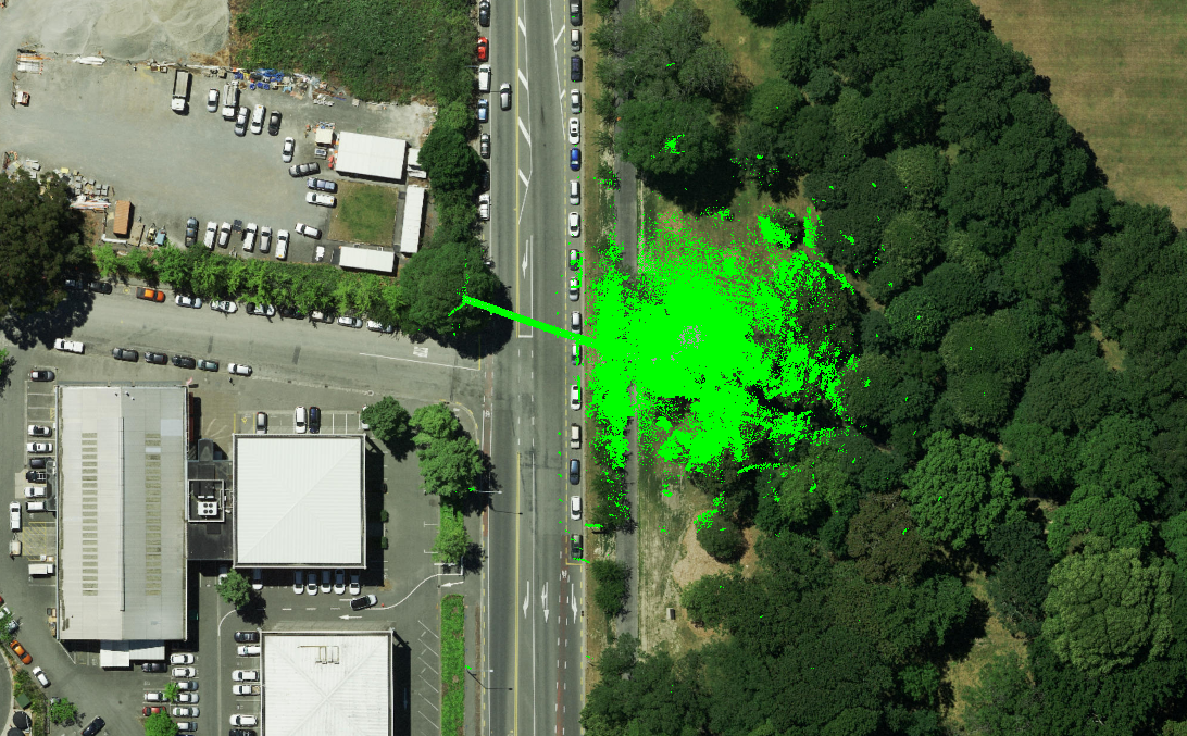
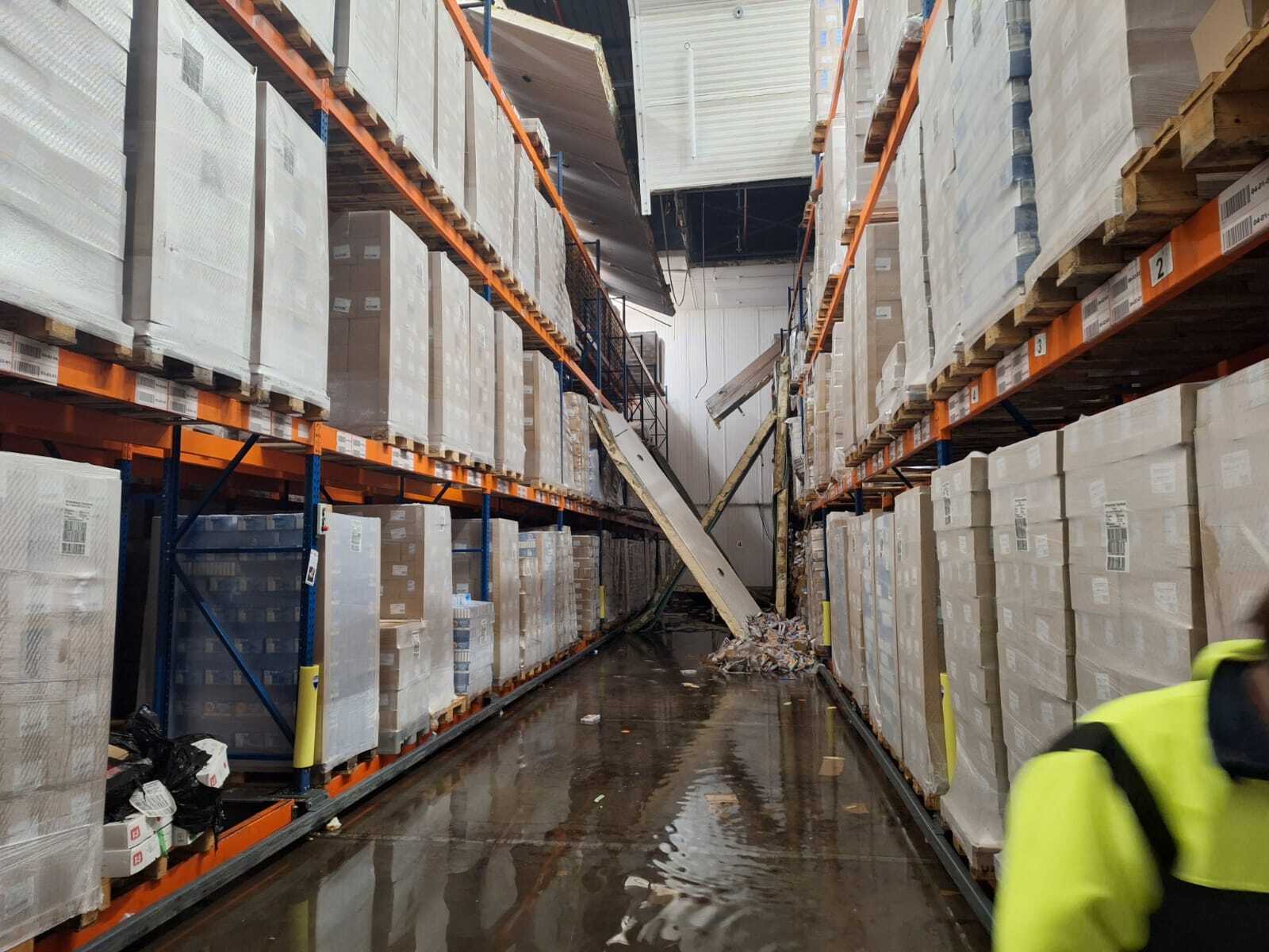
In a residential area of Lyon, a large hole opened up next to an apartment building. The Lyon Metropole immediately suspected a potential hazard - if Roman ruins were beneath the city, the hole could expand and potentially damage the building above. Should that building collapse, it would not only endanger the current residents but also people in the nearby area including the building next door.

The sinkhole was close to a residential building, increasing concerns about the size and nature of the sinkhole
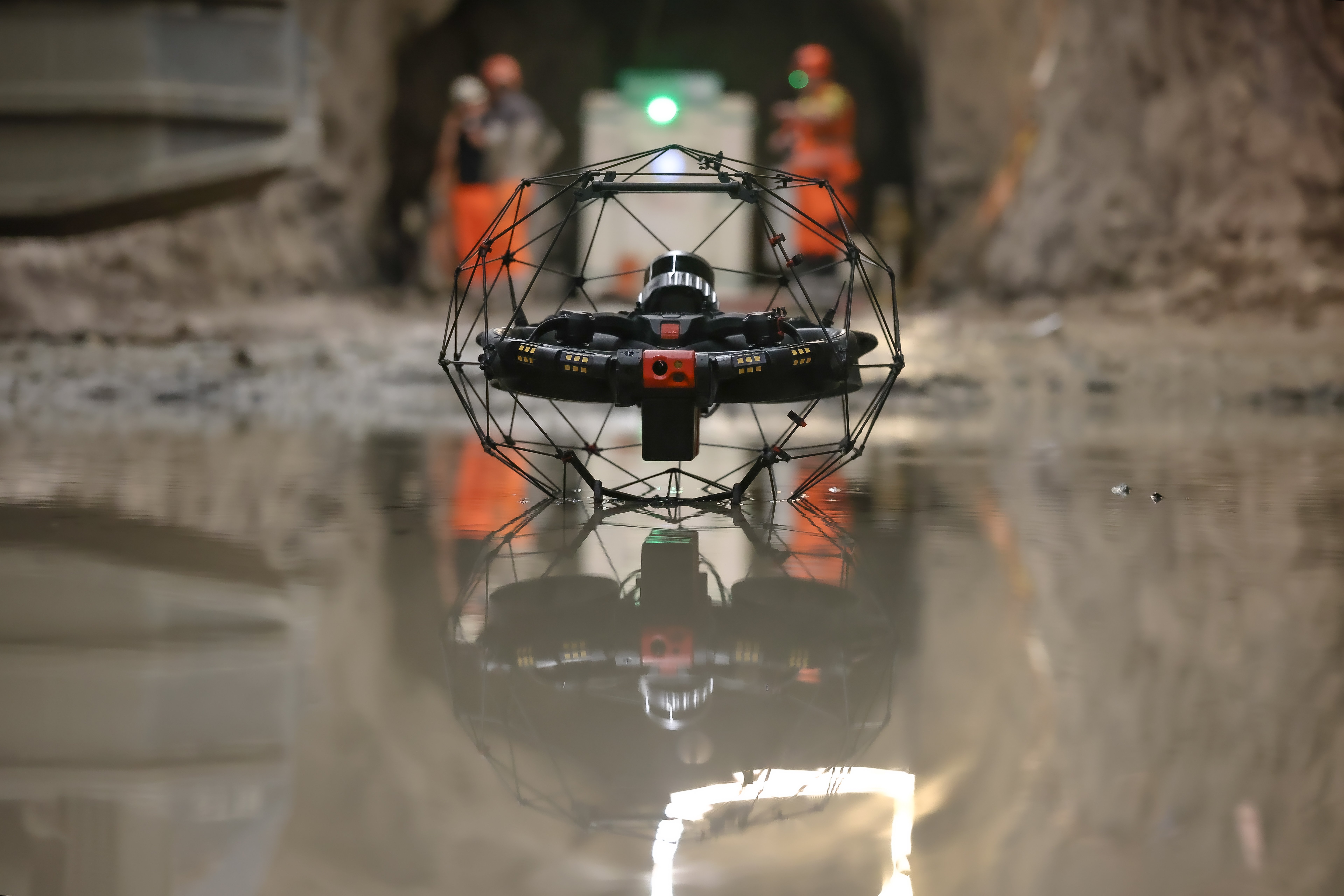
Xenodrone, a specialist inspection company, was contacted by a contractor for the Lyon Metropole to urgently complete an inspection. Julien Gay, head of Xenodrone, is a former fire fighter and understands the urgency of scenarios like this, and how they call for flexibility. He believed his Elios 3, which can operate as an underground drone, would be the ideal tool to gather the critical data the authorities required.
Responding To Land Subsidence With An Underground Drone
When Julien arrived at the site, he found a hole situated just 2.5 meters from the wall of the building. He had heard of a similar situation a few kilometers from this area where Roman galleries were found underground, and understood there was a potential for this to be the case too.
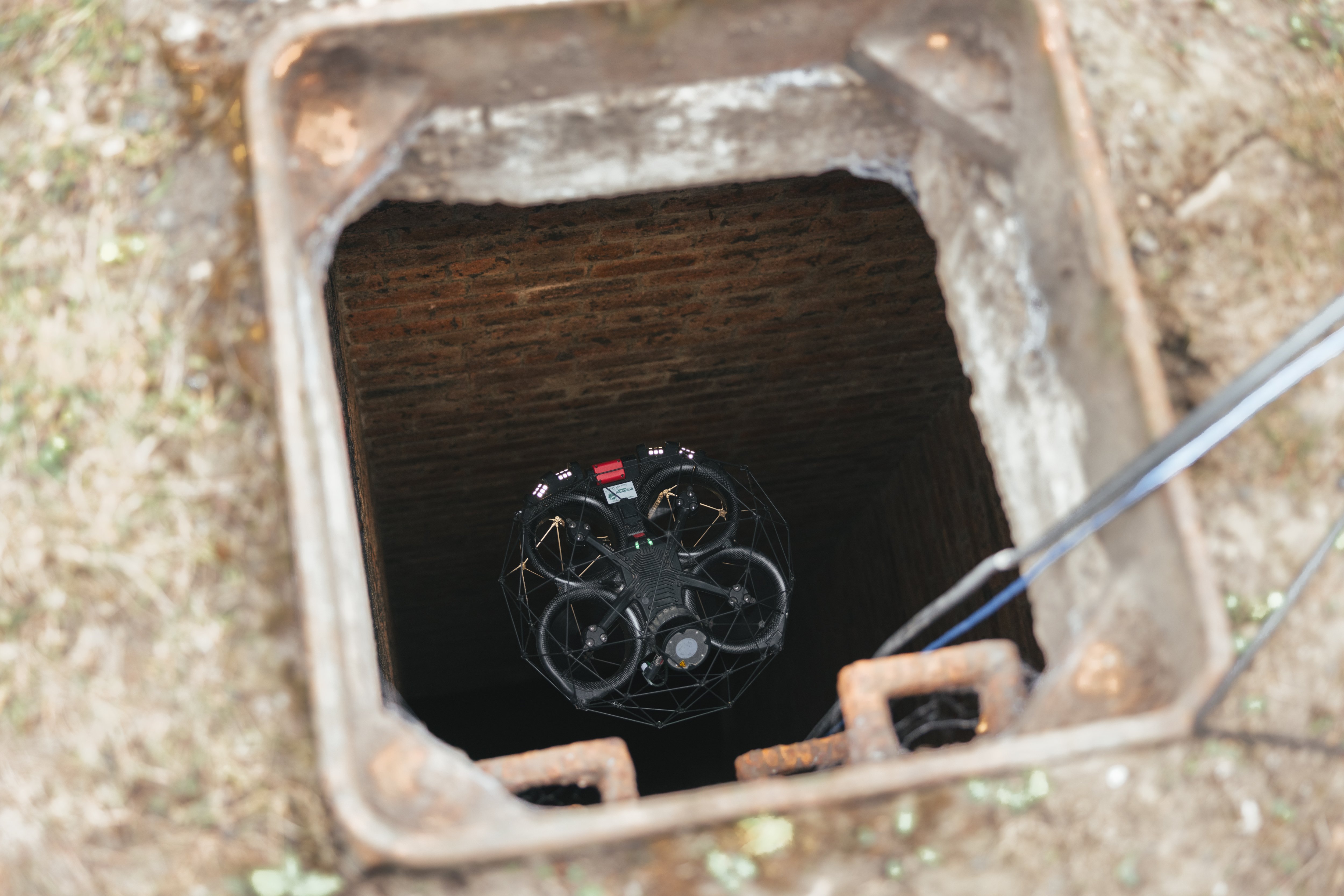
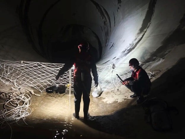
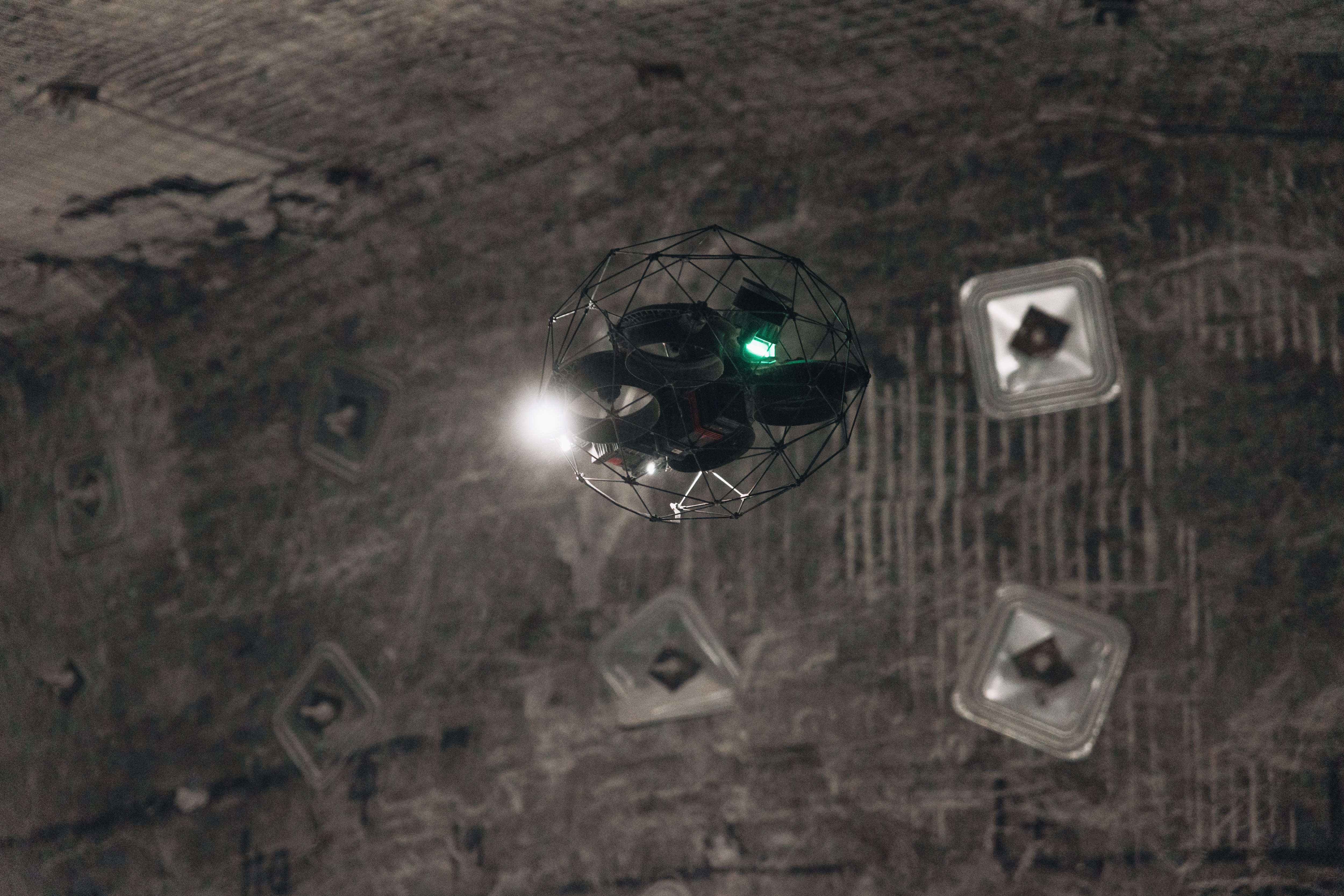
Without a drone, it can be challenging to gather information about a subsidence event safely. The cavity was dark and it was not clear how deep it was or if it was still active. Sending the Elios 3 underground was the only way to get clear data in a safe manner. Although the site was not stable, the risks posed to the drone were far less than the potential risks to people in the building and nearby area.

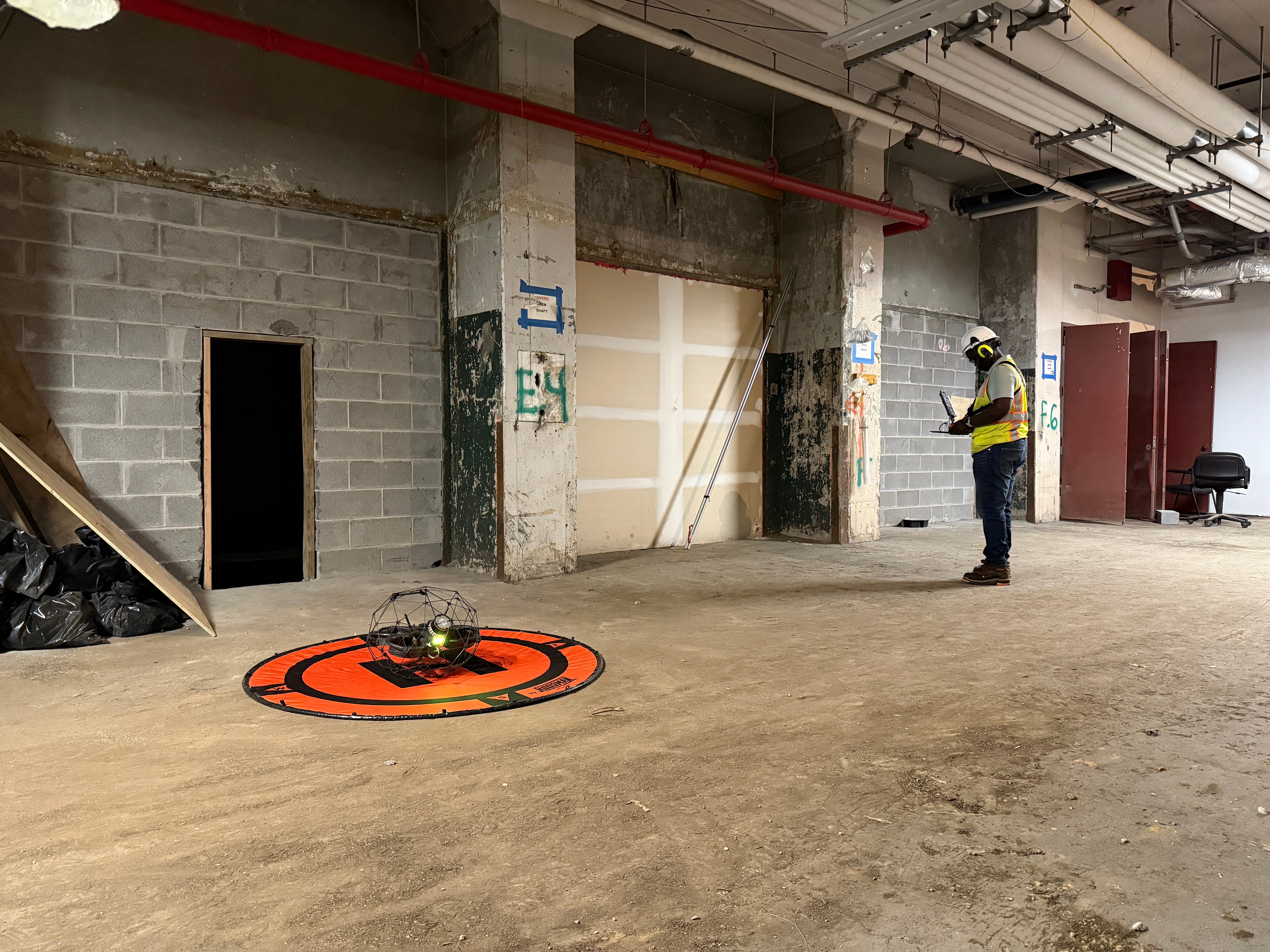
The Elios 3 entered the sinkhole without anyone having to go near it, keeping emergency response staff
Julien was asked to determine if there was an immediate risk of further land subsidence and if the cavern was extending towards the building. This meant he would need to gather LiDAR data inside the space to create a 3D model that could be analyzed in detail. Thanks to the speed of the Elios 3 in flight and the density of point cloud its LiDAR scanner creates, the inspection flight was completed in just 4 minutes.
Using An Underground Drone To Analyze Subsidence
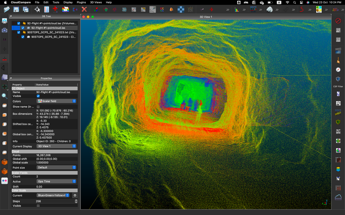
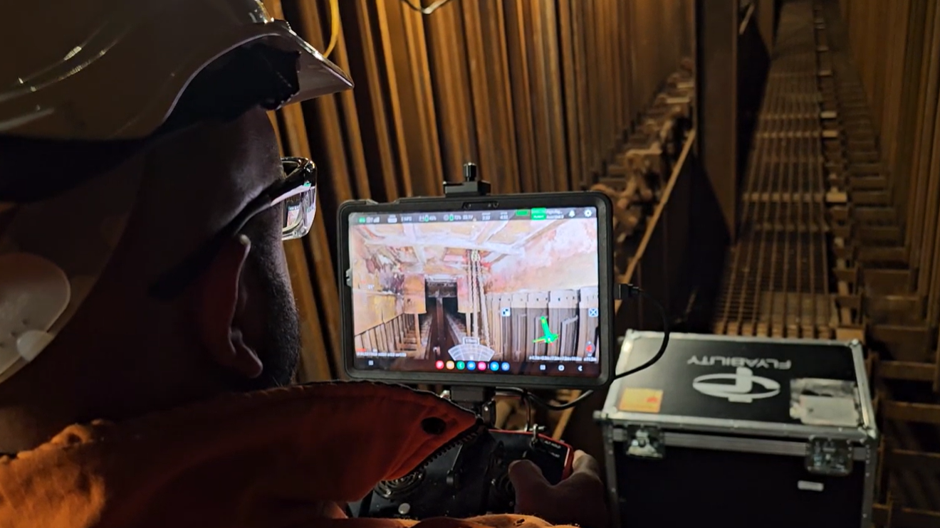
Julien gathered the LiDAR scan as quickly as possible. He flew the drone vertically down into the cavity and performed a 360 degree turn inside the space. Once the FlyAware point cloud showed a complete model, he flew the drone out of the space.
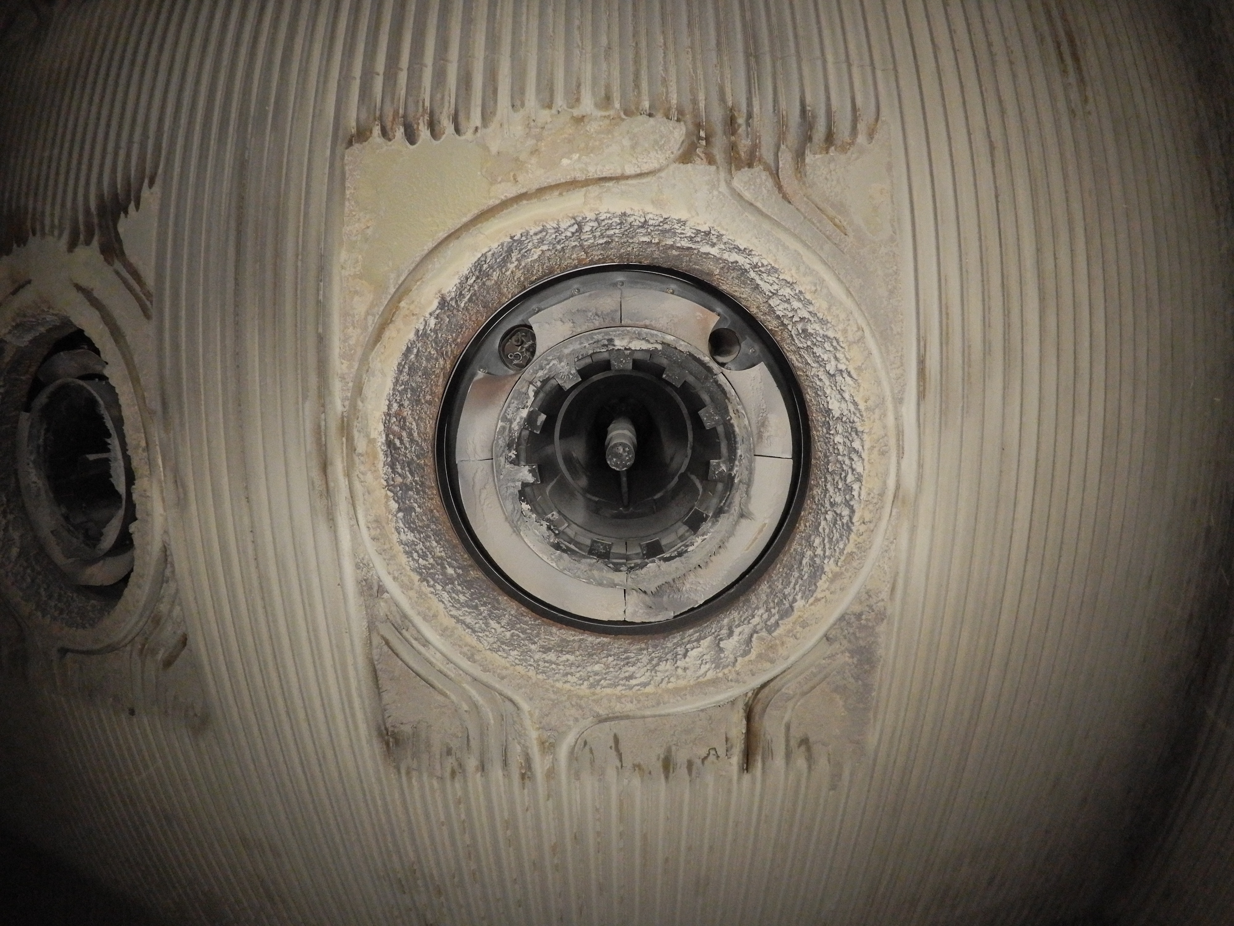
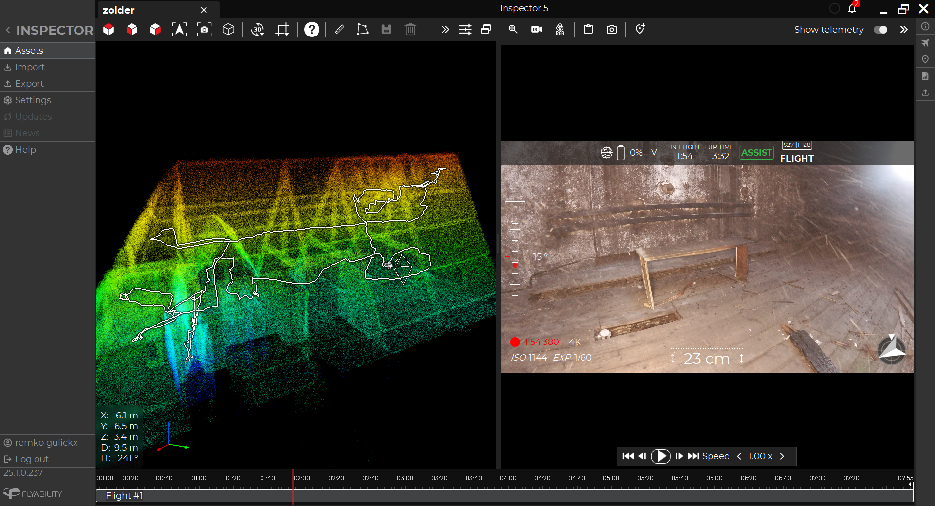
The initial results showed the cavity was huge, going 6 meters down. The Elios 3’s accuracy enabled Julien to provide clear information about the dimensions and layout of the cavern.

As part of the report, Julien helped responders analyze the proximity of the cavern to the building foundations
Once Julien returned to his office, he completed a report quickly using Inspector 5 to provide clear results to the local authorities. The LiDAR scan could be used to determine the level of risk to the building near the hole while the visual data could also give surveyors an idea of what was in the cavern - was it a geological feature or leftover Roman structure?
The Flexibility Of The Elios 3 Empowers Emergency Response
In a mission like this where the situation can change rapidly, the Elios 3 is the ideal tool for rapid data collection. A 4-minute flight was all it took to gather the data that would have been impossible to reach with any other method. Not only this, but the data was collected safely without the need for anyone to approach or go into the hole. The guaranteed safety of the pilot in this scenario was a huge relief to the local emergency response team and mitigated the risks associated with the inspection.
Julien explains that his mission has increased the confidence in using drones in the people involved in the project. “We pride ourselves on responding quickly, and when I was a firefighter, I remember seeing cases like this where speed is of the essence. Now with the Elios 3 we are able to complete building inspections on the day-to-day, but it is clear our services can be deployed in emergency response to gather the critical data for making decisions.” - Julien Gay. Since this project, Julien's report helped response teams find a spring underneath the hole, which was filled in with 63 cubic meters to stabilise the earth.
Now, the local authorities can plan how to deal with the subsidence with a clear idea of the conditions they face. It will also be easy for Julien to return to the site with the Elios 3 to gather further data should the terrain shift, which can be overlaid with the existing data to track changes and predict future movement. The Elios 3 helped Julien set himself apart from other service providers and carry out a mission where safety and speed were paramount.

.jpg)
-Jan-16-2026-10-59-56-8006-AM.png)
.jpg)
.png)