Major Cement Company Improves Stockpile Measurement With Elios 3
A cement plant in France used LiDAR data from the Elios 3 in stockpile measurements for a clinker inventory, making the process safer and more accurate.
Benefits In A Nutshell
|
Speed In 30 minutes—10 minutes for data collection and 20 minutes for post-processing with GeoSLAM Connect—plant operators were able to create an accurate stockpile measurement for the clinker. |
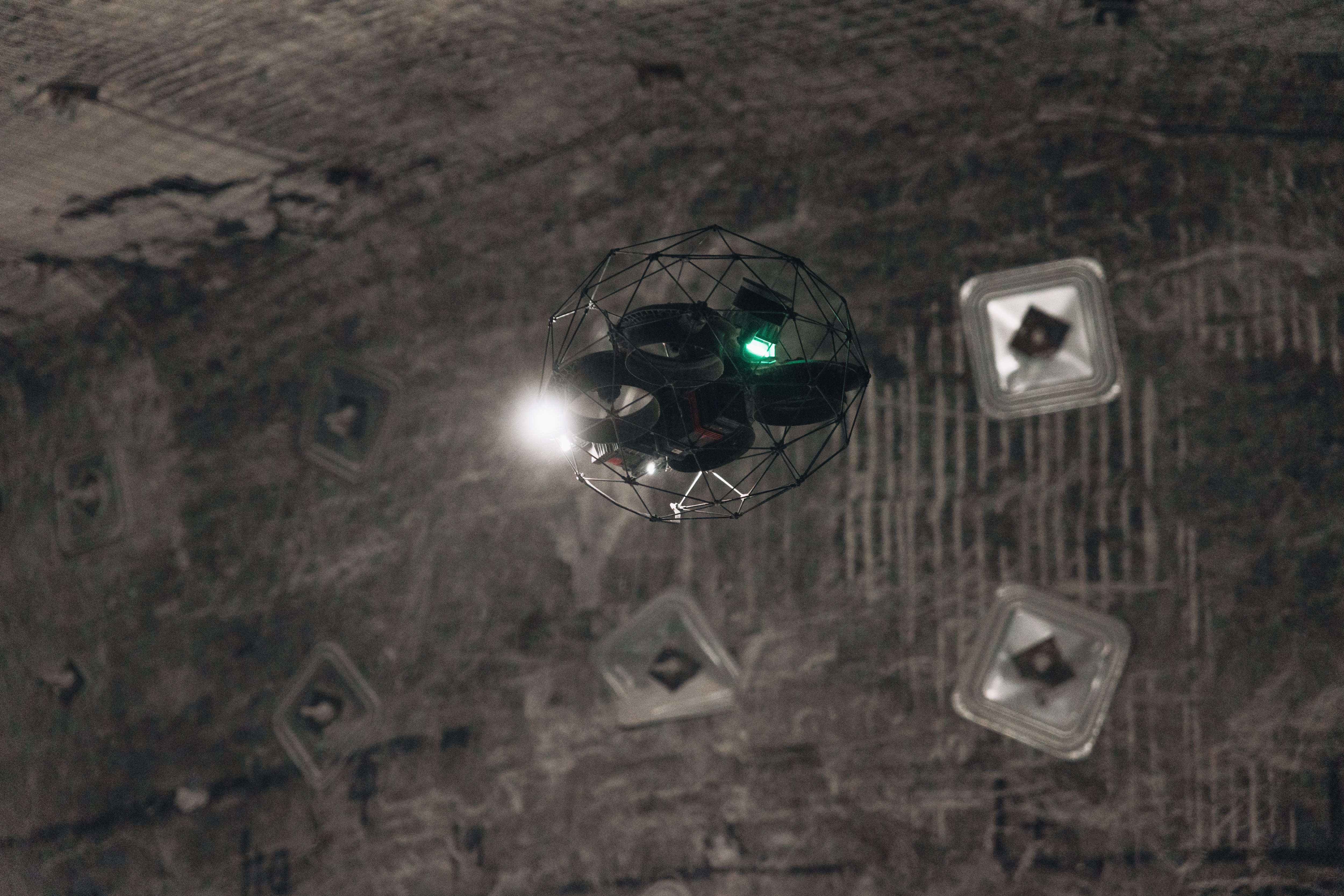
Operating in Dusty Environments The Elios 3’s 3D Live Map made it possible to fly inside the silo despite the poor visibility due to the high amount of dust. |
Safety The accuracy of the stockpile measurement was much more reliable than the accuracy obtained using the traditional method, which consists of standing on a platform in the silo and using a pole to estimate the amount of clinker in the silo. |
Clinker Inspection Requirements
A material called clinker is commonly used to manufacture many different types of cement. In the manufacturing process, clinker is ground down to a fine powder and that powder is then used as a binding agent to make cement.
Clinker looks like small gray pebbles. It’s stored in huge silos, and it’s important for cement plants to know how much they have on hand in order to plan for how much cement they can expect to produce.
At most cement plants, operators use a manual approach for tracking the inventory of clinker they have on hand.
The approach requires a plant employee to stand on a platform inside a clinker silo and poke into the clinker stored below with a long pole. Feeling around with the pole, the employee will make an estimation about how much clinker is currently stored in the silo, and report that estimate back to the production team for their planning.
Drone Inspections for Clinkers
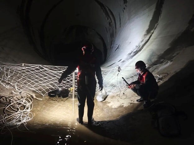
Clinker silos are dusty, dark, and potentially dangerous environments.
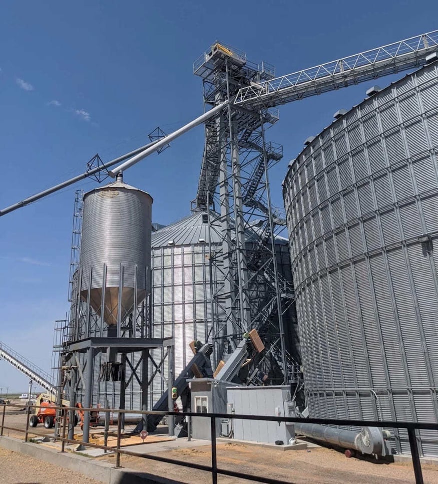
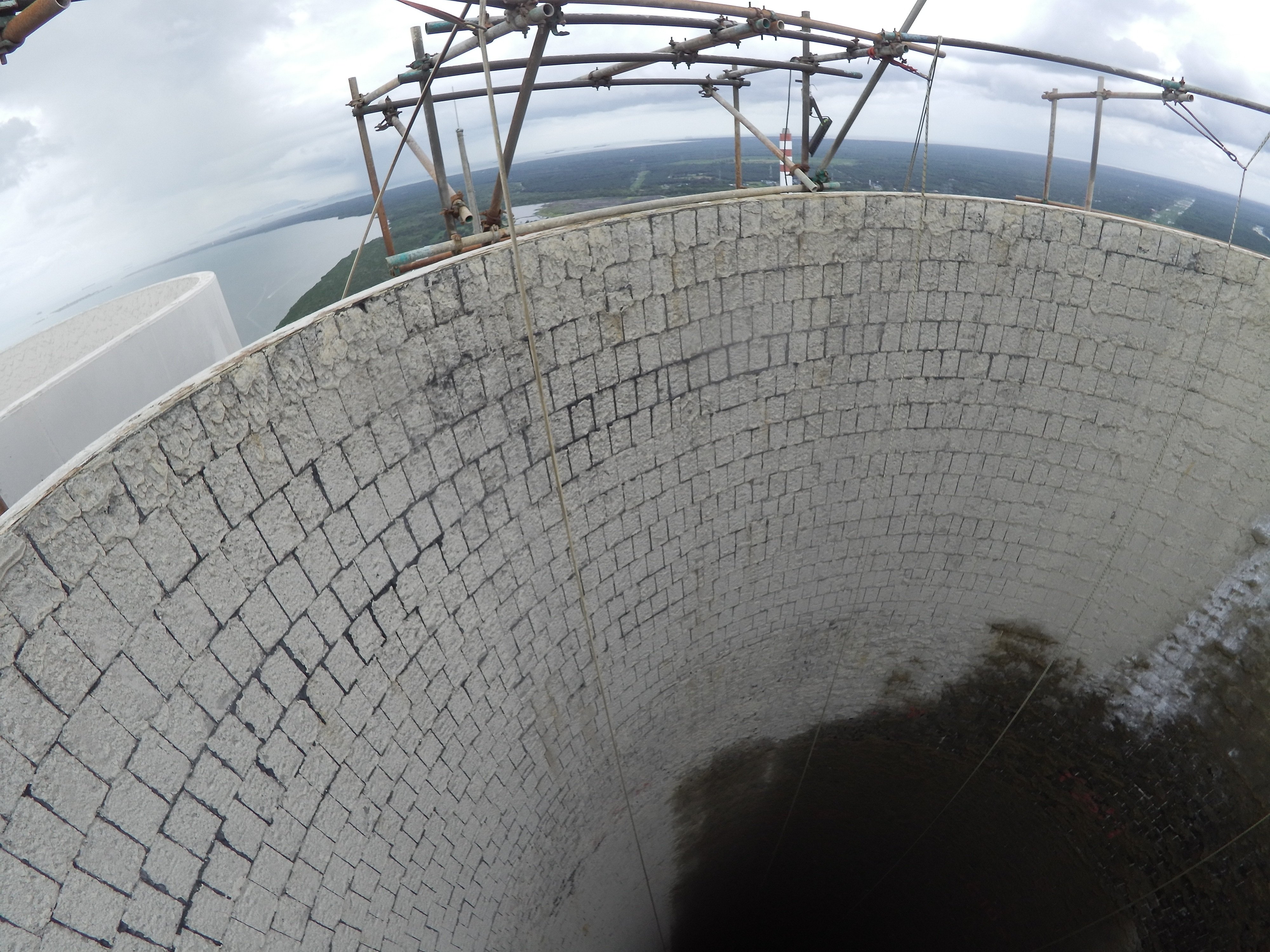
At a cement plant in France, employees doing clinker inventories by using the pole method described above had to stand on a small, shaky platform located 25 meters (82 feet) in the air at the top of the silo.
The approach exposed them to the dangers inherent in working at height, while also producing fairly inaccurate data about the amount of clinker in the silo.

The clinker silo platform where personnel stand to collect inventory data
Plant operators knew that the approach for taking inventory of clinker was inexact and potentially dangerous, and wanted to see if new technologies could be used to improve the process.
Impact of a Clinker Drone Inspection
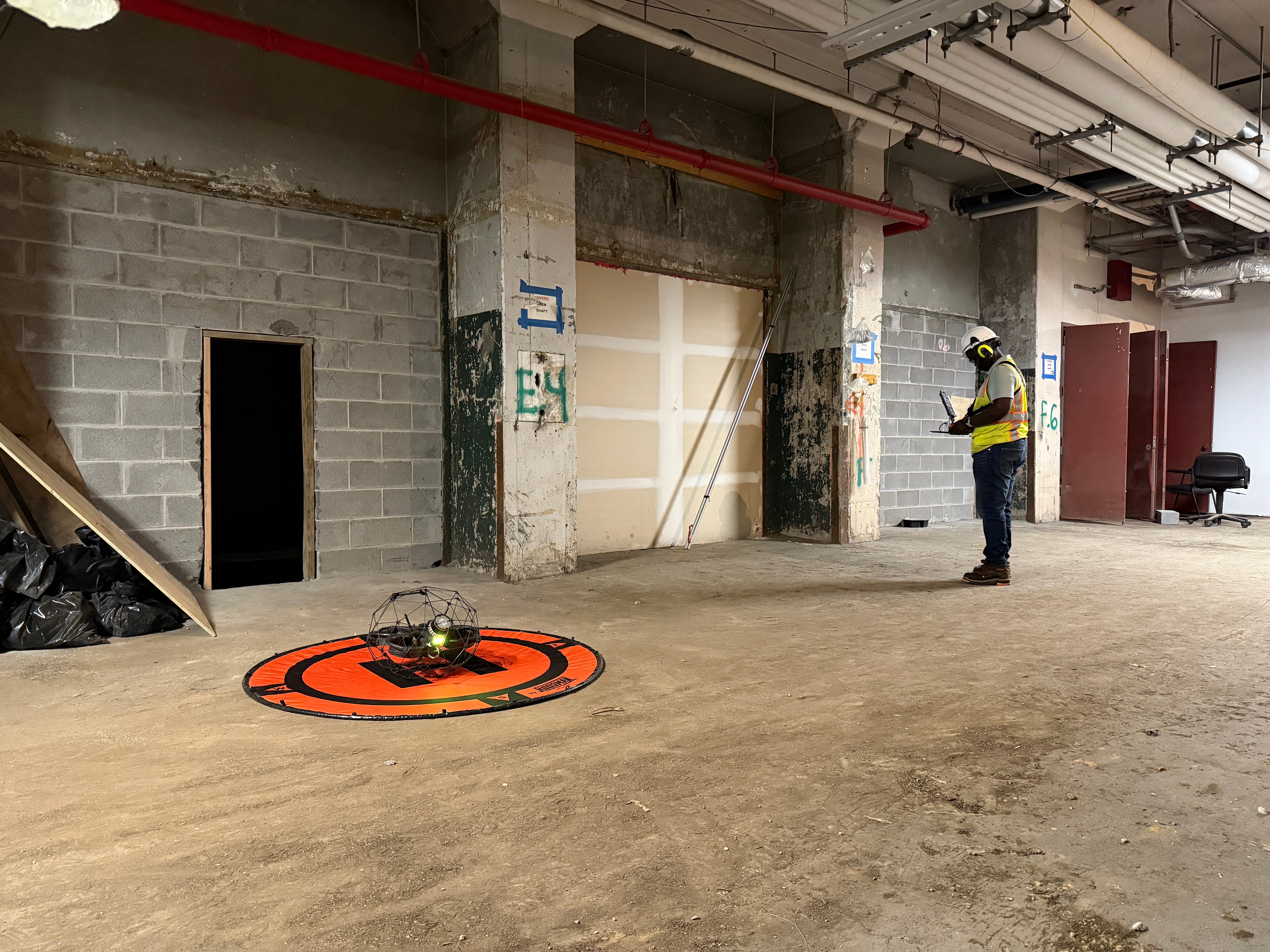
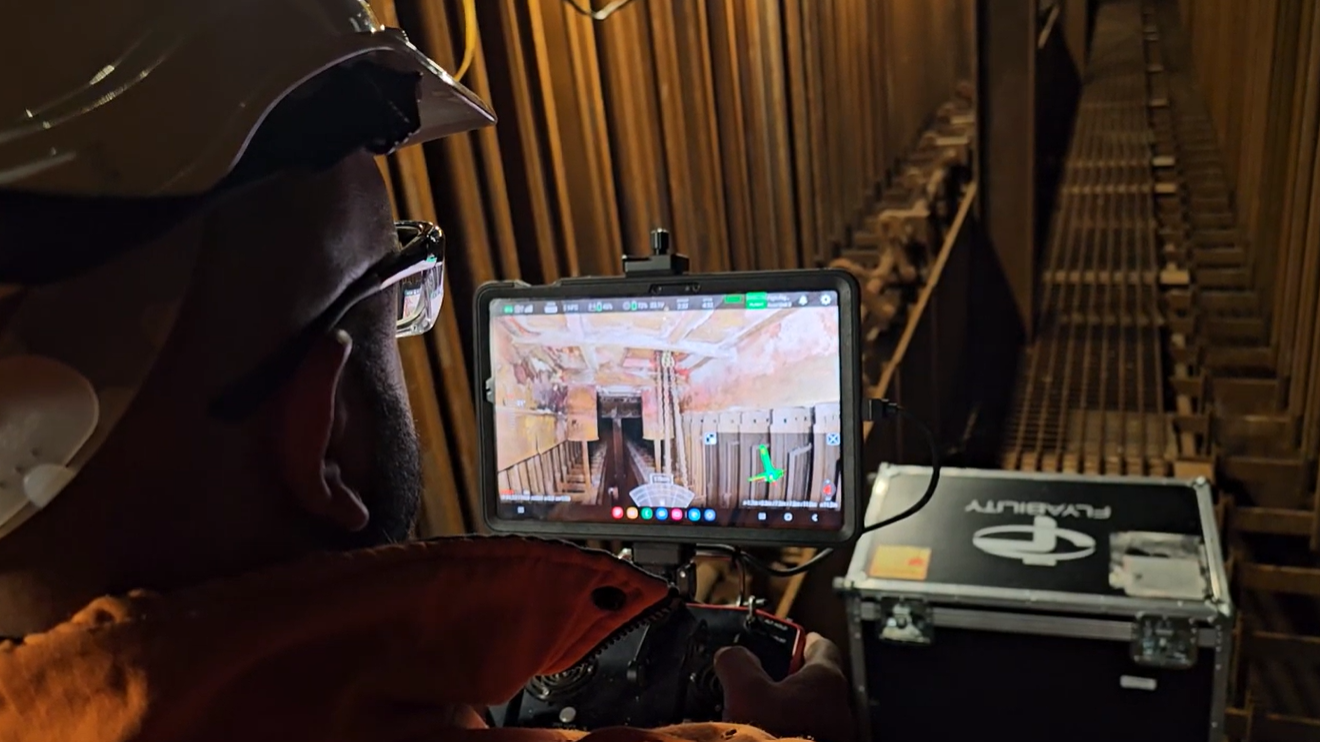
Administrators at the cement plant decided to test the Elios 3 to see if it could be used for the clinker inventory.
The Elios 3 comes with a LiDAR sensor, allowing it to collect highly precise data while in flight.
Plant operators wanted to see if this data could be processed with FARO Connect to perform a stockpile measurement of the amount of clinker present in the silo.
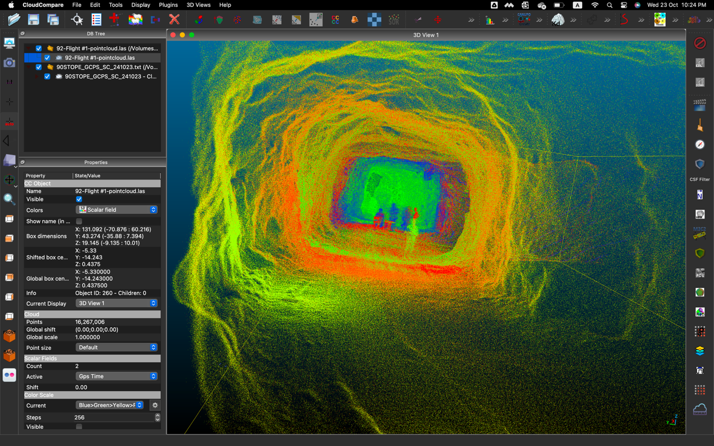
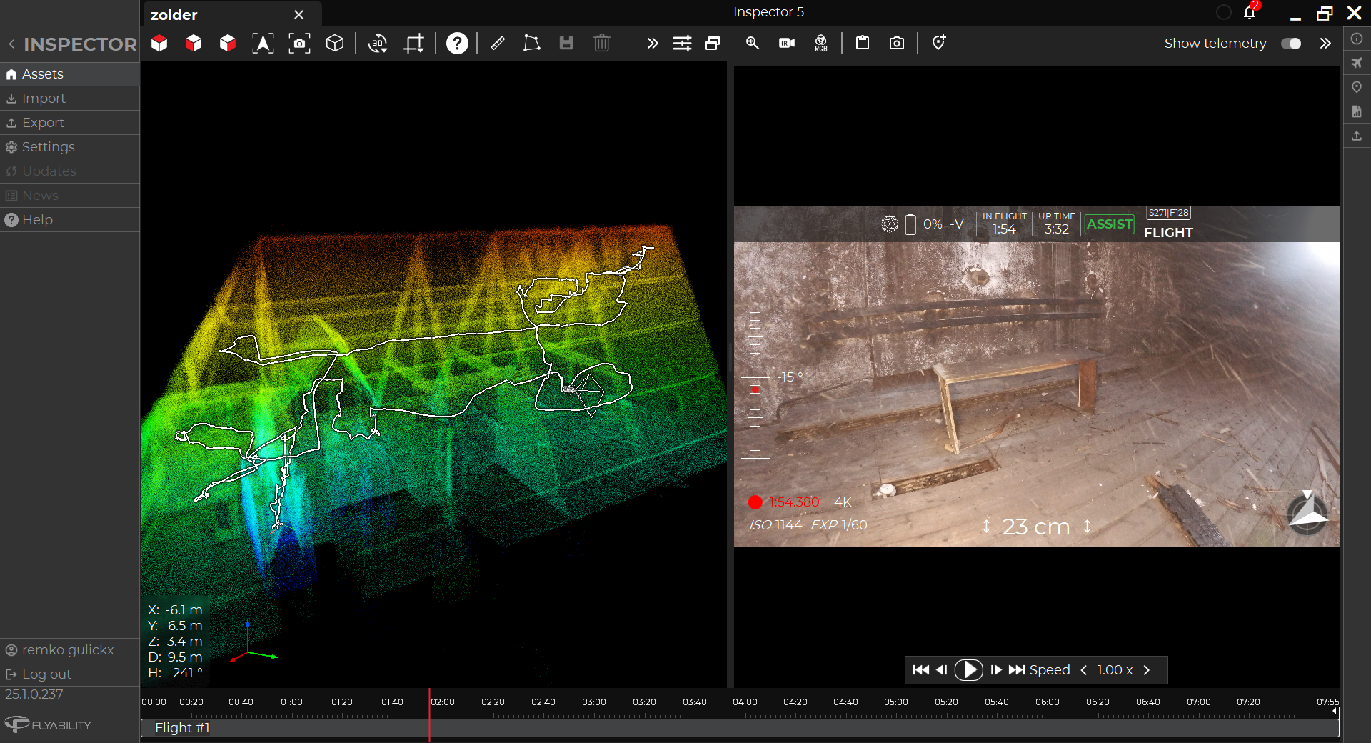
The Elios 3’s LiDAR data also allows it to make 3D maps in real time, as the drone flies, using SLAM (simultaneous localization and mapping).
NB: FARO Connect was formerly GeoSLAM

3D Live Map of the clinker silo platform side-by-side with the live visual feed
These maps make the Elios 3 an ideal tool for operating in a dusty environment like that found inside the clinker silo, where it can be very hard to see. Even if the drone’s live video feed is obscured by dust, the pilot can fly using the 3D Live Map to see where the drone is located within the silo, allowing them to fly even when the drone is visually blind.
Successful Elios 3 Inspection of a Clinker
The clinker stockpile measurement with the Elios 3 was a success.
Further, the stockpile measurement of the clinker was produced quickly and proved to be much more accurate than the inventory that was taken manually.
Further, the pilot was able to operate in the dusty environment using the Elios 3’s 3D Live Map, and the drone remained stable despite the lack of visibility due to its LiDAR-enabled stabilization system.

Here are all the benefits the cement plant realized from using the Elios 3:
-
Speed. In 10 minutes of flight time and 20 minutes of post-processing on FARO Connect plant employees were able to obtain a highly accurate volume measurement for the clinker.
-
Accuracy. The Elios 3’s stockpile measurement was much more accurate than the measurement made using traditional approaches.
-
Dusty flying. The high amount of dust present in clinker silos and other assets at cement plants can make it hard to fly—or do any kind of work—in them, but the Elios 3’s 3D Live Map and cutting edge stabilization made the mission possible.
-
Safety. Using the Elios 3 for the stockpile measurement meant that no one had to climb onto the shaky platform located 25 meters (82 feet) in the air to collect inventory data manually.
-
Coverage. The Elios 3’s 3D Live Map helped plant personnel ensure they got full coverage of the clinker for their stockpile measurement.

The 3D Live Map made it possible to fly even in very dusty conditions inside the silo
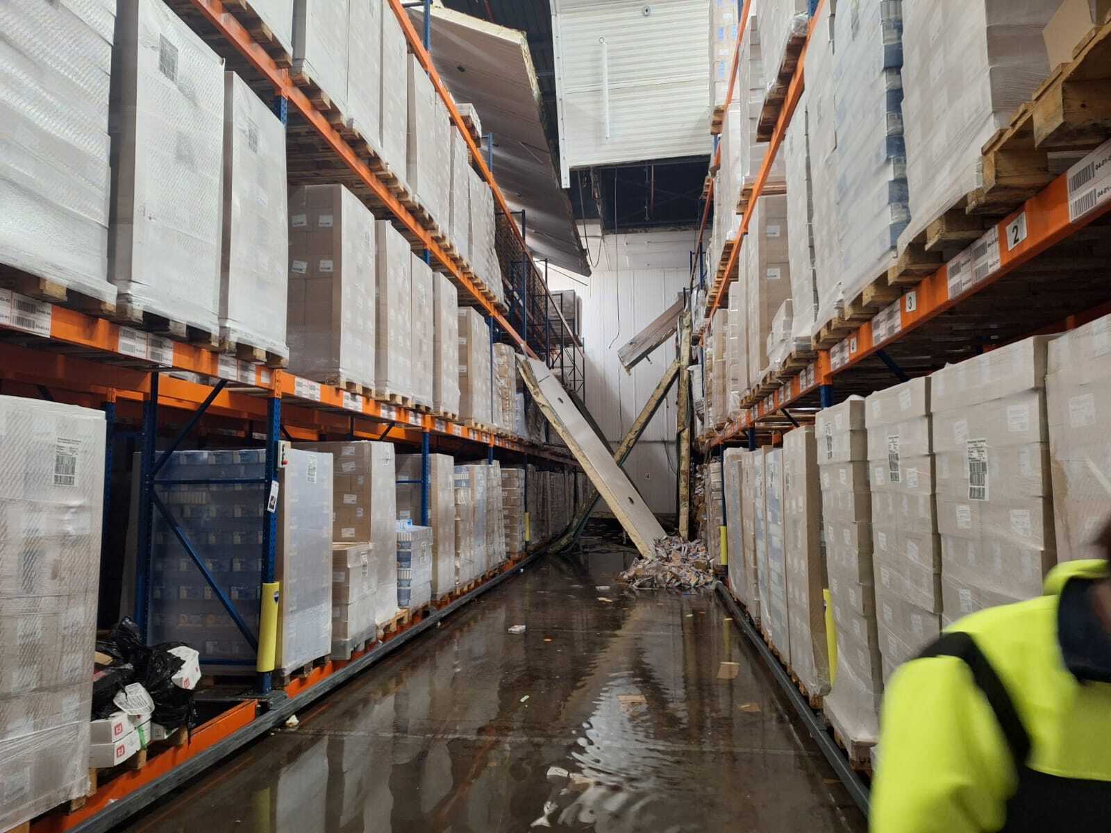
Additional Visual Inspection Of A Filter Shaft
In addition to taking inventory of the clinker with the Elios 3’s LiDAR data, plant personnel decided to test the Elios 3 for inspecting a filter shaft.
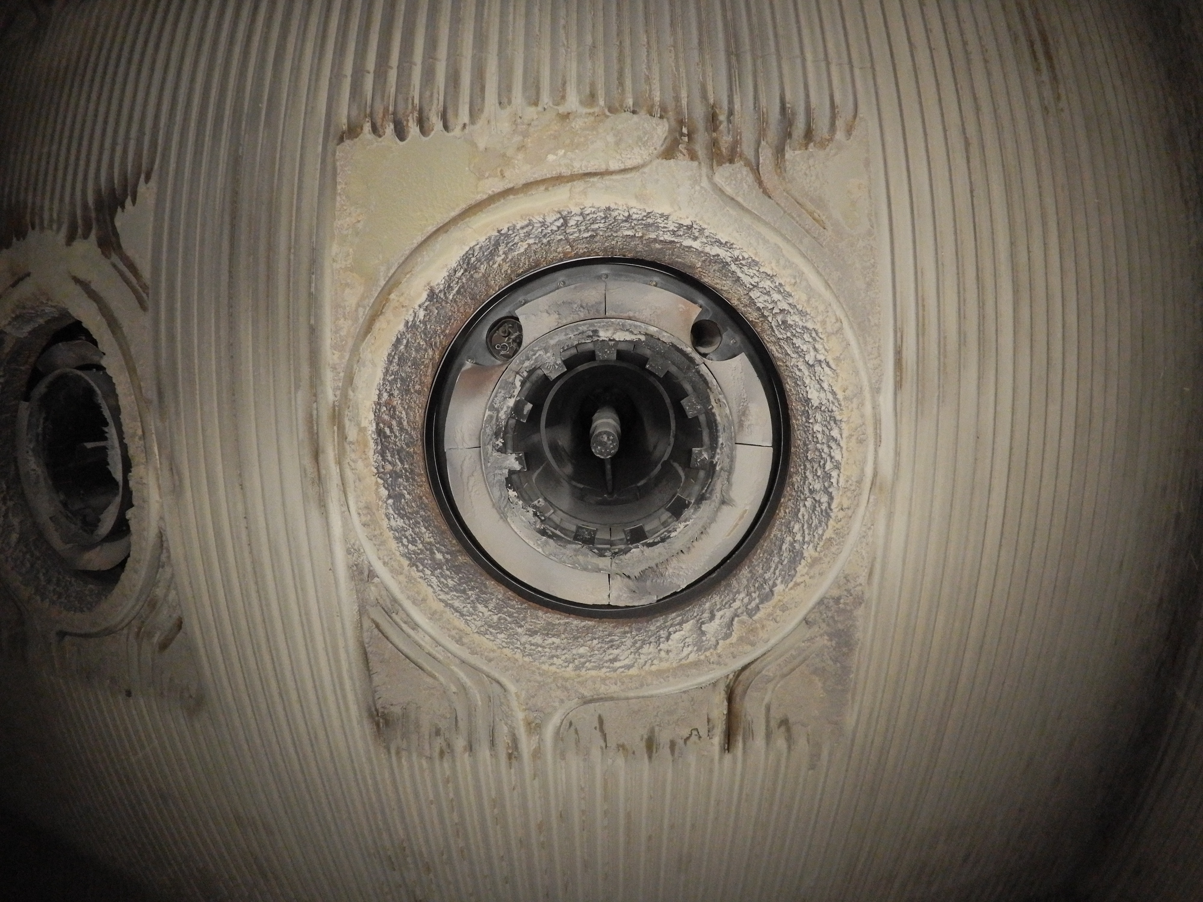
Personnel suspected that the shaft’s beams might have some damage, and they wanted to see what the beams looked like up close.
Flying the Elios 3 into the filter shaft, inspectors were immediately able to see that several of its beams were severely deteriorated. These findings helped inform the maintenance team’s efforts, and repairs were quickly planned for the shaft so that it could continue functioning and any unplanned shutdowns at the plant could be avoided.


Pictures of the deteriorated beams inside the filter shaft
The Future of Drone Inspections for Cement
The stockpile measurement in the clinker silo was such a success that the plant’s operators are considering permanently adopting the Elios 3 for its inventory needs.
In addition to taking inventory of clinker, plant personnel are also considering using the Elios 3 to conduct regular visual inspections of the interior of several of the plant’s assets.
Given that pilots can fly using the 3D Live Map even inside very dusty environments, the Elios 3 could be used in a variety of assets where dust typically makes it very difficult to see or operate.
Learn more about the Elios 3's centimeter-accurate Surveying Payload.
.jpg)
-Jan-16-2026-10-59-56-8006-AM.png)
.jpg)
.png)