Testing The Elios 3 Surveying Payload At ICL Boulby Mine
See how the new Surveying Payload completed surveys faster and more easily at the underground mine ICL Boulby
Key Benefits
|
Greater Data Coverage The Elios 3's new LiDAR payload has more range. In the same time it can cover greater areas than the standard configuration with higher accuracy. |
Speed The Surveying Payload enables faster data collection and reduced flight times. At ICL Boulby a 340 meter tunnel was surveyed in just 10 minutes. |
|
Simplified Flights The Rev 7 LiDAR empowers simpler flight plans thanks to its greater range and data coverage. This means that surveying flight times at ICL Boulby were reduced by 50%. |
Accuracy The new payload has reduced drift in LiDAR scans to be 5 times less than the standard configuration, which provides greater accuracy even in challenging areas.
|
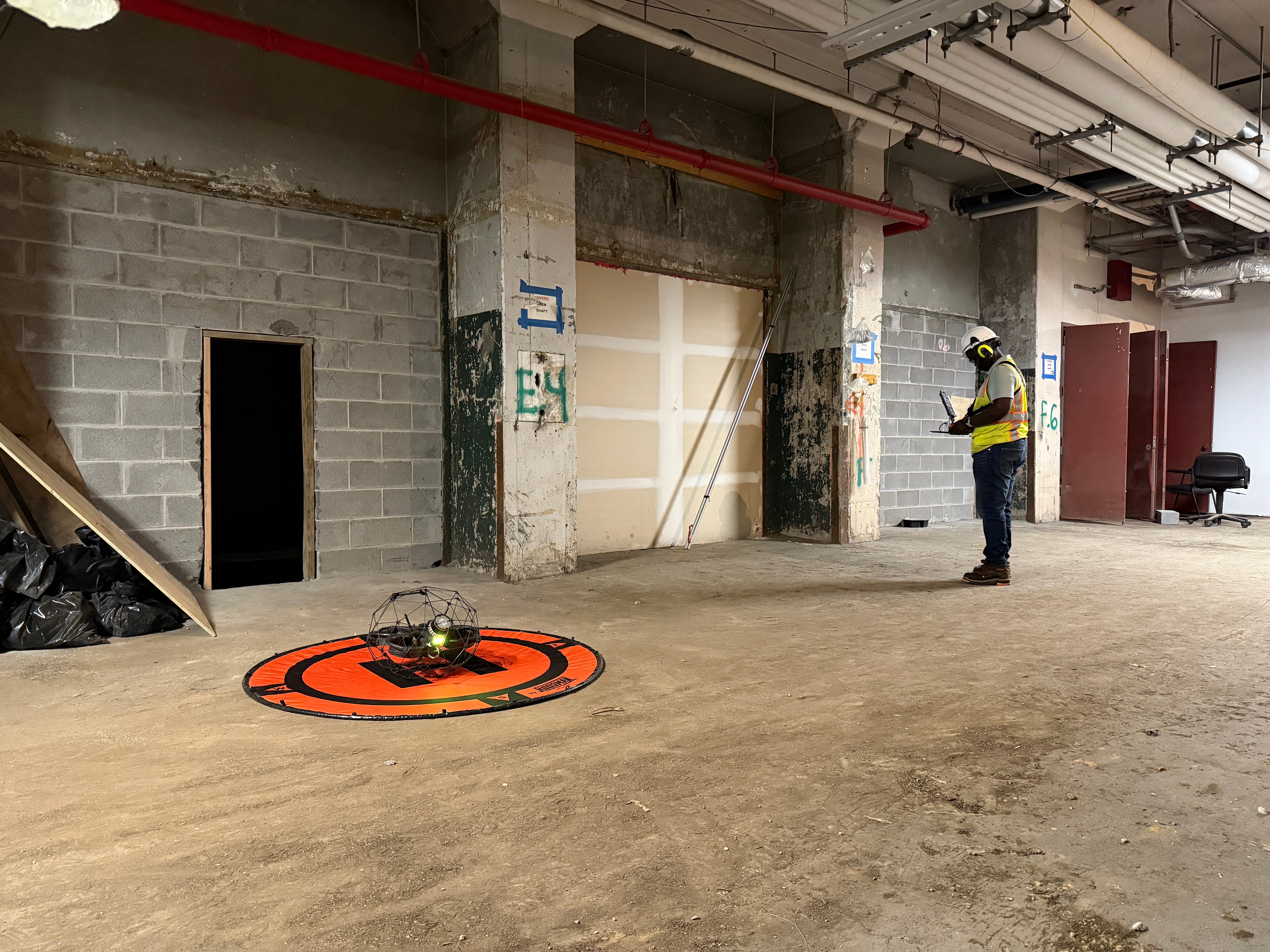
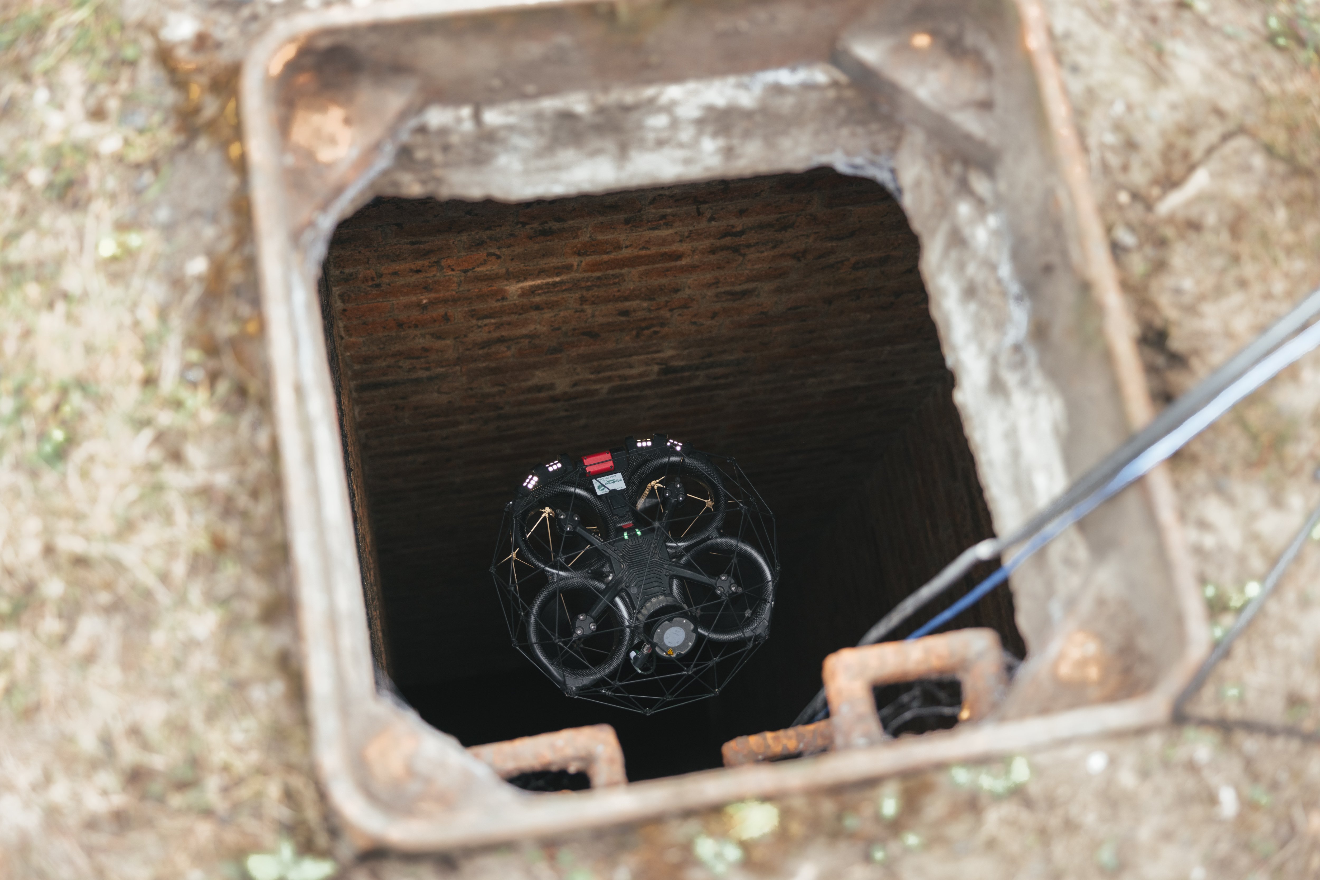
When Flyability were testing the new Surveying Payload for the Elios 3, they chose to visit a site that already uses the Elios 3’s LiDAR data for regular inspections. A team from Flyability traveled to ICL Boulby to test the new Ouster Rev 7 LiDAR payload in an environment already mapped with the original payload and see how the results compared.
Using The Elios 3 At The World's Only Polyhalite Mine, ICL Boulby
ICL Boulby is the only polyhalite mine in the world. It is just North of Whitby, in Northeast England. The mine was originally established to mine potash in 1968, but has now been repurposed to mine polyhalite, an organic fertilizer.
Now, ICL Boulby runs as deep as 1,200 meters below the surface and extends underneath the North Sea, reaching as far as 12 kilometers (8 miles) off the shore.
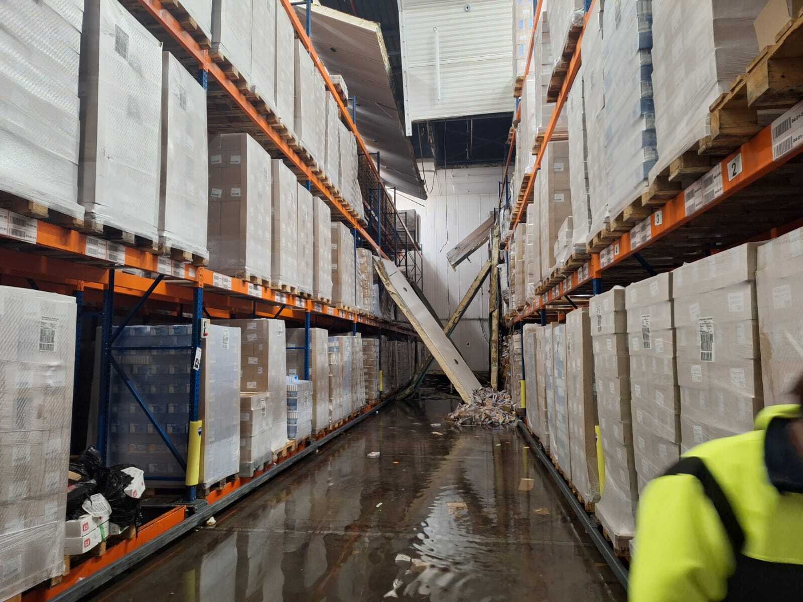
Part of the challenge of working on such a large, historic site is the huge patchwork of old workings as well as current excavations. These all need to be very carefully mapped to update records. This helps new developments avoid old workings, as holing through them risks an inrush of gas or water. Accurate records of mine workings are a statutory requirement in the UK.
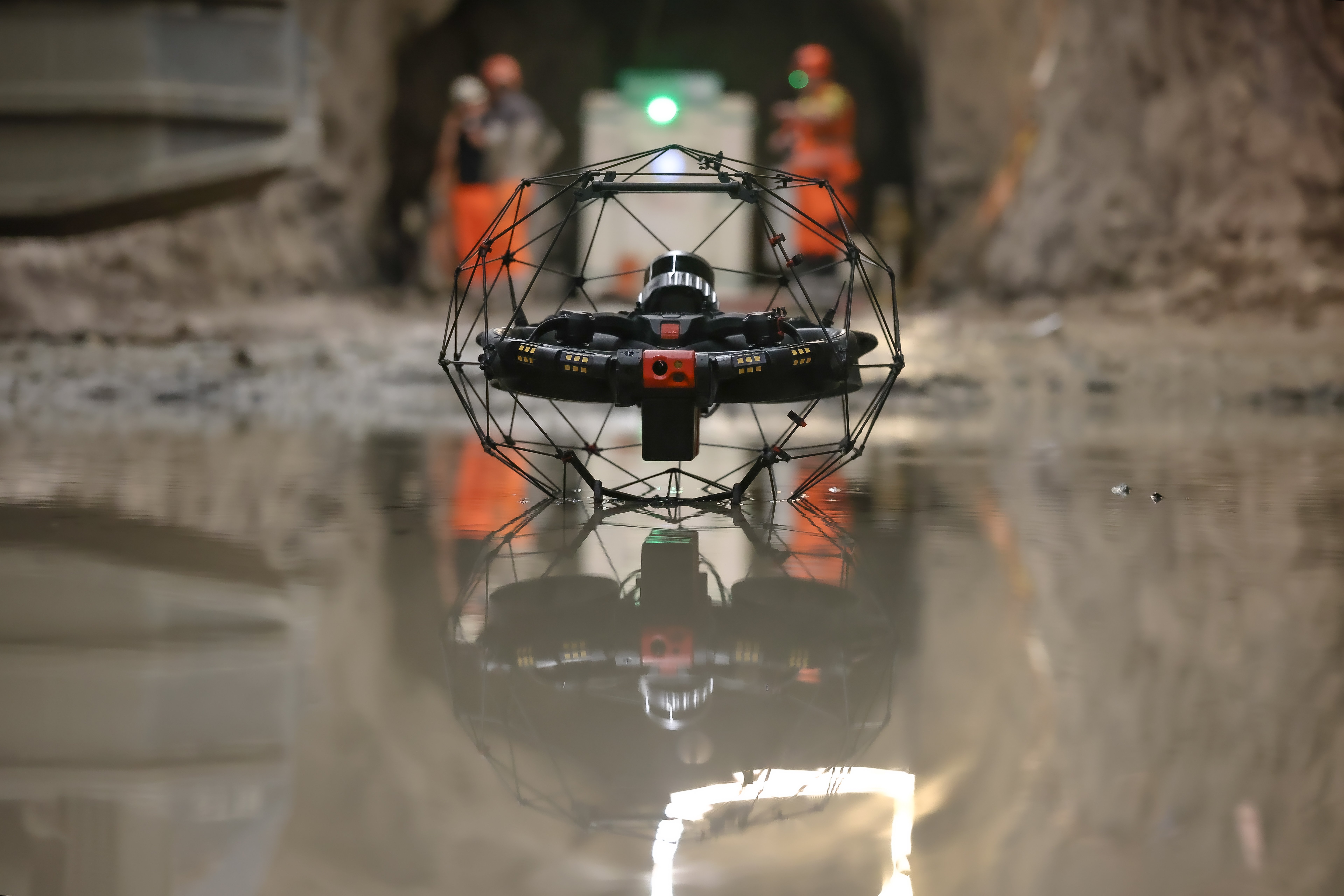
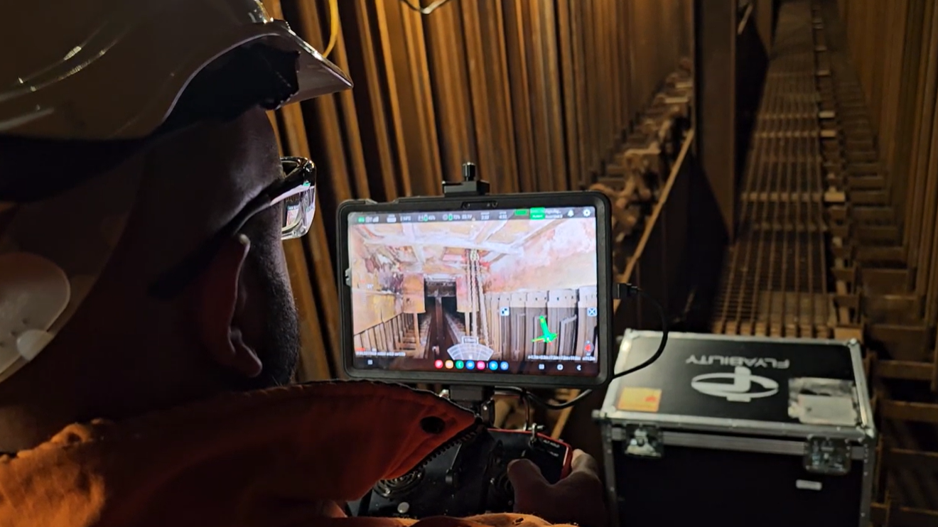
Simon Pollitt of ICL Boulby had proposed using the Elios 3 to map mine workings as part of record keeping. The mine operates an advance and retreat mining method, where tunnels are supported in advance and stripped out on retreat. Once an area has been retreated it is a NoGo area for personnel. The Ellios 3 enables ICL to capitalize on an advance retreat mining method while still working within the confines of the regulations.
As of 2023, the Elios 3 has been in use at ICL Boulby for 9 months, and the surveying team rely on its regular LiDAR scans for various surveying and volumetric projects.
Cutting Drone Flight Time In Half With The New Surveying Payload
The tunnel in question was 340 meters long, and in the past, required 4 flights with the Elios 3 to cover the entire area which took 20 minutes in total. This included scanning beyond the visual line of sight, adding to the complexity of the flights which can challenge the connection between the remote controller and the drone. On the surface, the scans would be registered and post-processed to provide a new point cloud.
However, the new LiDAR scanner made a big difference.

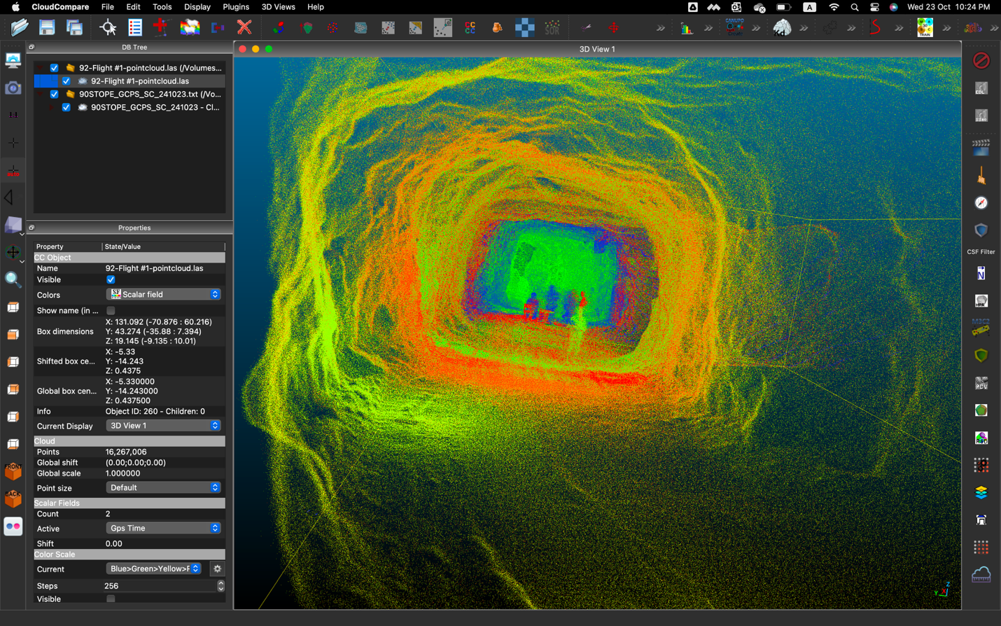
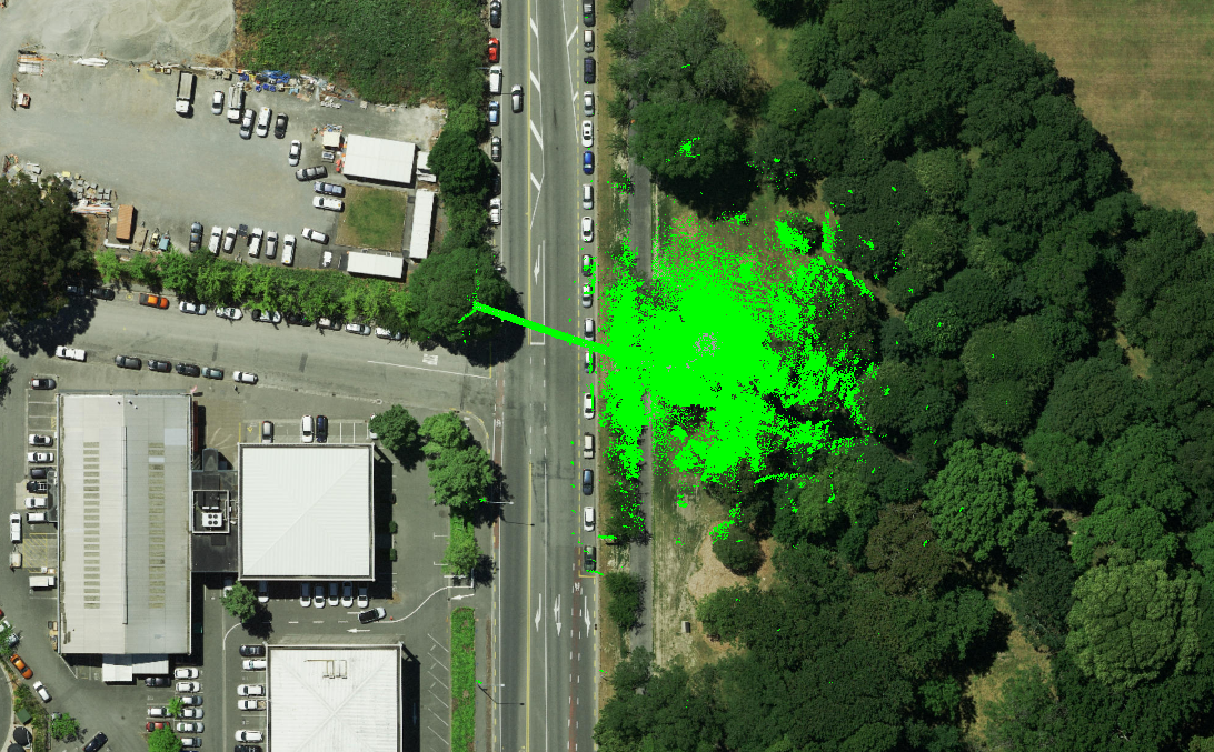
2x time more coverage: Overlay of the flights with the two LiDAR configurations shows twice the coverage with the Surveying Payload
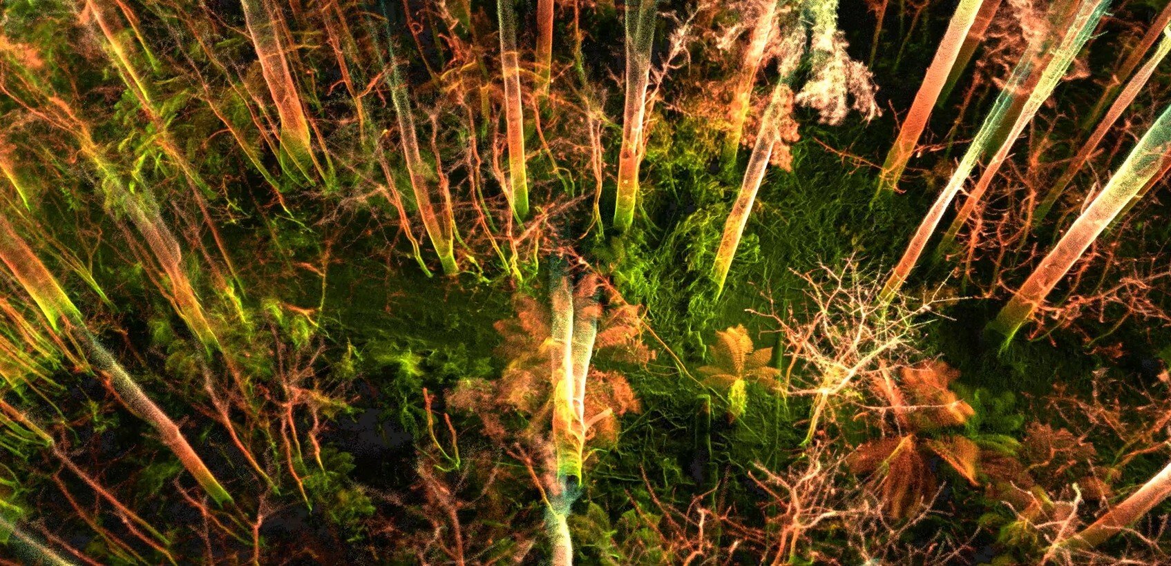
The new Surveying Payload includes an upgrade of the Elios 3’s LiDAR sensor, which is now the Ouster LiDAR OS0-128 Rev 7. This update provides several key advantages. The Rev 7 has greater accuracy in positioning and scanning, as well as better robustness in symmetrical environments. In addition, it has a greater range, enabling it to scan beyond safe access and gather more data than was previously available. The results are denser richer point clouds which can be gathered in a more time-efficient manner and can be processed with the payload’s attached software FARO Connect. This software processes data from the Elios 3’s new payload to produce clean georeferenced point clouds automatically.
VIDEO: Fly-through of the data captured in one flight by the Elios 3 Surveying Payload
With the new surveying payload, Simon completed one scan covering the area previously surveyed: halving the flight time and preserving battery life. Furthermore, due to the increased range, post-processing time is halved as multiple scans do not need to be merged.

Simplified flight trajectory for comparable results: The left image demonstrates the trajectory of the original survey payload whereas the right image shows the new surveying payload.
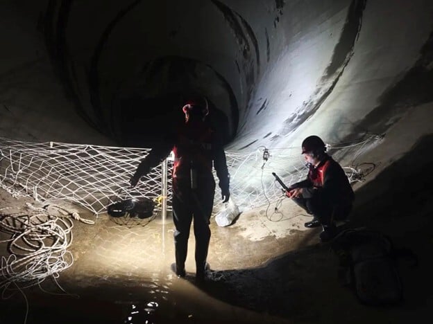
Matching Terrestrial Scans With The Payload's Improved Drift And Z-Values
When surveying with a LiDAR sensor, surveyors expect a degree of drift. Drift is the difference between the measured location and the true location. This occurs on all axes but most prominently in the Z-Axis. Drift is corrected by scanning several known coordinates or points, also known as control points, and using them to georeference the scan.
With the new surveying payload, Simon saw improvements in the drone reducing drift. The increased scale and range of the Elios 3’s new surveying payload is comparable to ICL Boulby’s terrestrial laser scanners. Thus, reducing post-processing time and enabling ICL to further experiment with the new surveying payload on jobs requiring a higher degree of precision.

Almost 5x more accurate on the z-axis: The red demonstrates a scan taken with the old payload showing greater drift compared to the scan in black with the new Rev7 LiDAR. The difference of accuracy in this case was a 5x reduction in drift.
The improvements of Z accuracy mean the surveying payload will be utilized for water draining planning.
Adopting The New Payload For New Use Cases
Currently, ICL Boulby uses scans from the Elios 3 for mapping mine working as well as volume measurements for indoor stockpiles. In the past, they saw limits on using drones to survey stockpiles due to a combination of drone size and maneuerability. ICL Boulby now anticipates using the new surveying payload to scan further in-door stockpiles and workings.
"The Elios 3 Surveying Payload is a game changer for our operations. The faster data collection and heightened accuracy alone make it worth changing from the standard sensor to the new, and we're expecting to unlock some new projects with it too," - Simon Pollitt, Chief Surveyor at ICL Boulby
In addition, the greater accuracy with regards to the z-axis will make it easier to do large-scale surveys with fewer flights and shorter flight time. This helps the surveyors reduce the work per survey and thus see more sites in a shorter period, boosting efficiency while updating records accurately. Overall, the new payload presents the ideal upgrade for ICL Boulby and Simon’s team, helping save time, cut costs, and always keep the team safe with drone inspections.
For more information on the capabilities of the Elios 3 Surveying Payload or, to further assess the technology fit for your surveying activities, talk to us! We have a team of specialists available to assist you regardless of where you are in your drone adoption journey.
The most accurate surveys with the Elios 3 are completed with the surveying payload.

.jpg)
-Jan-16-2026-10-59-56-8006-AM.png)
.jpg)
.png)